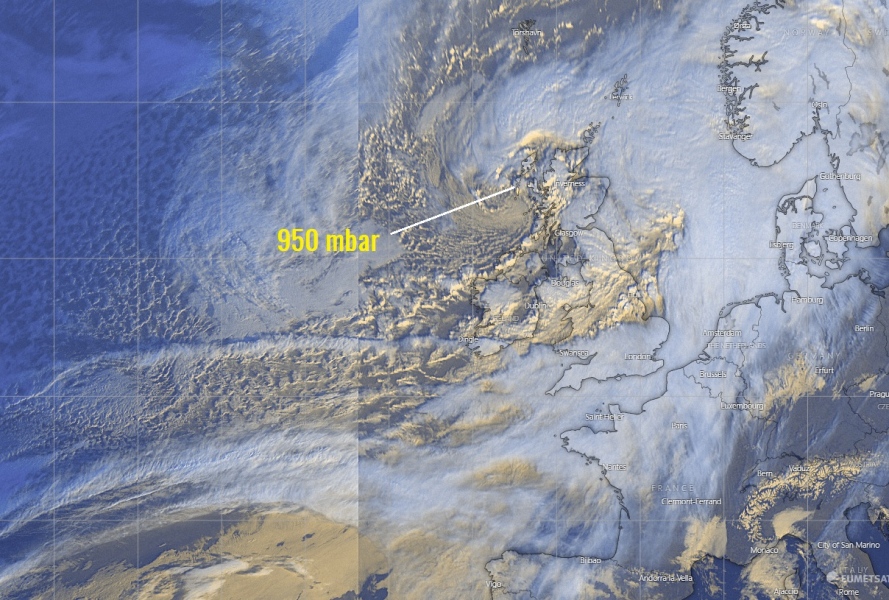
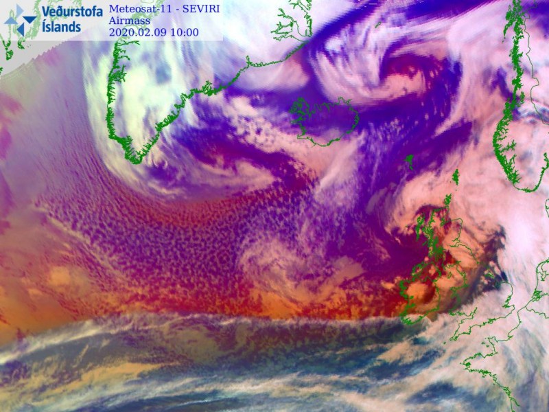
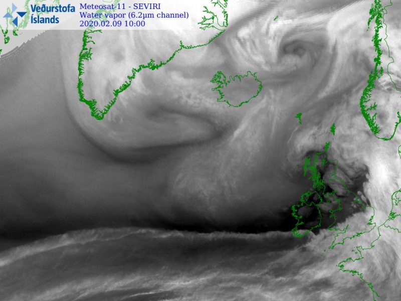
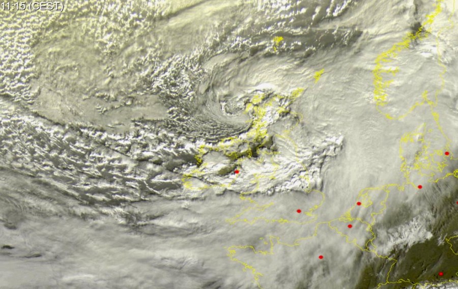
As expected, a powerful deep cyclone and frontal system are entering western Europe today, delivering a severe windstorm #CIARA across the UK and Ireland. Severe winds locally in excess of 120 km/h have already been reported, conditions are expected to worsen through the afternoon hours! The frontal system will then push further east into continental Europe and introduce a severe damaging windstorm #SABINE into France, Benelux, Germany, W Poland and Czechia tonight! Huge waves are developing over the far North Atlantic and will spread towards Ireland and Scotland tomorrow.
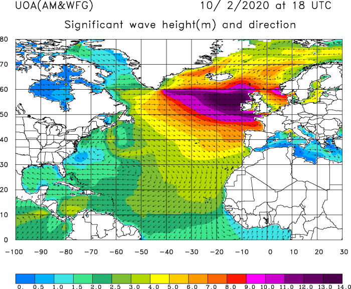
WW3 model animation of the significant sea waves across the western Europe and North Atlantic:
*********************************************
NEW UPDATE: LIVE coverage of the very powerful windstorm #CIARA soon entering continental Europe
LIVE *update* on the very powerful windstorm #CIARA soon entering continental Europe
*********************************************
Satellite imagery reveals the powerful frontal system is now moving into the northern UK and Ireland, with the fast speed. Some convective storms are also likely with the frontal passage, supporting intense rain/wind squalls.
Spectacular visible satellite animation of a deep cyclone and frontal system moving into UK and Ireland today. Severe damaging winds are spreading into western Europe this afternoon! Animation: @meteociel pic.twitter.com/rxbJdGsZ7e
— severe-weather.EU (@severeweatherEU) February 9, 2020
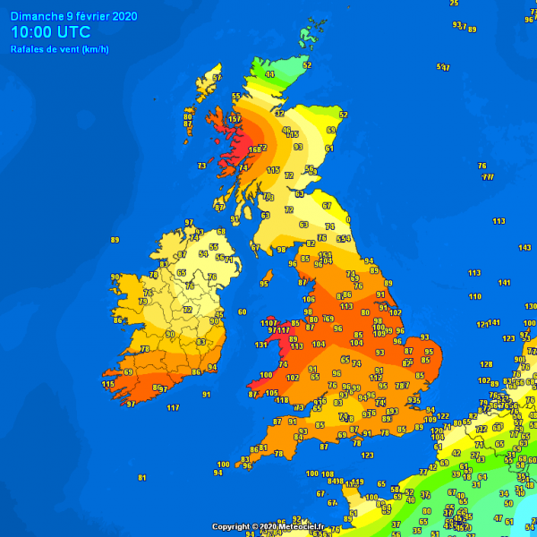
Peak wind gusts across the UK and Ireland so far, late Sunday morning; 100-120 km/h across England, Wales and south Ireland, up to 160 km/h in Scottish Highlands.
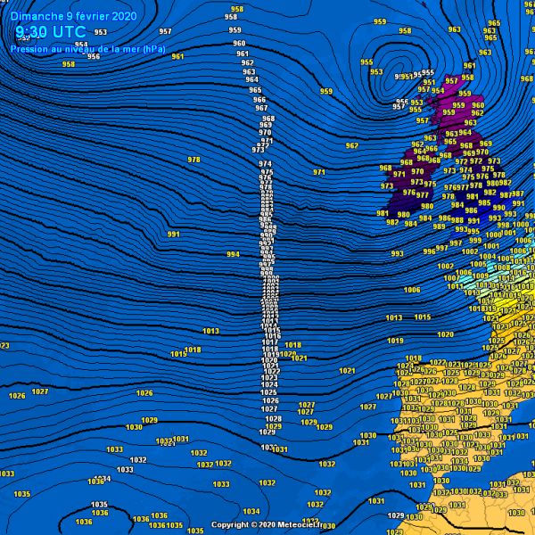
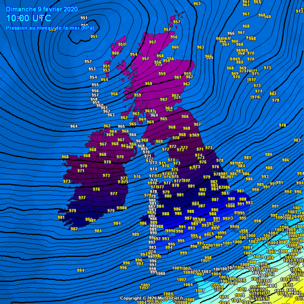
There is a *huge* pressure difference across the North Atlantic today. While strong ridging is persisting over the southern and southwestern Europe – more than 1030 mbar pressure is observed in Spain, a deep low is moving into northern Scotland – near 950 mbar in its center. That means the pressure difference between northern Scotland and northern Spain is near 80 mbar! Tight pressure gradient is resulting in a severe windstorm! There is also near 50 mbar difference across the UK – extreme southeast parts (England) are reporting 1001 mbar, while the extreme northwest parts (Scotland) are reporting 950 mbar!
Windstorm #Ciara will be spreading across western Europe today, introducing damaging severe to locally extremely severe winds.
Stay alert for dangerous weather conditions!
See also – previous discussions of cyclone #Ciara:
This powerful winter storm will continue east tonight and bring an intense squall-line with storms along the leading cold front across Benelux and Germany!
Significant 15 mt / 50 ft waves will develop across the North Atlantic tonight and push towards the UK and Ireland through Monday!
