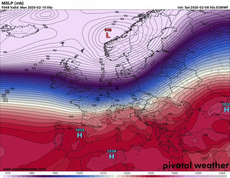
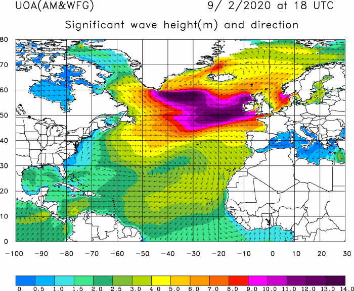
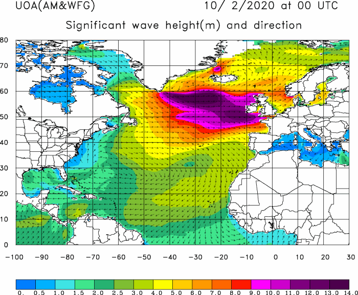
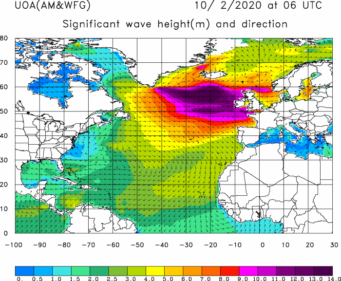
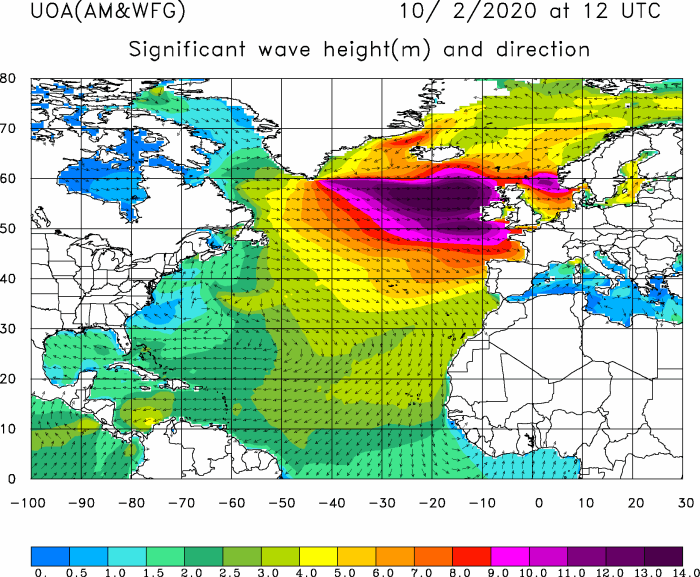
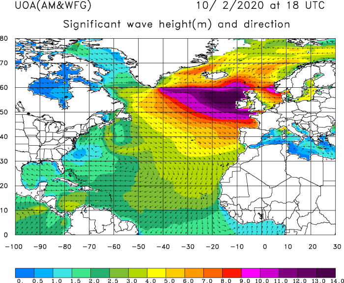
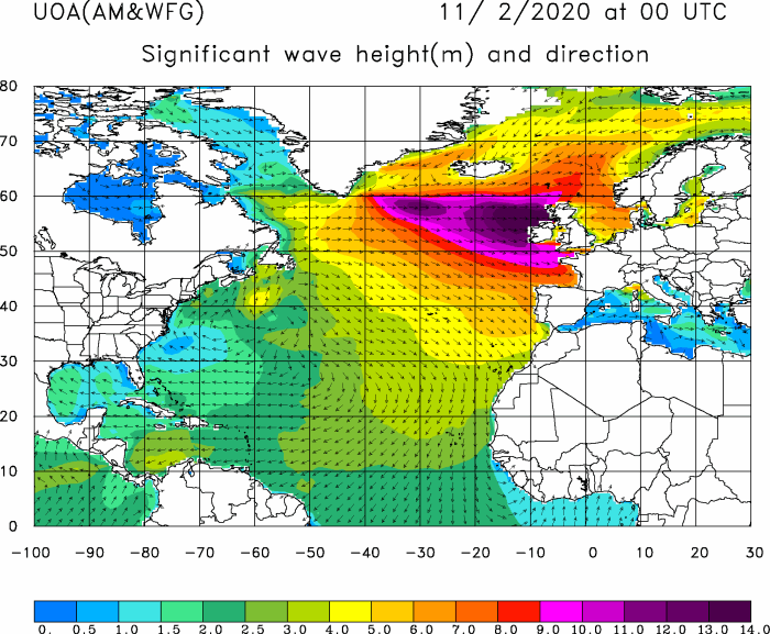
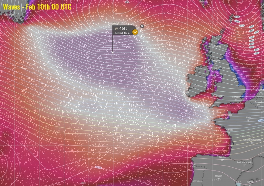
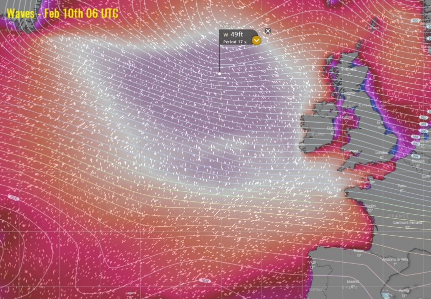
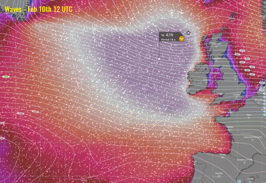
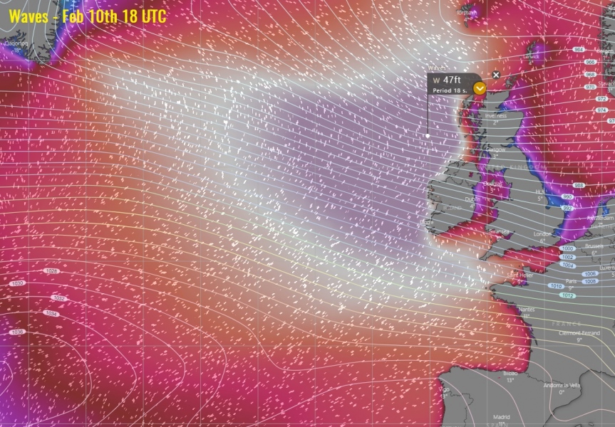
The ongoing severe windstorm spreading across the western Europe is associated with the deep upper trough across the North Atlantic, and a secondary surface low moving towards Scotland. In its wake, strengthening pressure gradient results in the even stronger windstorm over the Atlantic, developing major swell and significant wave heights towards the UK and Ireland. Highest waves could exceed 15 meters / 50 feet through late tonight and on Monday!
The significant waves animation across the North Atlantic through the next 72 hours:
*Extreme* anomalies of geopotential heights and surface pressure will be present over Europe these days. Much below over the north and much above normal over the south. In between, a powerful westerly jet stream will be placed. The maximum sustained speeds in its center will be above 210 knots (= 240 mph = 390 km/h), at 300 mb level!
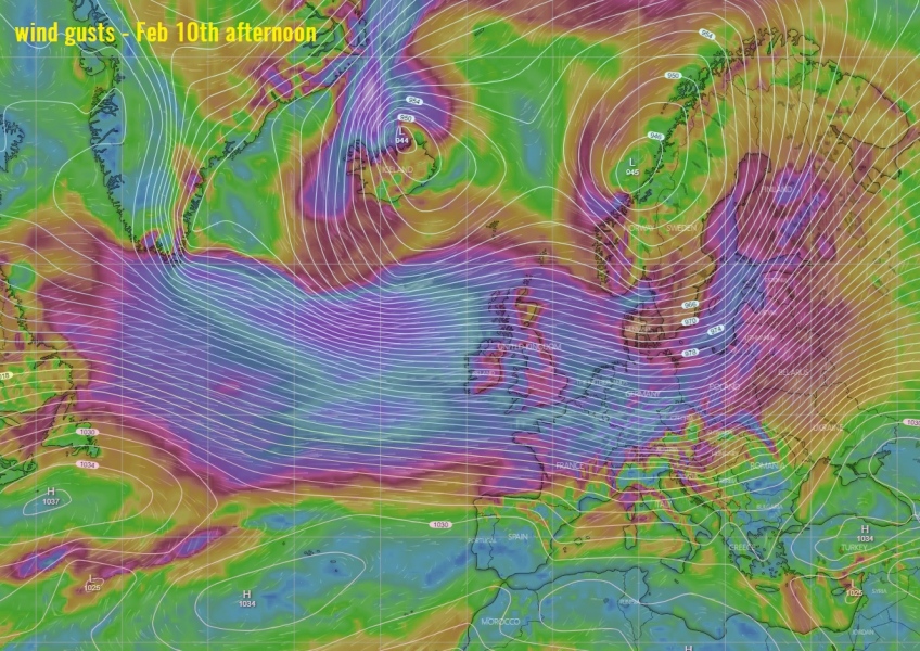
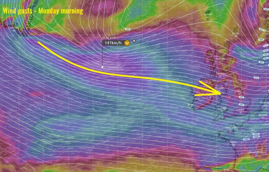
As mentioned above, a very powerful jet streak will be placed between the two anomalous systems across the North Atlantic into western Europe. This means violent dynamics also near the ground. Attached are wind gusts at the surface on Monday afternoon – this broad wind maximum will support significant waves towards our continent:
Wave heights will become significant tonight through Monday, in response to a broad channel of severe winds on the southern flank of the large North Atlantic cyclone. It pushes a windstorm towards western Europe and produces major swell with significant waves heights – likely near 50 ft = 15 meters! Waves will be gradually spreading towards Scotland, Northern Ireland, Ireland and also towards Southwest England, Faroe Islands and NW France:
Close-up view over the significant waves towards the UK and Ireland:
Here is the sounding diagram at the location of the powerful ~200 knots jet streak moving towards western Europe on Sunday evening! There will be violent winds spread through all layers.
These significant waves will be smashing the coastal areas western Ireland, Northern Ireland and western Scotland, and could locally produce damage! Stay alert for dangerous conditions – we will keep you updated!
See also:

