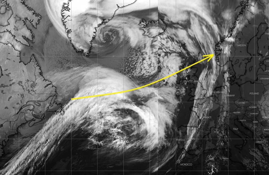
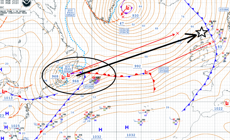
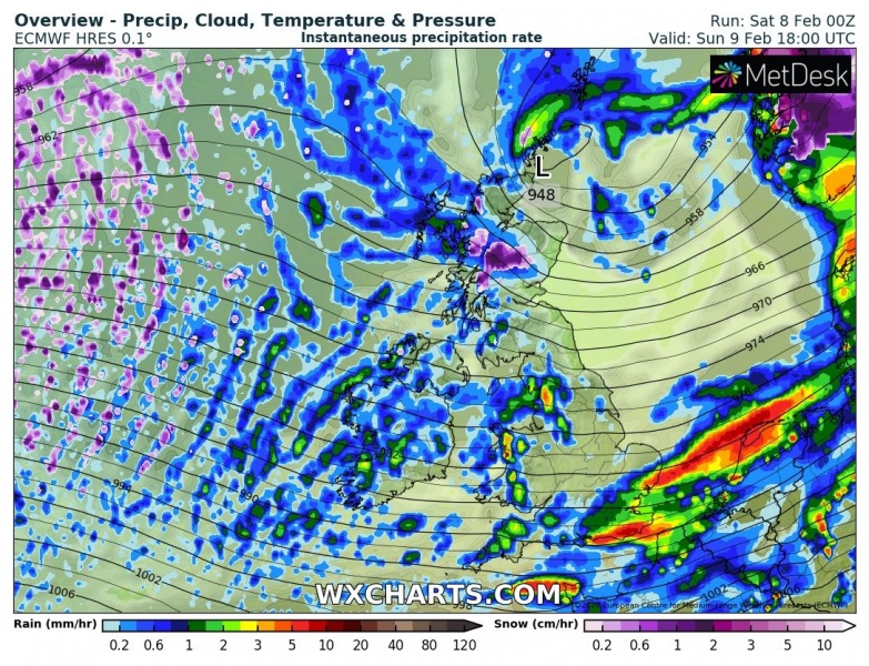
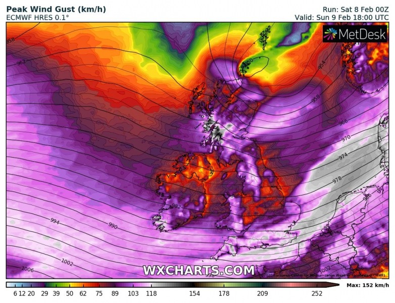
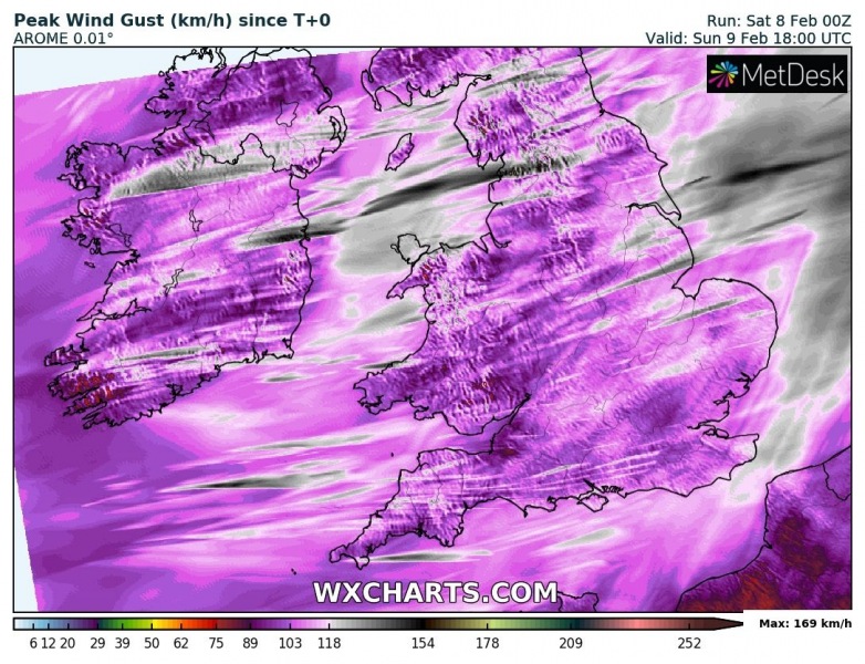
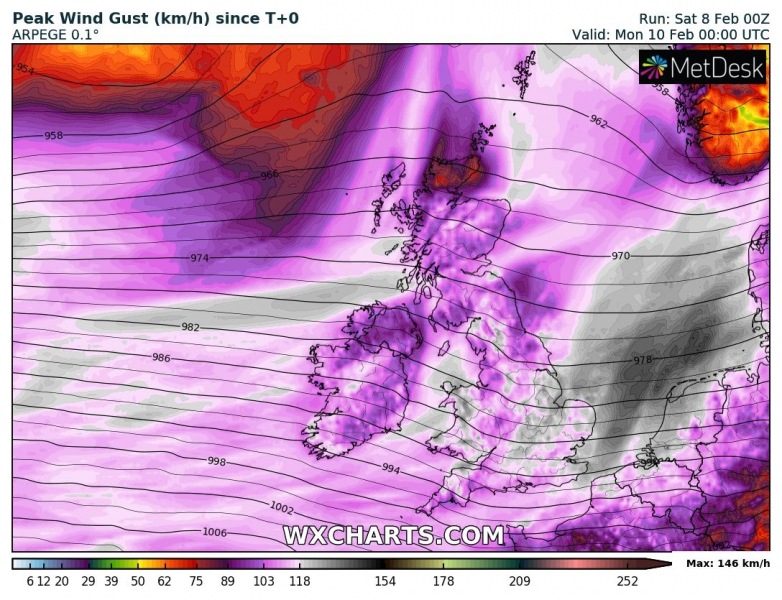
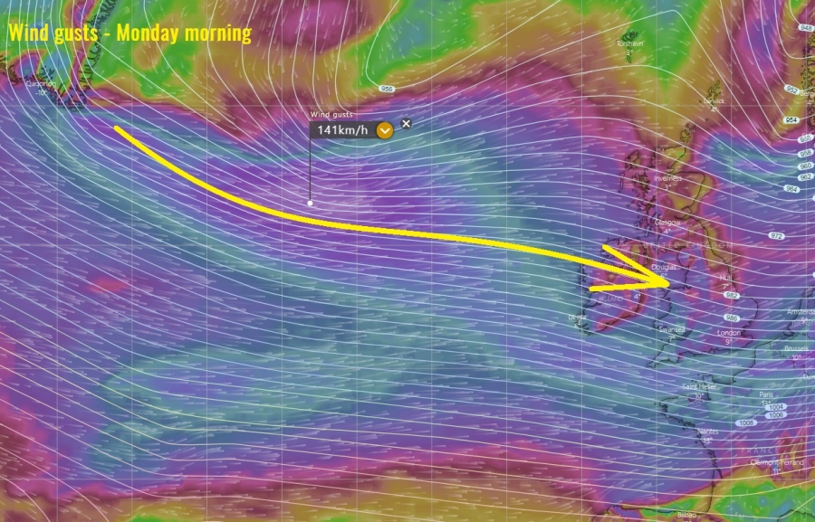
The former wave with the ‘bomb cyclone’ which significantly deepened over eastern Canada, is now moving across the North Atlantic towards western Europe. Located south of the extremely deep cyclone near Greenland and Iceland. It is expected to deliver an intense windstorm – #stormCiara – across Ireland, Scotland, Wales and England tomorrow, Feb 9th. As #Ciara continues towards northern Europe, severe winds will also spread across the English Channel and across the North Sea into SW Scandinavia, Benelux, Denmark, and N Germany overnight to Monday! Significant waves are also expected to blast into western coasts of Ireland and Scotland!
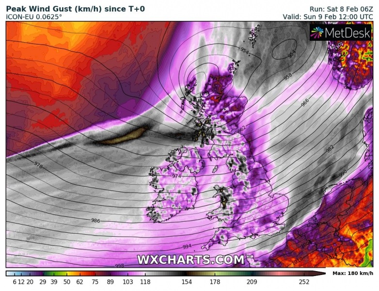
An overview of the peak wind gusts by ICON-EU model, expanding across the North Atlantic and western Europe through several days:
Infrared satellite image with surface pressure and fronts analysis across the North Atlantic this morning – deep surface low was located near the Newfoundland and is expected to rapidly intensify while crossing the North Atlantic and reach Scotland tomorrow afternoon, Sunday 12 UTC.
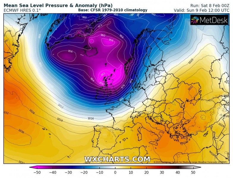
While the upper-level trough will be very large and dominating much of the North Atlantic, a secondary surface low on its southern edge will be rapidly deepening while moving towards western Europe and Scandinavia through Sunday into Monday. It will become very large:
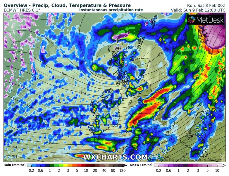
The low will be moving in from the west and will be approaching the UK and Ireland in the morning hours. Its center will then drift east-northeast towards Scotland while deepening below 950 mbar. The associated frontal system will blast across Ireland in the morning hours, then across Scotland, Wales and England in the early afternoon hours. Severe to locally extremely severe winds are possible with the rain squalls.
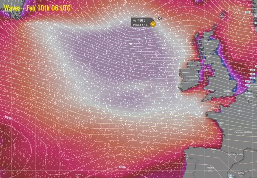
Sunday, 06 UTC
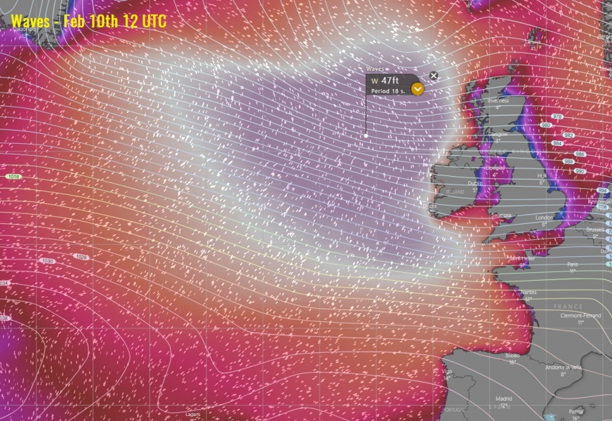
Sunday, 12 UTC
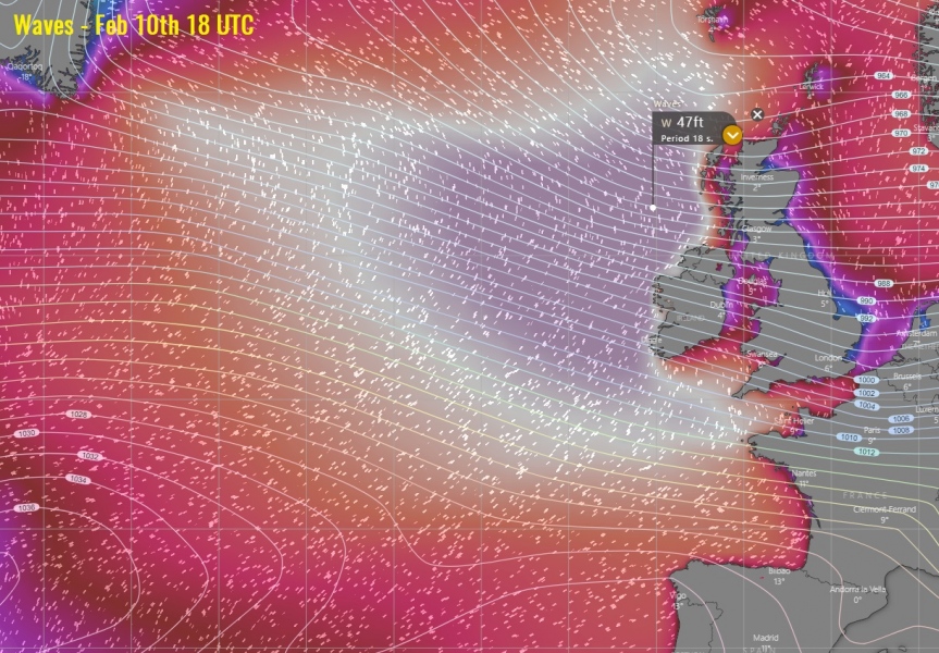
Sunday, 18 UTC
Widespread severe to extremely severe winds are expected across the whole western Europe, particularly intense across western Scotland and higher elevations of Wales and northern England. Peak gusts could reach 75-80 mph (= 120-130 km/h), even higher locally. Scottish Highlands might peak close to 125 mph (= 200 km/h) again.
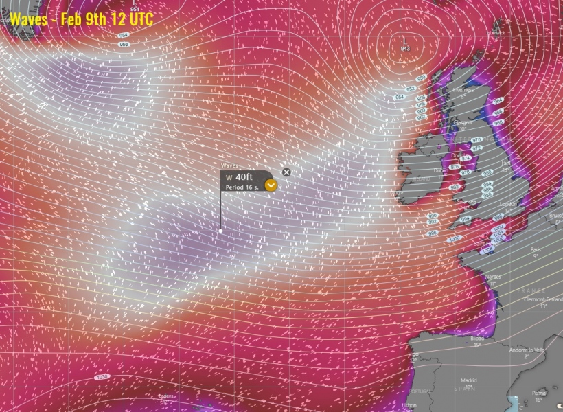
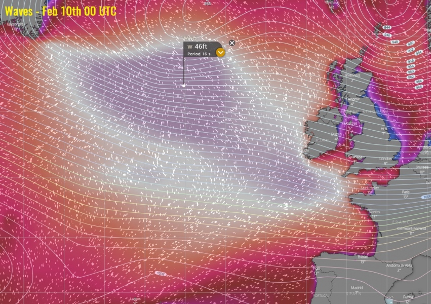
Major waves are likely to be expected along the western coasts of Ireland and Northern Ireland and Scotland:
Wave animation forecast:
Wave heights will become significant after Monday morning, as a broad channel of severe winds develop in the wake of the large North Atlantic cyclone. It pushes a windstorm towards the western Europe and produces major swell. Waves heights are likely to reach near 50 ft = 15 meters!
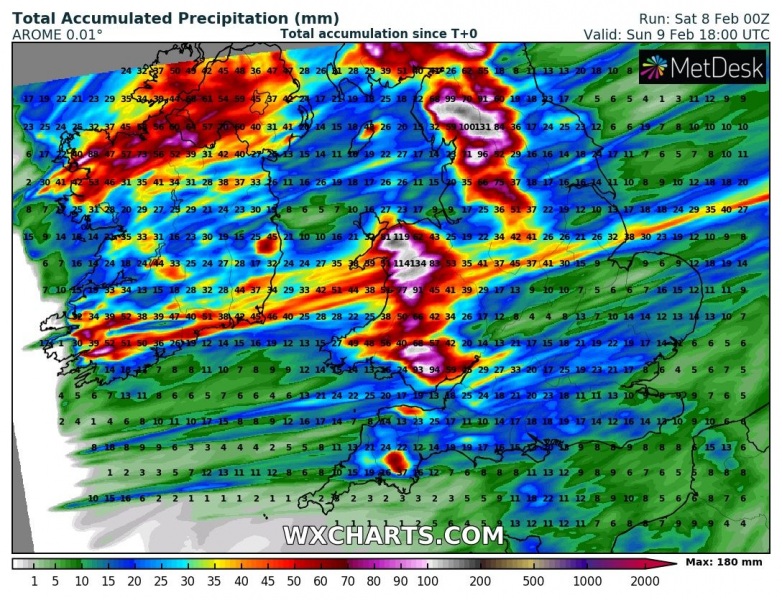
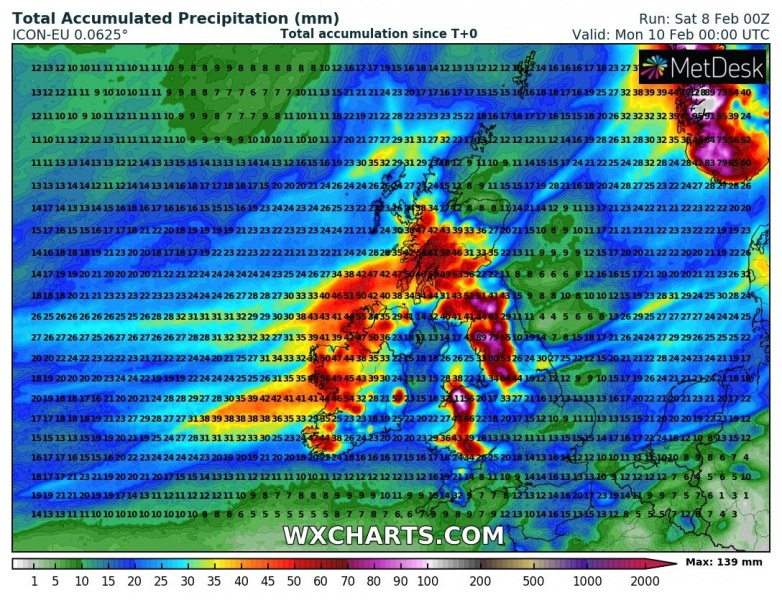
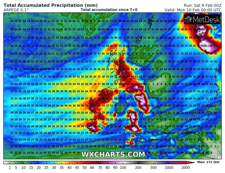
Excessive rainfall is also expected across northern England and Scotland, locally 150+ mm seems possible. This will enhance flooding threat!
Stay alert for dangerous conditions, severe wind squalls and major waves could locally produce damage!
Read the primary forecast discussion:
See also – a monster extremely deep ~930 mbar cyclone is currently along the southern tip of Greenland:
https://www.severe-weather.eu/mcd/explosive-cyclone-west-of-iceland-mk/
