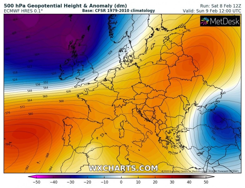
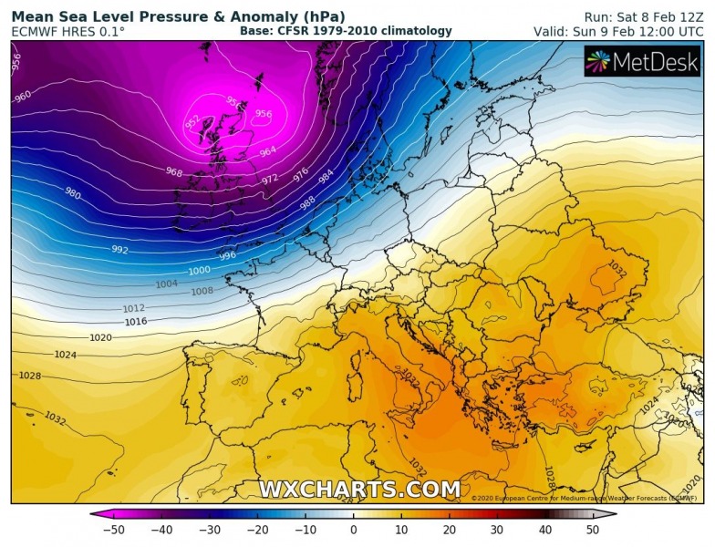
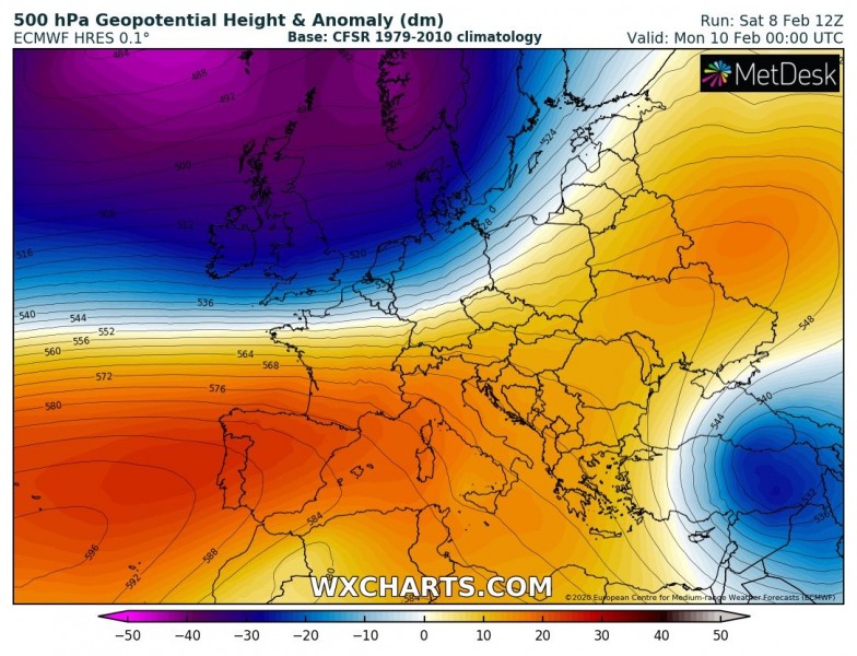
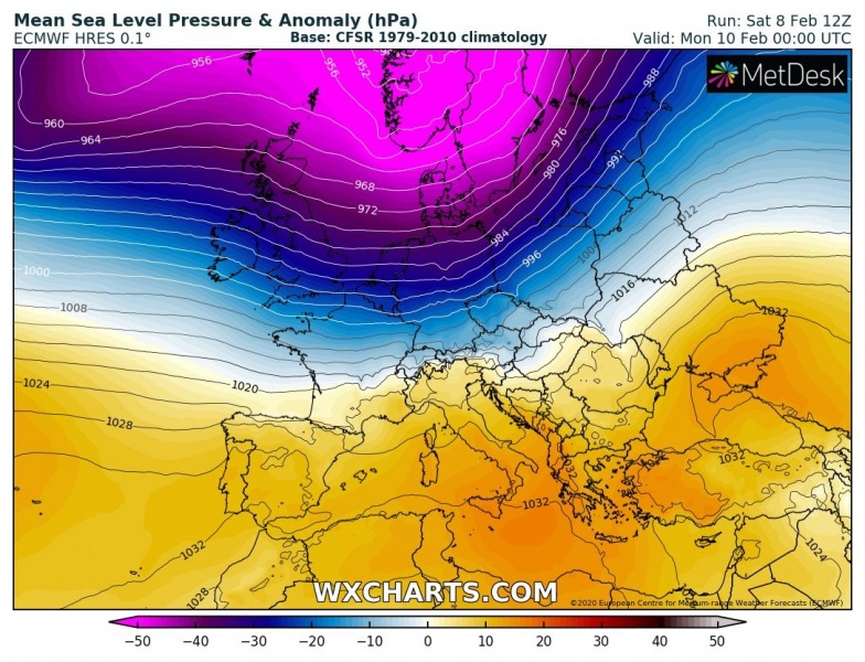
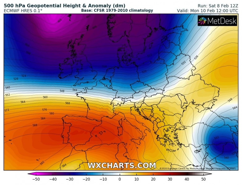
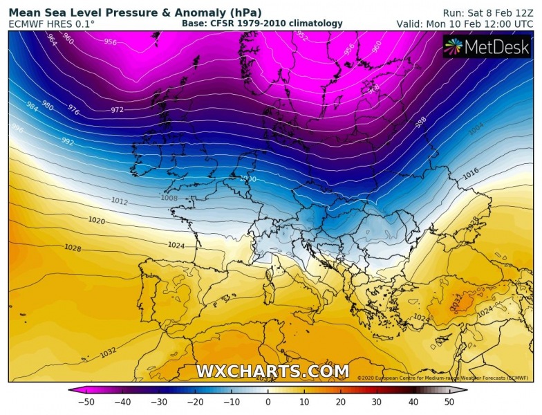
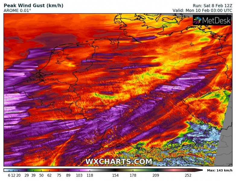
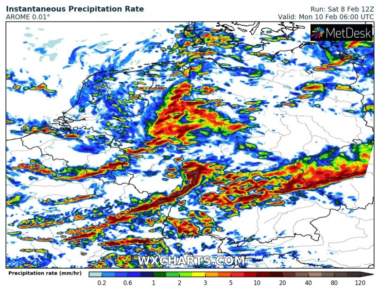
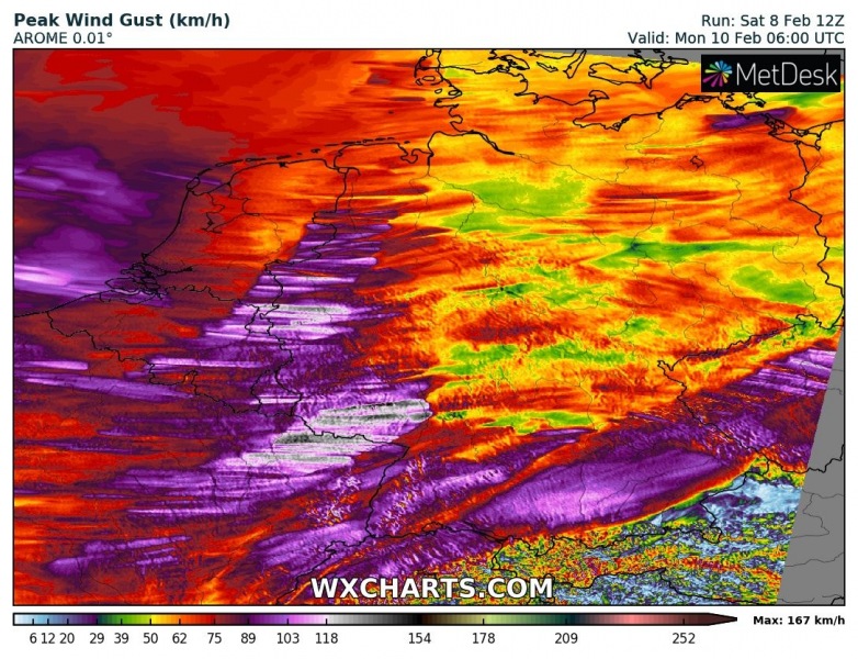
The large upper-level trough moving across northern and western Europe on Sunday, will spread east from the afternoon hours until Monday afternoon, with a pronounced cyclone and an associated surface frontal system. A very strong pressure gradient between the deep cyclone on the north and upper ridge over southwest Europe will introduce severe wind field in between, rapidly translating a surface cold front from west to east overnight to Monday. Damaging winds are expected!
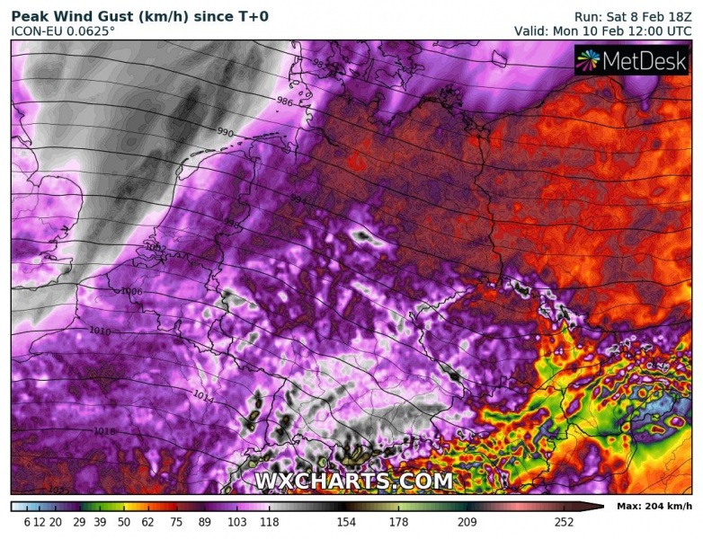
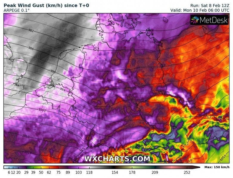
Peak wind gusts by ICON-EU model, expanding across the North Atlantic and western Europe in the coming days:
Deep core of the large North Atlantic trough will continue strengthening a surface low over the UK through Sunday, while it drifts into southern Scandinavia overnight to Monday. It expands in size and develops a strong pressure difference across Benelux and Germany. The result is an intense windstorm from western towards central Europe.
Sunday, Feb 9th, 12 UTC
Monday, Feb 10th, 00 UTC
Monday, Feb 10th, 12 UTC
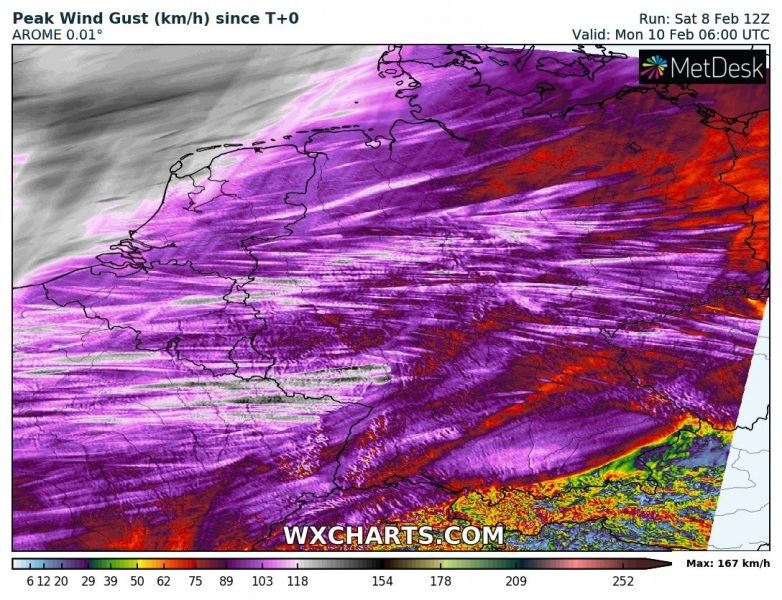
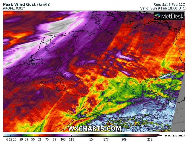
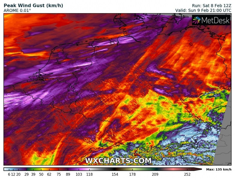
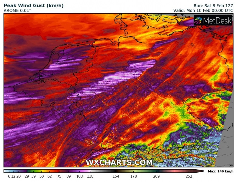
The peak wind gusts swath across the region indicates winds will be severe to locally extremely severe, exceeding 130 km/h in some areas. Intense wind squalls will develop along the leading surface front. Even higher gusts – 150-200 km/h – are expected over the mountain ranges in Germany and northern Alps.
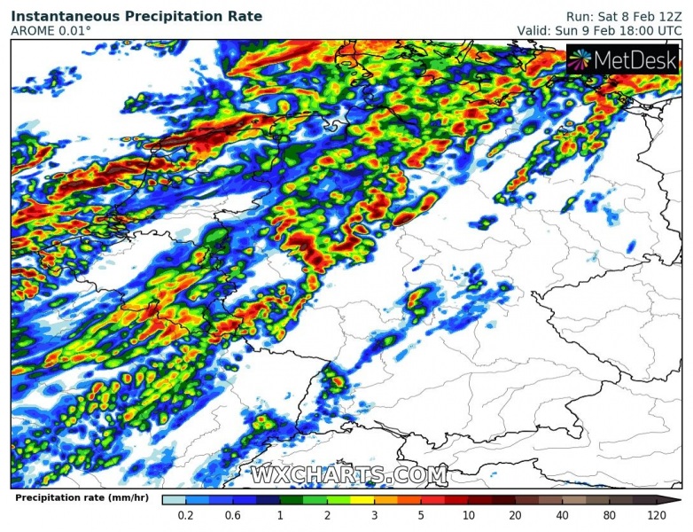
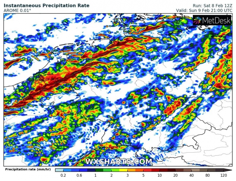
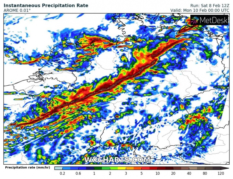
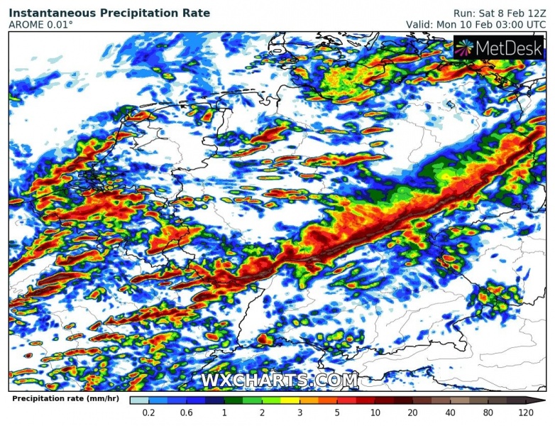
3-hour sequence of the cold front passage, rapidly moving in from the North Sea into Benelux on Sunday evening, continuing overnight to Monday across France and Germany, already reaching Czechia during the Monday morning hours! An intense line of heavy rainfall with some shallow convection is expected, introducing severe damaging winds threat in excess of 100-130 km/h in some areas! Storms along the front could bring some hail as well. Early Monday, another intense line forms over eastern France and spreads into southern Germany. Traffic disruptions due to dangerous wind gusts and fallen trees are likely to result along this leading line – stay alert!
Sunday, Feb 9th, 18 UTC
Sunday, Feb 9th, 21 UTC
Monday, Feb 10th, 00 UTC
Monday, Feb 10th, 03 UTC
Monday, Feb 10th, 06 UTC
Stay alert for dangerous conditions with destructive winds along the leading cold frontal squall-line!
See also:
