Skip to content

Severe Weather Europe

Global Weather News and Forecasts, covering the United States, Canada and Europe

  • HOME
  • WEATHER ANALYSIS
    • RECENT EVENTS
    • LATEST NEWS
    • Satellite Live
    • Radar Live
    • Lightning Live
    • EVENT ANALYSIS
    • Notable Events
  • WEATHER FORECAST
    • SWE weather models
    • SEVERE WEATHER FORECAST
      • Severe Weather Outlooks FAQ
    • SEVERE WEATHER OUTLOOK ARCHIVE
    • GLOBAL WEATHER
    • LONG RANGE
    • WINTER WEATHER
    • Europe Weather
    • TROPICAL WEATHER
    • MESOSCALE DISCUSSION
  • POLAR VORTEX
  • LEARN WEATHER
  • ABOUT & CONTACT
    • ABOUT US
    • Privacy Policy
    • CONTACT US

Marko Korosec

Marko Korošec is a veteran storm chaser and expert weather forecaster with over 25 years of experience specializing in the analysis of extreme atmospheric events. A former forecaster for Estofex, he draws on deep-layer shear dynamics and thermodynamic analysis. Marko is highly recognized for his technical proficiency in short- and mid-term forecasting of high-impact weather, including severe convective systems and complex winter weather. In addition to his SWE role, Marko worked for 17 years as a Road Weather and Maintenance Decision Support System Supervisor until 2022, applying his expertise to the critical field of transportation meteorology. He focused on the forensic analysis of road surface conditions and the impact of extreme winter weather, including blizzards, freezing rain, and ice storms, on infrastructure safety. His work was instrumental in developing strategies for proactive winter maintenance and real-time hazard mitigation. Marko’s unique dual-career path combines rigorous meteorological forecasting with world-class visual documentation. An acclaimed visual artist and winner of the 2014 National Geographic Traveler Photo Contest, he uses his "awe-inspiring" photography to illustrate the power and complexity of the atmosphere. By merging technical forensic details with high-resolution visual evidence, Marko serves as a vital bridge between high-level atmospheric science and public understanding, dedicated to capturing "the fury of nature" for a global audience. Photo gallery: MarkoKorosec.net

#Vongfong becomes a powerful Category 3 typhoon after going through rapid intensification today

May 13, 2020 by Marko Korosec

Vongfong has rapidly intensified over the past 24 hours and is now supporting a violent strength. It has been upgraded into a typhoon, packing 105 … Read more

Categories Tropical Weather Tags ambo, pacific, Philippines, tropical storm, typhoon, vongfong

Western Pacific typhoon season 2020 begins – the first tropical storm #VONGFONG has formed today!

May 12, 2020 by Marko Korosec

First tropical storm of the Western Pacific typhoon season 2020 has formed! #Vongfong and is heading to the Philippines. Based on the 18 UTC analysis, … Read more

Categories Tropical Weather Tags destructive winds, flooding, Philippines, storm surge, tropical storm, typhoon, vongfong, western pacific

Extreme heatwave with peak temperatures close to +40 °C over south Greece and Turkey this weekend!

May 16, 2020May 12, 2020 by Marko Korosec

We are currently experiencing an unusually strong cold outbreak over a large part of Europe. But it appears likely we will be facing a second … Read more

Categories Mesoscale Discussion Archives Tags Balkans, extreme heat, greece, heat wave, ridge, turkey

Cold front racing across Europe, May 12th – snowfall in Poland and frost over Germany and UK

May 12, 2020 by Marko Korosec

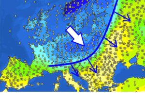
The Arctic outbreak has verified yesterday and continues this morning. Very cold temperatures are spread behind the cold front and have resulted in morning temperatures … Read more

Categories Mesoscale Discussion Archives Tags cold front, europe, frost, snow, spring, storms

A sharp temperature change along Arctic front flush away the summer weather on Monday

May 10, 2020May 10, 2020 by Marko Korosec

The cold air mass pool associated with the arctic outbreak is racing towards east-central Europe tonight. South of the deep trough and main cold front, … Read more

Categories Mesoscale Discussion Archives Tags alps, arctic outbreak, cold front, cold pool, cyclone, excessive rainfall, severe storms, snow

Tropical depression #AMBO (wave 95W) forms, heading towards the Philippines this week

May 10, 2020 by Marko Korosec

The tropical activity is ramping up in the western Pacific this weekend. A tropical wave #95W begins forming deeper and more widespread convection in the … Read more

Categories Tropical Weather Tags depression, hurricane, pacific, Philippines, tropical cyclone, tropical wave, typhoon

*update* on the powerful cold blast across west-central Europe through Sunday and Monday, May 10-11th

May 9, 2020 by Marko Korosec

Here is the follow-up update post on the developing sharp pattern change and soon a return of cold weather for a few days. The famous … Read more

Categories Mesoscale Discussion Archives Tags arctic outbreak, Benelux, cold outbreak, england, frost, ice saints, ireland, snow, spring, UK, winter

Global flights were down 62% in April, even more with the commercial flights – down by 74%!

November 28, 2023May 7, 2020 by Marko Korosec

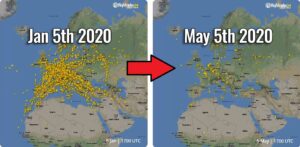
We have discussed about the direct effect of the national lockdowns due to coronavirus weeks ago, a remarkable decline in global flights was observed. The … Read more

Categories Recent events Tags air traffic, atlantic, China, CO2, commercial flights, Coronavirus, emissions, europe, flightradar24, flights, italy, united states
Older posts
Newer posts
← Previous Page1 … Page84 Page85 Page86 … Page225 Next →
Live radar, satellite and lightning maps SWE weather models Learn Weather

Recent Posts

  • Polar Vortex Reversal: Stratospheric Impact Wave Could Arrive by Thanksgiving
  • New Winter 2026/2027 Forecast: A Snowier Shift and a Mid-Winter Polar Vortex Signal
  • The Polar Vortex Is Collapsing in November: What It Could Mean for Your Winter
RSS Feed
© 2026 Severe Weather Europe • About • Contact • Privacy Policy