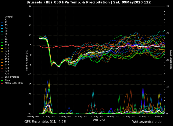
Here is the follow-up update post on the developing sharp pattern change and soon a return of cold weather for a few days. The famous Ice Saints – St. Mamertus (or St. Boniface), St. Pancras and St. Servatius start on Monday. This year, they bring us a cold outbreak into many parts of Europe. An incredible cold blast begins tonight, spreading across the North Sea and Scandinavia towards south. An impressive temperature drop and even snow locally!
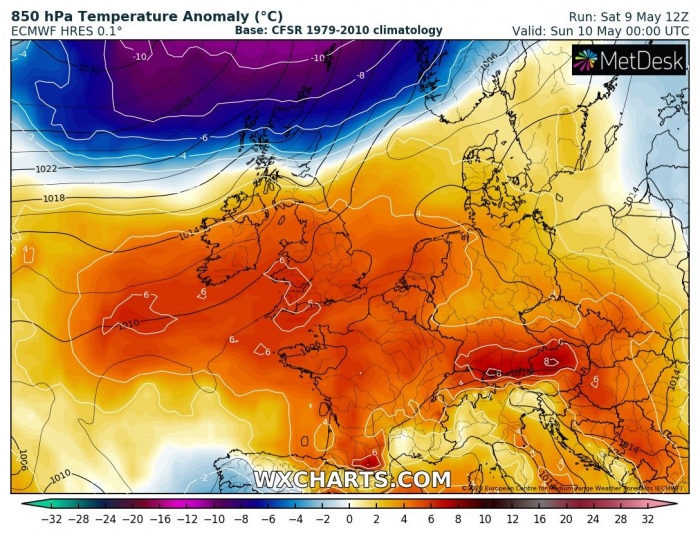
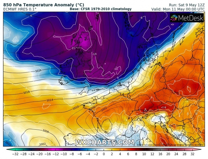
Here is the 850 mbar temperature anomaly across western and central Europe from tonight through Sunday and Monday. The 850 mbar level is best to show the intensity of the wave. Much warmer weather under the persisting warm advection remains over much of these regions. While the very cold air mass begins entering from the north. It first spreads across England, Wales and Ireland on Sunday, also over the North Sea and Denmark towards south. Overnight to Monday, the temperature anomaly becomes very impressive, even more than 10 °C lower than normal for this period across large part of western Europe. But it remains very warm over central Europe. Through Monday, the cold pool continues spreading south-southeast with the sharp surface cold front.
Sunday 00 UTC
Sunday 12 UTC
Monday 00 UTC
Monday 12 UTC
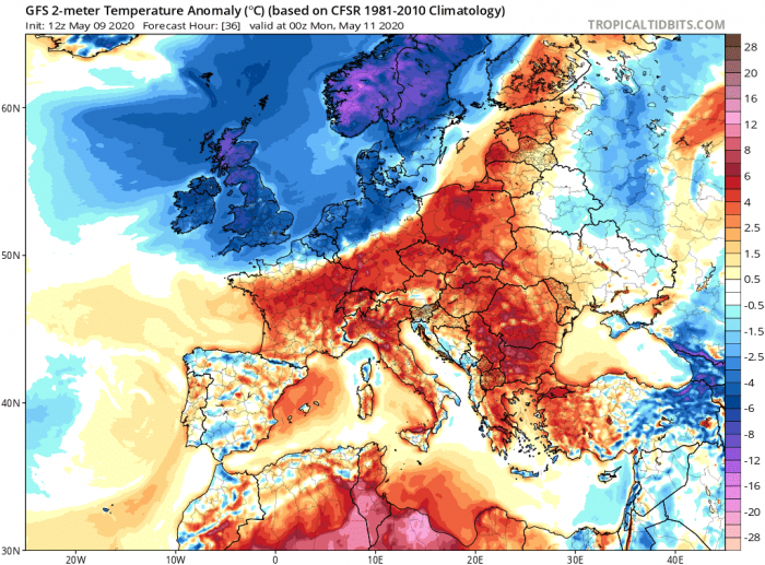
For the lowlands, we indeed use 2 m temperature anomaly. These maps are quite impressive with very warm day across eastern France, Switzerland and Germany on Sunday. To the north, the cold pool will already be spreading across western Europe. A sharp temperature gradient is nicely visible developing along the leading cold front overnight to Monday, even more intense during the afternoon hours. Notice a great temperature contrast between western and southeastern Poland on Monday:
Sunday 00 UTC
Sunday 12 UTC
Monday 00 UTC
Monday 12 UTC
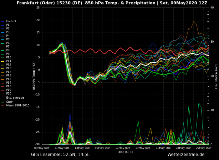
Attached are the GFS model meteograms for London (England), Brussels (Belgium) and Frankfurt (Germany) where a very rapid and sharp temperature drop is expected. While it was a very warm 23-25 °C spring day in England today, the cold pool spreads across Scotland, England and Wales tomorrow (Sunday) morning. It brings a huge temperature change compared to today! It then continues south-southeast overnight to Monday, reaching western Germany in the morning hours. The temperature change will be around 15 °C at 850 mbar (approximately 1500 m above sea level) in the matter of hours, even stronger close to the ground layer.
A much colder air mass spreading across western Europe could also bring some fresh snow into parts of Scotland. Nothing too significant, but snowfall is indeed possible!
We will have another forecast discussion regarding the Monday’s progression of the strong cold front across central Europe tomorrow – stay tuned!
Meanwhile, see also – the primary forecast: Ice Saints 2020 – An intense Arctic cold outbreak is likely next week, May 11th to 13th
