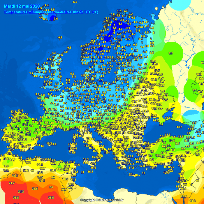
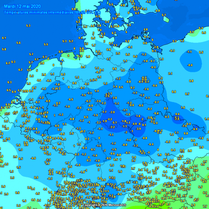
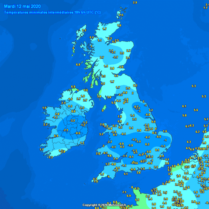
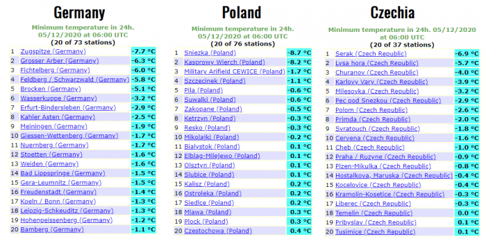
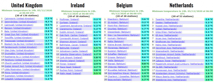
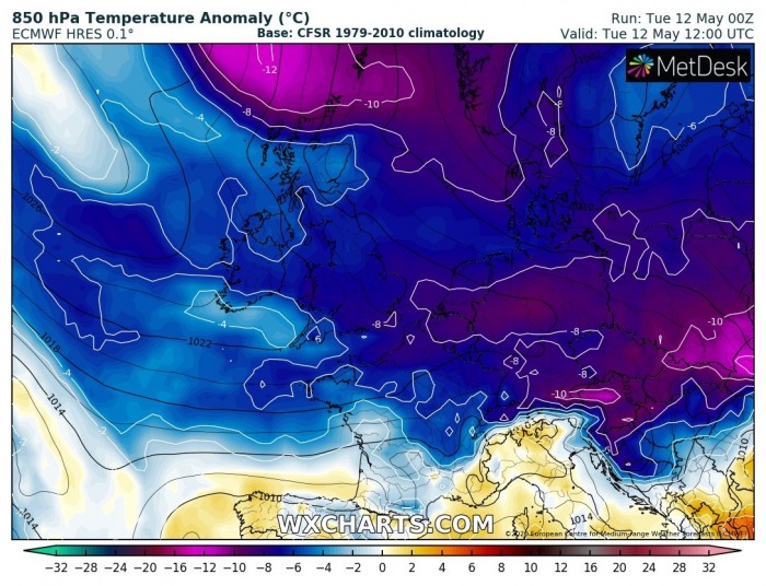
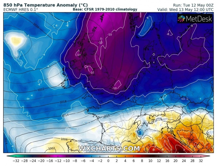
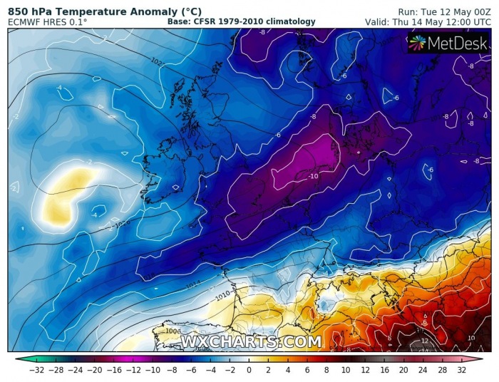
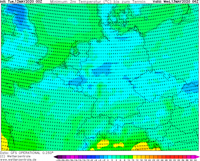
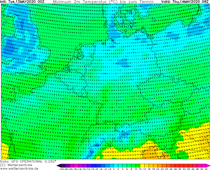
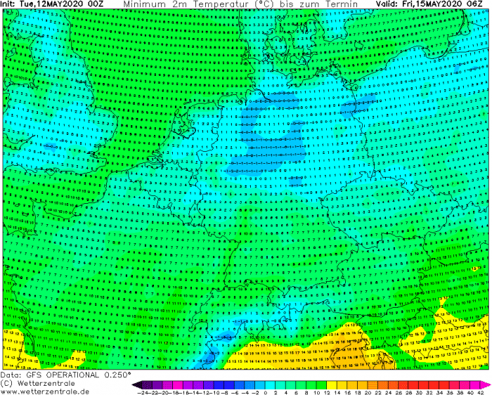
The Arctic outbreak has verified yesterday and continues this morning. Very cold temperatures are spread behind the cold front and have resulted in morning temperatures several °C below zero over Germany, part of Benelux, and also over the UK and Ireland. It is also snowing in northeast Europe. A few more very cold days are ahead until the weekend!
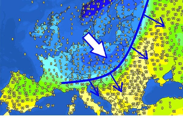
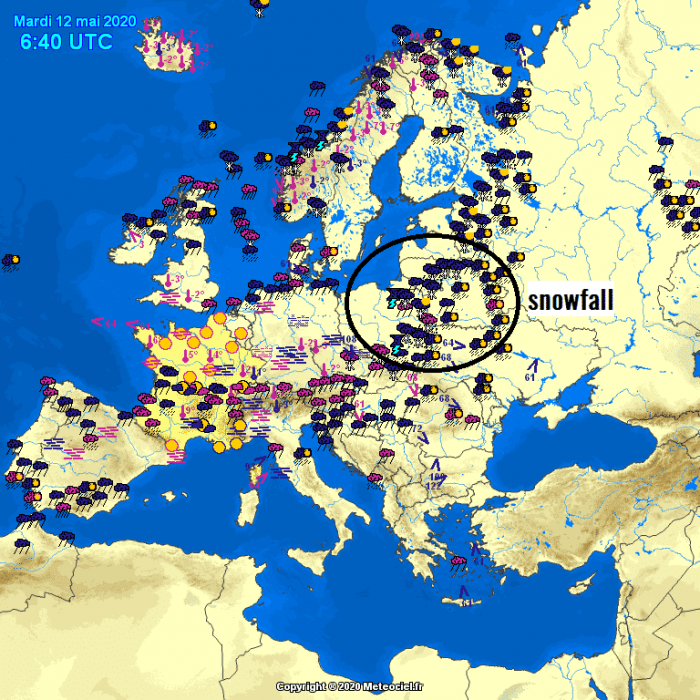
Spot the cold front! That is an easy job today. First, we can see the windchill map across Europe today, May 12th. A sharp surface cold front is extending from northwest Russia across northeast Europe into the Alpine region:
Cold morning, May 12th
The attached maps indicate today’s morning temperatures. Much colder weather is spread behind the front, but very warm temperatures remain in front of it. It was a very cold morning in some areas:
SYNOP/METAR tabular data:
Snowfall & storms
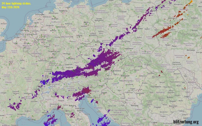
This morning, snowfall is also occurring in some regions along the front, especially over Poland and Belarus (northeast Europe). Further south and southwest, storms (including severe storms) were ongoing along the leading frontal boundary since yesterday afternoon as well.
Cold pool continues
The large cold pool will remain over north-central and eastern Europe for a few more days and is expected to gradually vanish towards the weekend.
With weakening winds behind the front and much colder temperatures present aloft, there is additional potential for damaging morning frosts in some regions. Like this morning, it may again be a cold morning with temperature below zero degrees Celsius over parts of Germany, Wales, England, Denmark, Poland, also Czechia and Slovakia until Friday. That’s pretty low for mid-May, so vulnerable crops will be in frost danger – stay alert!
See also:
- A sharp temperature change along Arctic front flush away the summer weather on Monday
- *update* on the powerful cold blast across west-central Europe through Sunday and Monday, May 10-11th
- Ice Saints 2020 – An intense Arctic cold outbreak is likely next week, May 11th to 13th
- Very cold mid-April morning across parts of Europe, with destructive frost in some areas, Apr 15th
- An impressive ~ 25 °C temperature drop this morning with snowfall across the northern Balkan plains – *high risk* for damaging frost on Wednesday morning
