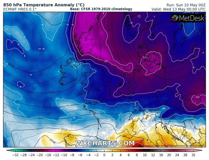
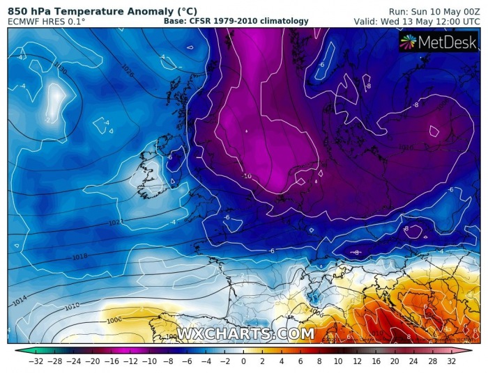
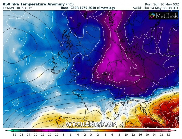
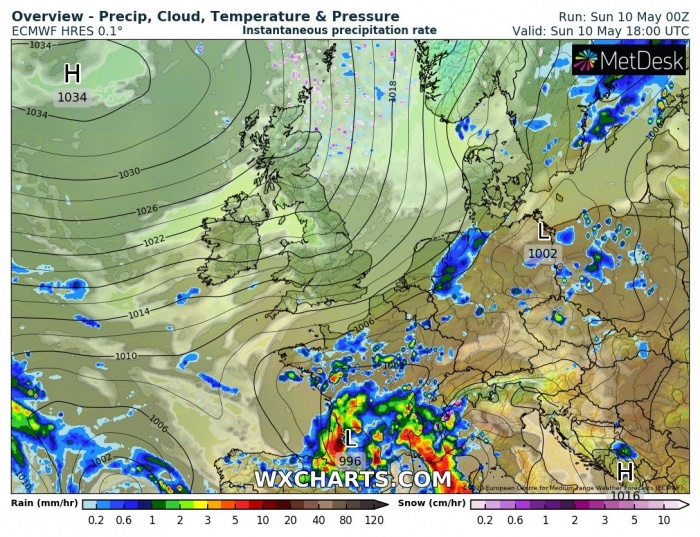
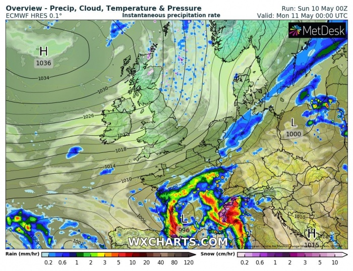
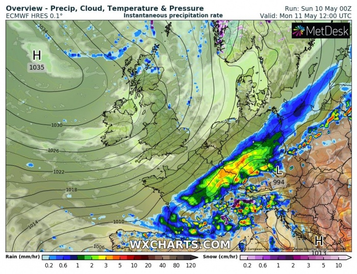
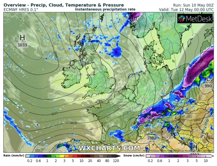
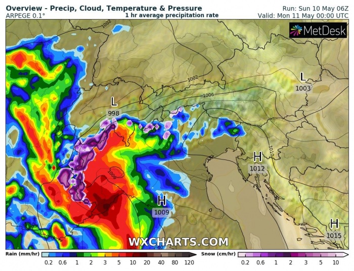
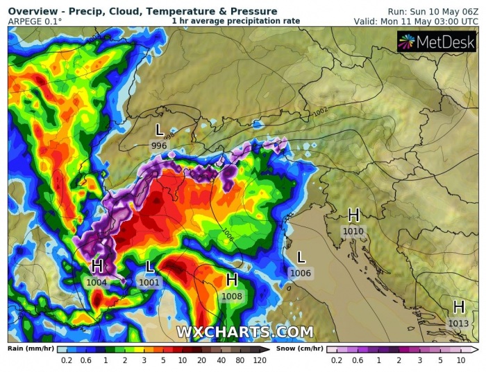
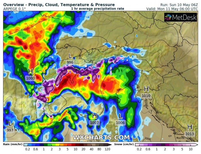
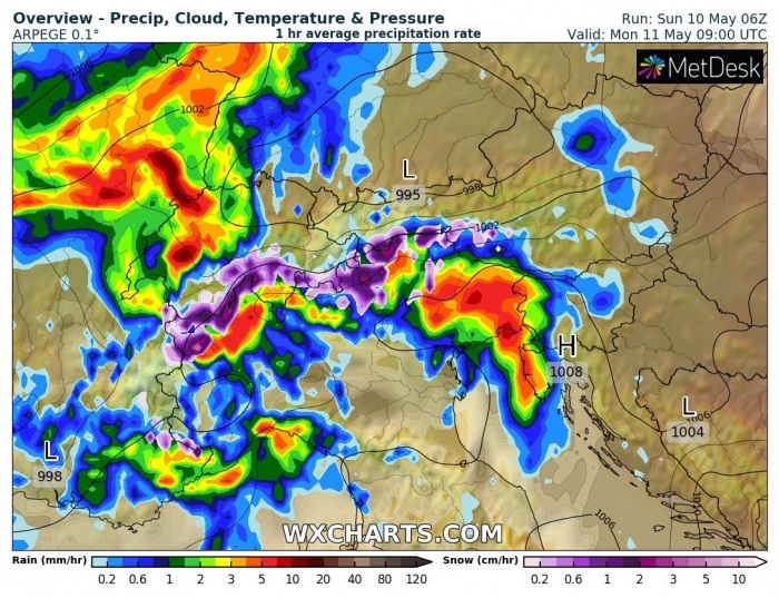
The cold air mass pool associated with the arctic outbreak is racing towards east-central Europe tonight. South of the deep trough and main cold front, a frontal system should bring excessive rainfall and severe storms threat over France and the Alps tonight. Much colder weather will spread behind the front and likely result in 15-20 °C temperature change in less than 12 hours! Some snow will also be possible from eastern Germany into Poland. Severe storms are possible over southern Germany towards Czechia on Monday afternoon.
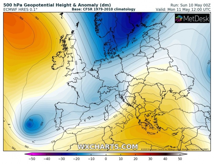
The 500 mbar chart over Europe reveals a strong upper-level ridge over the North Atlantic. Additionally, a deep trough is placed over northern Europe. The trough digs south with a short-wave over France, moving into central Europe. This wave also merges with the eastward drifting upper low from the Iberia and intensify over the Alpine region.
Dramatic temperature change
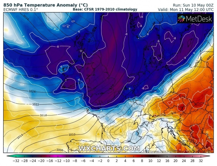
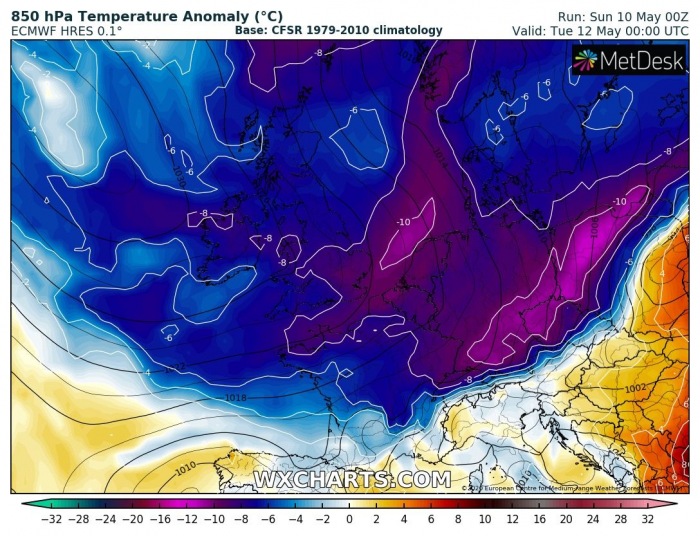
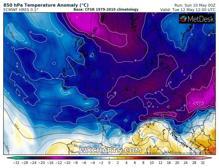
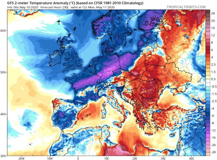
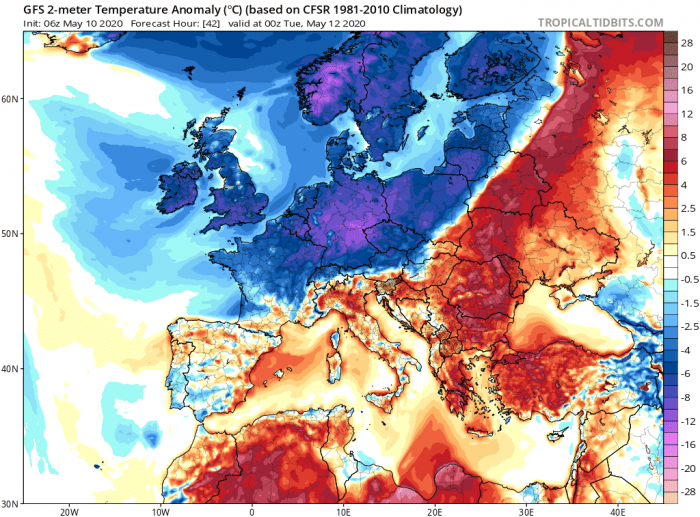
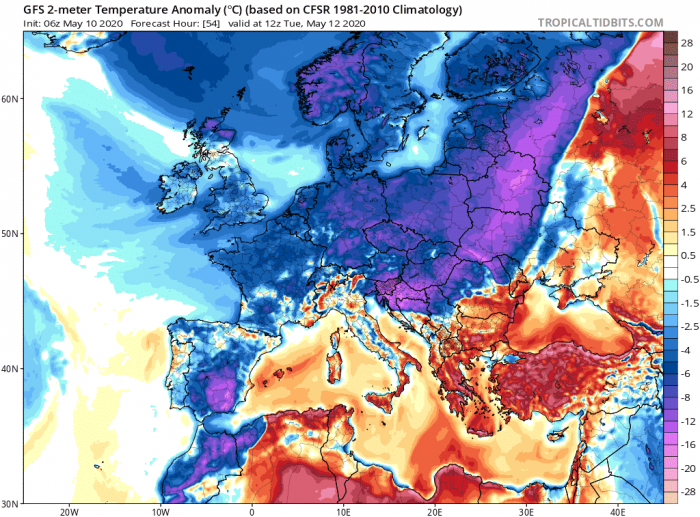
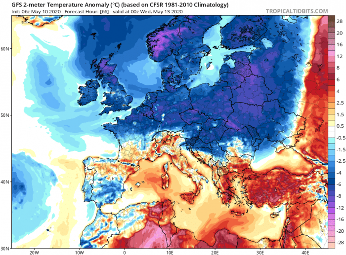
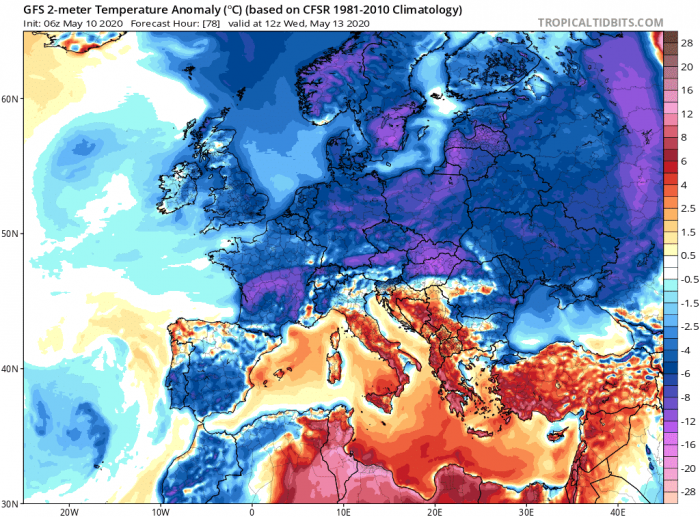
The pattern change over Europe will bring much colder weather into a large part of Europe after tonight. An intense cold outbreak will continue spreading from north to south, reaching central Europe by Monday morning and the Alps in the evening hours. Then, the cold pool continues spreading east-southeast into northern Balkans on Tuesday. It also maintains its strength over western and central Europe until Wednesday. The persistent warm advection over the Mediterranean should maintain warm weather over Italy and the rest of Balkans:
Looking over the 2 m temperature anomaly, we can see a very sharp cold front racing across Europe. The temperature change will be the most dramatic over central and eastern Europe where a sharp contrast in temperatures is seen. 15-20 °C temperature drop in 6-12 hours is expected!
France and Germany severe threat
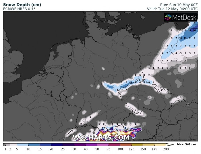
The surface low over southern France deepens this evening. As the result, more widespread storm activity is likely. Its frontal system begins accelerating northeast overnight to Monday. Heavy rainfall with flash floods and locally severe storms will develop. With the approaching Arctic front from the north during Monday, precipitation also increases along it. The surface low already reaches the northern Alps by early afternoon and continues northeast towards Tuesday. Ahead of the front, some severe storms are also possible across southern Germany, northern Austria, and Czechia in the afternoon hours. Precipitation could turn from rain to snow overnight to Tuesday, most likely from eastern Germany towards Poland.
Italy and Alps severe threat
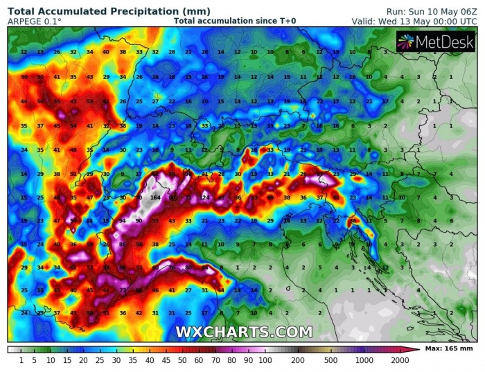
The pre-frontal activity will also bring the potential for severe storms and excessive rainfall across northern Italy. A frontal system pushes into the Alps and North Italy this evening. Heavy rainfall with convective storms is expected. Additionally, also heavy snowfall in the higher Alps. Therefore, excessive rainfall could result in flash floods in some areas of the Ligurian region and northwest Italy.
This activity could bring 100-150 mm of rainfall over the western Alps and the northern Apennines.
Excessive rainfall threat
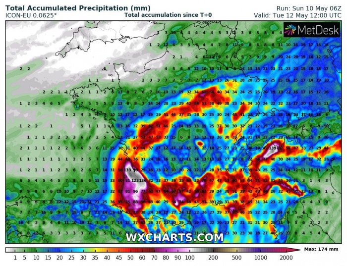
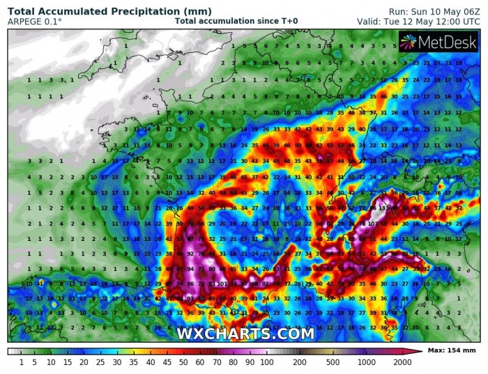
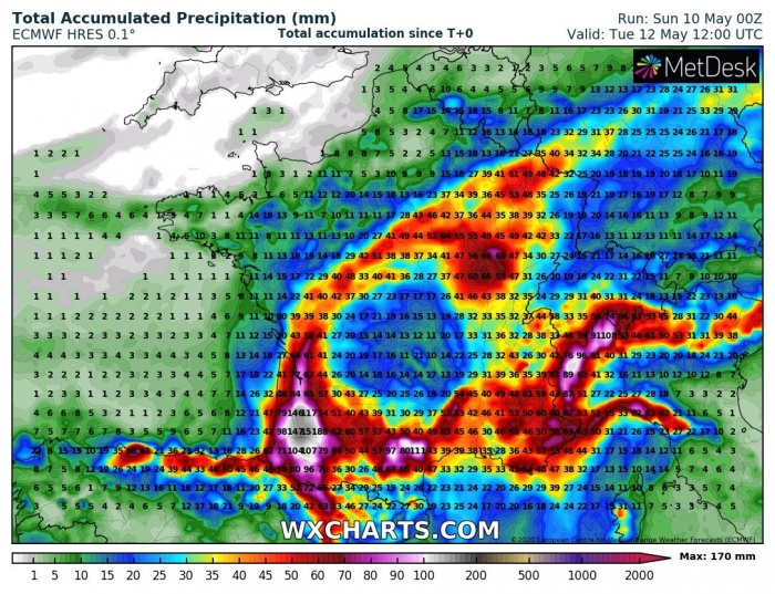
Overall, the system and the main Arctic cold front will bring a lot of rain across southern France and the western Alps. Attached are several model comparisons (ARPEGE, ECMWF, and ICON-EU). 140-170 mm of total rainfall is quite possible until Tuesday in some areas.
The very cold air mass associated with the Arctic outbreak will dramatically push the temperatures lower across Germany, Poland, and Czechia. There, some snowfall will be possible also in the lowlands through Monday afternoon and evening time. Although no significant amount is expected, 5-10 cm could accumulate in some areas. That is still very late in spring for such occurrence.
See also the other discussion related to Arctic outbreak activity these days:
