Skip to content

Severe Weather Europe

Global Weather News and Forecasts, covering the United States, Canada and Europe

  • HOME
  • WEATHER ANALYSIS
    • RECENT EVENTS
    • LATEST NEWS
    • Satellite Live
    • Radar Live
    • Lightning Live
    • EVENT ANALYSIS
    • Notable Events
  • WEATHER FORECAST
    • SWE weather models
    • SEVERE WEATHER FORECAST
      • Severe Weather Outlooks FAQ
    • SEVERE WEATHER OUTLOOK ARCHIVE
    • GLOBAL WEATHER
    • LONG RANGE
    • WINTER WEATHER
    • Europe Weather
    • TROPICAL WEATHER
    • MESOSCALE DISCUSSION
  • POLAR VORTEX
  • LEARN WEATHER
  • ABOUT & CONTACT
    • ABOUT US
    • Privacy Policy
    • CONTACT US

Marko Korosec

Marko Korošec is a veteran storm chaser and expert weather forecaster with over 25 years of experience specializing in the analysis of extreme atmospheric events. A former forecaster for Estofex, he draws on deep-layer shear dynamics and thermodynamic analysis. Marko is highly recognized for his technical proficiency in short- and mid-term forecasting of high-impact weather, including severe convective systems and complex winter weather. In addition to his SWE role, Marko worked for 17 years as a Road Weather and Maintenance Decision Support System Supervisor until 2022, applying his expertise to the critical field of transportation meteorology. He focused on the forensic analysis of road surface conditions and the impact of extreme winter weather, including blizzards, freezing rain, and ice storms, on infrastructure safety. His work was instrumental in developing strategies for proactive winter maintenance and real-time hazard mitigation. Marko’s unique dual-career path combines rigorous meteorological forecasting with world-class visual documentation. An acclaimed visual artist and winner of the 2014 National Geographic Traveler Photo Contest, he uses his "awe-inspiring" photography to illustrate the power and complexity of the atmosphere. By merging technical forensic details with high-resolution visual evidence, Marko serves as a vital bridge between high-level atmospheric science and public understanding, dedicated to capturing "the fury of nature" for a global audience. Photo gallery: MarkoKorosec.net

Cristobal will bring a significant threat to the Gulf Coast this weekend

June 5, 2020 by Marko Korosec

Tropical Storm Cristobal, the third named system of an already active hurricane season 2020, had maximum sustained winds of 35 knots / 40 mph on … Read more

Categories Tropical Weather Tags cristobal, flooding, florida, gulf coast, gulf of mexico, Louisiana, mississippi, storm surge, Texas

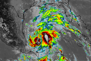
Severe storms and flooding for central Europe – cooler weather develops after the pattern flip

June 4, 2020 by Marko Korosec

We are now entering a much more dynamic weather pattern we’ve been experiencing lately. Especially over the western half of Europe, as well as the … Read more
Categories Mesoscale Discussion Archives Tags alps, central europe, england, lightning, ridge, severe storms, severe winds, trough, UK

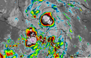
Tropical storm Cristobal forms in the Gulf of Mexico, it might turn towards New Orleans

June 2, 2020June 2, 2020 by Marko Korosec

We have discussed about the potential formation of tropical depression in the Gulf of Mexico a few days ago. The remnants of the ex-tropical storm … Read more
Categories Tropical Weather Tags amanda, cristobal, el salvador, flooding, gulf of mexico, hurricane season, Louisiana, Texas, tropical storm

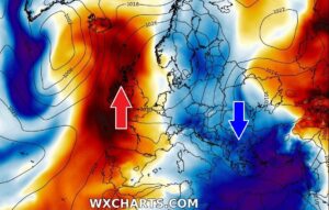
Remnants of Tropical Storm Amanda lead to destructive flooding in El Salvador – could re-develop as Cristobal into the Gulf of Mexico

June 1, 2020 by Marko Korosec

The remnants of the Eastern Pacific Tropical storm Amanda are moving into Central America. The system is releasing a huge amount of rain across portions … Read more
Categories Tropical Weather Tags amanda, cristobal, el salvador, guatemala, gulf of mexico, honduras, hurricane, hurricane season, tropical storm

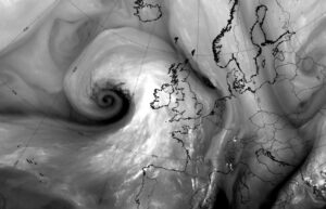
Dipole pattern over Europe continues – stable and warm to the west, dynamic and cooler to the east

May 28, 2020 by Marko Korosec

A classic dipole pattern is underway across European continent this week. A strong upper-level ridge/blocking pattern has established over the western half of Europe, providing … Read more
Categories Mesoscale Discussion Archives Tags arctic region, Balkans, dipole pattern, ridge, storms, upper low, western europe

UPDATE: Severe winds are spreading across Ireland, Wales and Scotland today – will also reach England on Saturday

May 22, 2020 by Marko Korosec

A deep and intense surface cyclone is moving into western Europe this morning, with its central pressure near 970 mbar. It is delivering severe winds … Read more

Categories Mesoscale Discussion Archives Tags Britain, cold front, cyclone, dry intrusion, faroe islands, ireland, north atlantic, North Sea, satellite, scotland, UK, Wales, waves

Spectacular satellite imagery of a rapidly organizing depression moving towards western Europe today

May 21, 2020 by Marko Korosec

An impressive satellite presentation of a rapidly developing cyclone is seen over North Atlantic today. It is moving towards western Europe. It’s been a while … Read more

Categories Mesoscale Discussion Archives Tags cyclone, ireland, north atlantic, satellite, scotland, UK, waves

Turkey swings from extreme heat back to winter temperatures in two days – Cold blast across the eastern half of Europe

May 22, 2020May 20, 2020 by Marko Korosec

We have been discussion the historic and record-breaking heatwave across Turkey and Cyprus lately. But now there is a huge change for them, and also … Read more

Categories Mesoscale Discussion Archives Tags Balkans, cold blast, cold outbreak, cold pool, eastern europe, heat, turkey, winter
Older posts
Newer posts
← Previous Page1 … Page82 Page83 Page84 … Page225 Next →
Live radar, satellite and lightning maps SWE weather models Learn Weather

Recent Posts

  • Polar Vortex Reversal: Stratospheric Impact Wave Could Arrive by Thanksgiving
  • New Winter 2026/2027 Forecast: A Snowier Shift and a Mid-Winter Polar Vortex Signal
  • The Polar Vortex Is Collapsing in November: What It Could Mean for Your Winter
RSS Feed
© 2026 Severe Weather Europe • About • Contact • Privacy Policy