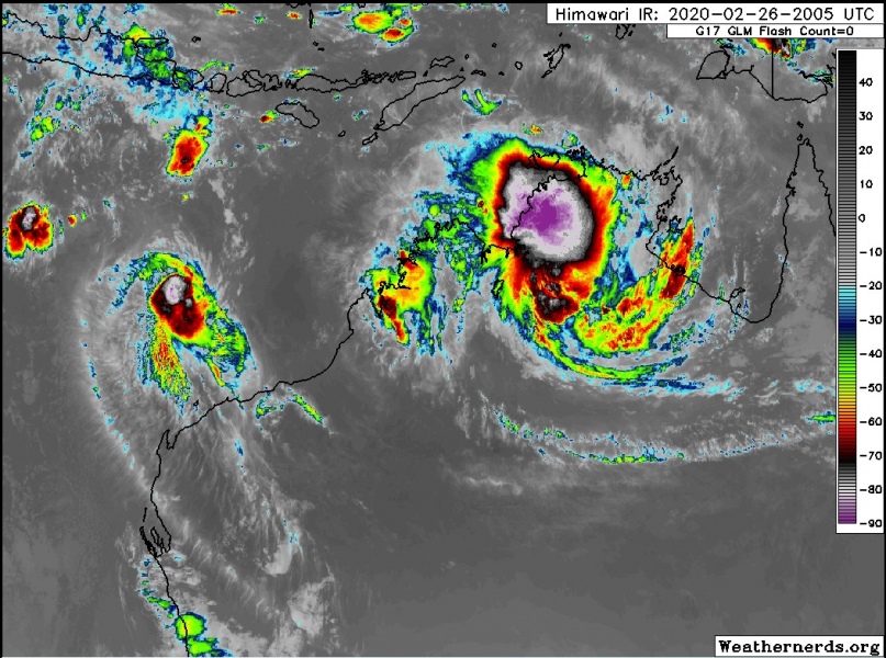
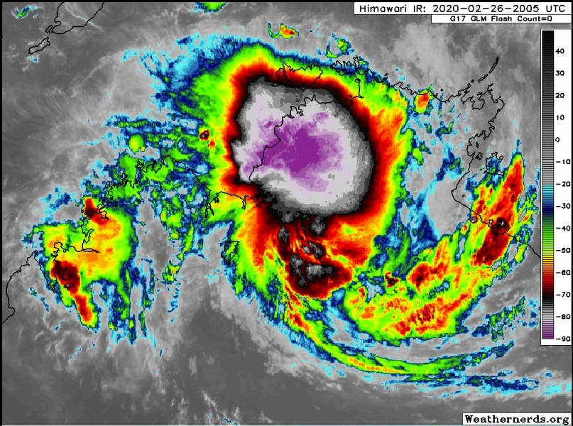
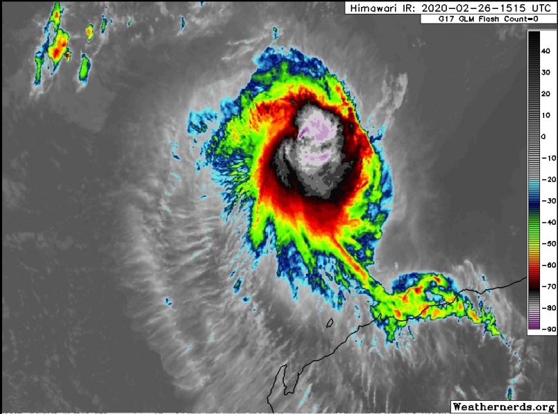
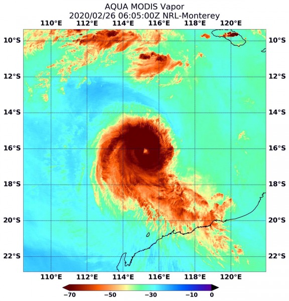
Severe Tropical Cyclone #Ferdinand has peaked last night as a strong Category 3 system, while the remnants of Tropical Cyclone #Esther have been re-organizing and collapsing again while traveling west across the Northern Territory state. The latest activity indicated an explosive cluster of storms with Esther. Both systems are expected to live further until the weekend where Ferdinand is likely to dissipate while Esther continues with an extremely dangerous threat for flooding.
*********************************************
NEW UPDATE: The tropical depression 19P (ex-#Esther) now moving along the Western Australia coast
*update* on the tropical depression 19P (ex #Esther) now moving along the Western Australia coast
*********************************************
En el día de ayer el satélite #Himawari8 Geocolor captó los restos del Ciclón Tropical #Esther y la formación simultánea del Ciclón #Ferdinand a lo largo de la costa norte de #Australia. En esa zona del hemisferio sur continúan bajo la temporada de Ciclónes Tropicales. pic.twitter.com/alIOZjUWdz
— Tropical Weather Service (@TropicalWS) February 26, 2020
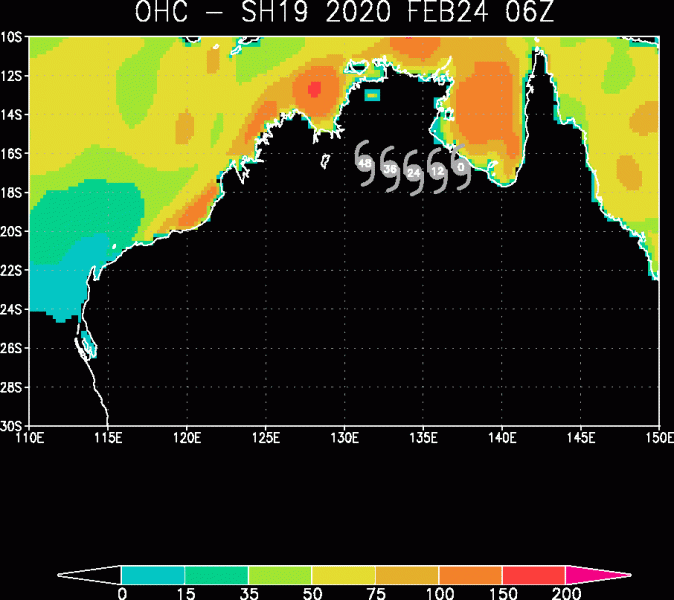
The Ocean Heat Content (OHC) graphics reveal very favorable sea-surface conditions around northern Australia. Ferdinand is going away from the best conditions while Esther is partly fueling from the conditions along coastal areas, which helps to maintain its deep convective storms.
System #19P – #Remnants of Tropical Cyclone #Esther
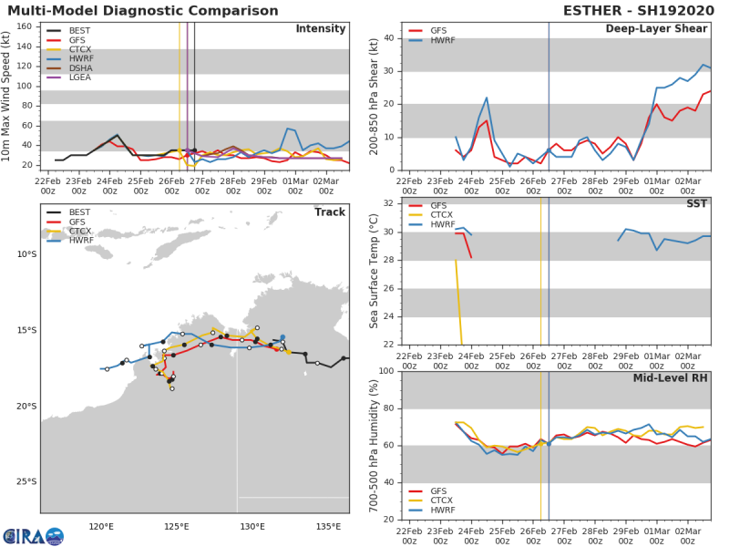
As of 18 UTC on Feb 26th, Esther had the maximum sustained winds of 35 knots and the minimum central pressure of 996 mbar. The satellite imagery this morning (local time, Feb 27th) indicates that explosive cluster of storms has formed around the virtual center of Esther’s remnants, showing conditions are still very good to support deep convection. Its relative close position to the warm air mass inflow from the ~31 °C ocean surface to its north, is helping to fuel the storms.
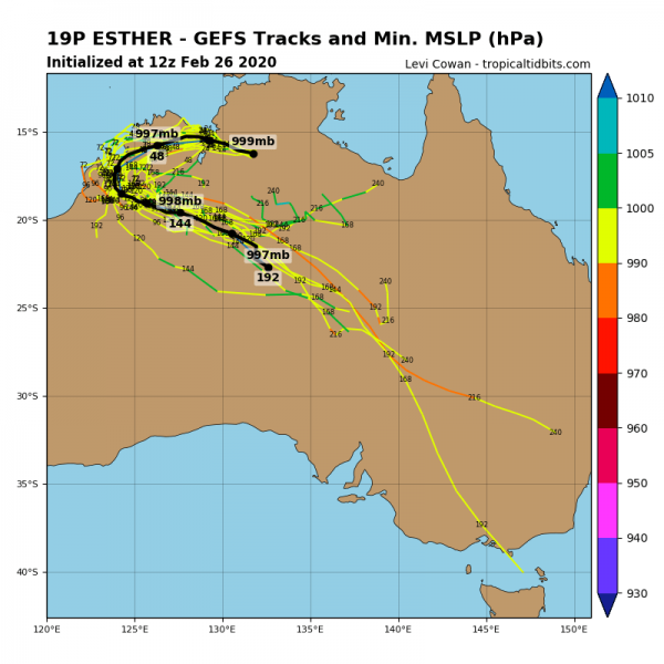
The future behavior of Esther depends if the system’s center will be able to make it back west to reach the warm ocean again. If this happens, it would boost its intensity significantly. However, the latest model guidance suggests Esther might end up its westward movement right on the coast of the extreme northeast part of Western Australia state, then making a sharp U-turn back towards the southeast and going further inland into central Australia (back into the Northern Territory state) again.
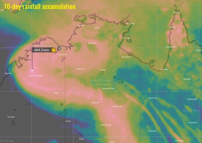
The greatest concern with Esther remains its extremely dangerous flooding potential as models are still in further agreement for a very significant rainfall amount along its track. Even more than 500 mm will locally be possible!
The system #20S – Tropical Cyclone #Ferdinand
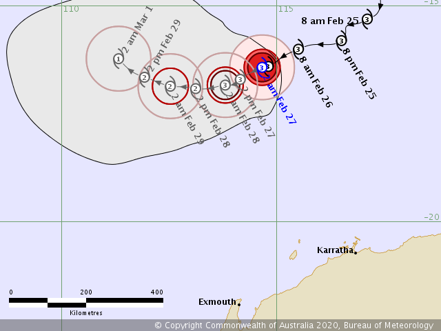
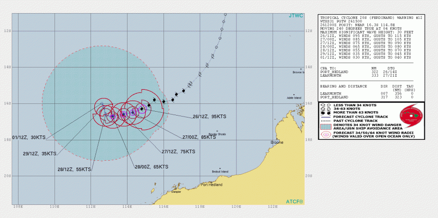
Ferdinand has peaked last night and it now in the weakening trend while slowly drifting west-southwest, away from any land areas.
As of 18 UTC on Feb 26th, it was still a Severe Tropical Cyclone with Category 3 maximum sustained winds of 90 knots and the minimum central pressure of 966 mbar. Although the system is in its gradually weakening trend, it is still a compact cyclone with impressive outflow ventilation on the satellite.
https://twitter.com/windyforecast/status/1232718037243121664
See the previous discussions:
