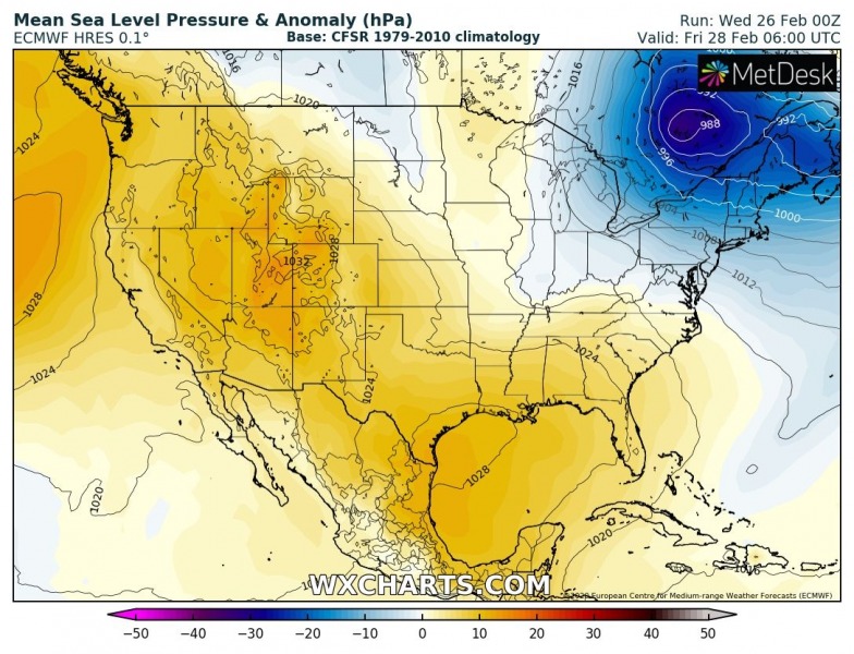
There is a concerning threat developing over the Great Lakes region as a part of the deep low-pressure system crossing the northeast US tomorrow. When the low moves further northeast, it slows down and establishes a strong Arctic air mass advection over the Great Lakes. Resulting in an extremely dangerous lake-effect snowfall for the eastern shores of the lakes Erie and Ontario. Models are hinting up to 4 feet (or potentially even more) of fresh snow by Saturday!
Note: Lake-effect snow develops when a very cold air mass (usually during the Polar / Arctic outbreaks) moves across the warmer lake (or sea, e.g. Black Sea, Adriatic sea, or Baltic Sea in Europe) water. The layers of air closer to the lake surface are heated up by the warm lake water, picking up moisture/water vapor from the lake and rises up through the colder air advection above. This results in convective squalls and bands of heavy snow. Snow is then deposited on the leeward (downwind) side of the lakes (seas) shores.
The pattern which establishes on Friday and Saturday is the classic setup for an intense lake-effect snowfall over the Great Lakes. Deep trough/surface low across the northeast US and ridge across the western CONUS. This supports a powerful intrusion of Arctic air mass from Canada into the Great Lakes region.
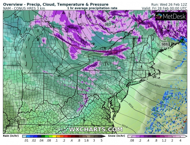
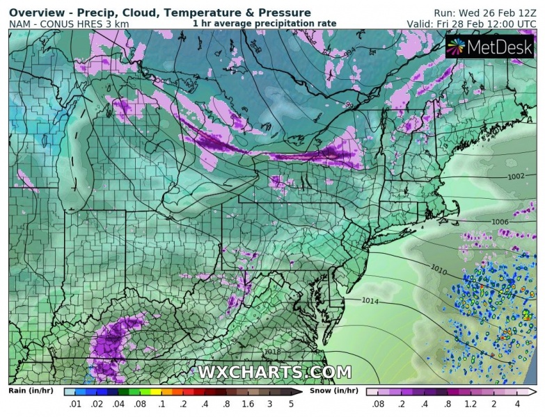
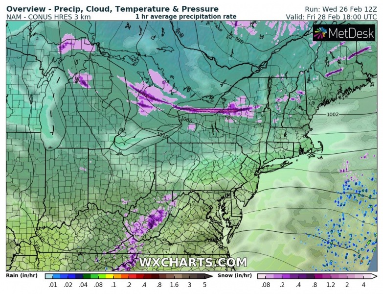
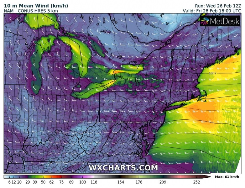
Let’s get into details on the 6-hour sequence from Thursday afternoon until Friday evening. The prevailing winds from west-northwest are clearly visible, blowing across the lakes and resulting in convective cloud bands and squalls with very intense and excessive snowfall. The Arctic cold air mass blowing over the warmer lakes will introduce a textbook lake-effect snowfall with intense snowfall rates – likely 2-4 inches (8-12 cm) hourly! The event starts on Thursday towards the evening, with the establishing corridor of northwesterly winds over the lakes Huron and Michigan. But the main concern is the further evolution as the deep low-pressure system pushes a bit further east over the Northeast US, so the intense lake-effect snow develops and soon intensifies downwind of the lakes Erie and Ontario. Conditions will then significantly worsen overnight and persist through Friday into Saturday morning. Models are actually hinting the wind direction will be very favorable for collecting moisture across the large area (meaning the convective bands will likely form already over the lake Superior, then moving across the northern lake Michigan and across lake Huron towards the warmer lakes Erie and Ontario) which will allow much higher moisture content and even more intense snowfall rates and higher snow accumulations. Maps clearly show a persistent long-lived convective band extending all the way from the Lake Huron downwind to the Tug Hill Plateau, est of the Lake Ontario!
Thursday, 18 UTC
Friday 00 UTC
Friday 06 UTC
Friday 12 UTC
Friday 18 UTC
Along with the intense snowfall, huge snowdrifts are expected with the strong winds during the event. This locally creates extremely dangerous driving conditions and could also lead to impassable roads or roadblocks. We can expect extremely difficult driving conditions across all the roads to the immediate east of Lake Erie and Lake Ontario.
An interesting but quite concerning map of 24-hour precipitation total over the region – the long-lived narrow convective band is very well visible, introducing dangerous conditions with huge snow amounts possible to the east of Lake Ontario (2 inches of rain across the Tug Hill Plateau), but also lake Huron.
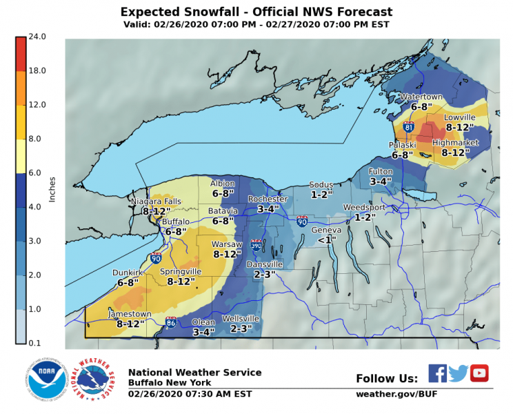
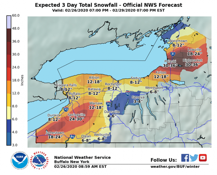
Here are the charts of the total snow amounts expected by the local National Weather Service in Buffalo, NY. Attached are the maps for Thursday (24 hours) and then Friday + Saturday (48 hours), as well as the total snow amounts until Saturday (72 hours). 35+ inches (3 feet = 90+ cm) is quite likely across the Tug Hill Plateau. This is an extreme amount of snow for roughly 3 days of snowing! We can see Friday and Saturday will bring the main snowfall amount.
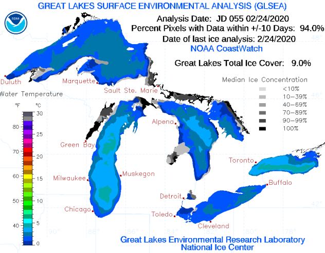
As the lakes are almost ice-free this February (only 9% coverage against the usual 40% by the end of February), this will allow strongly to extremely unstable air mass above the lakes, therefore resulting in intense convective snow bands/squalls into the immediate coastal areas! Conditions are there for a historic event over the most prone areas for a significant amount of lake-effect snow, likely resulting in 35-50 inches (4-5 feet)!
See the primary discussions:

