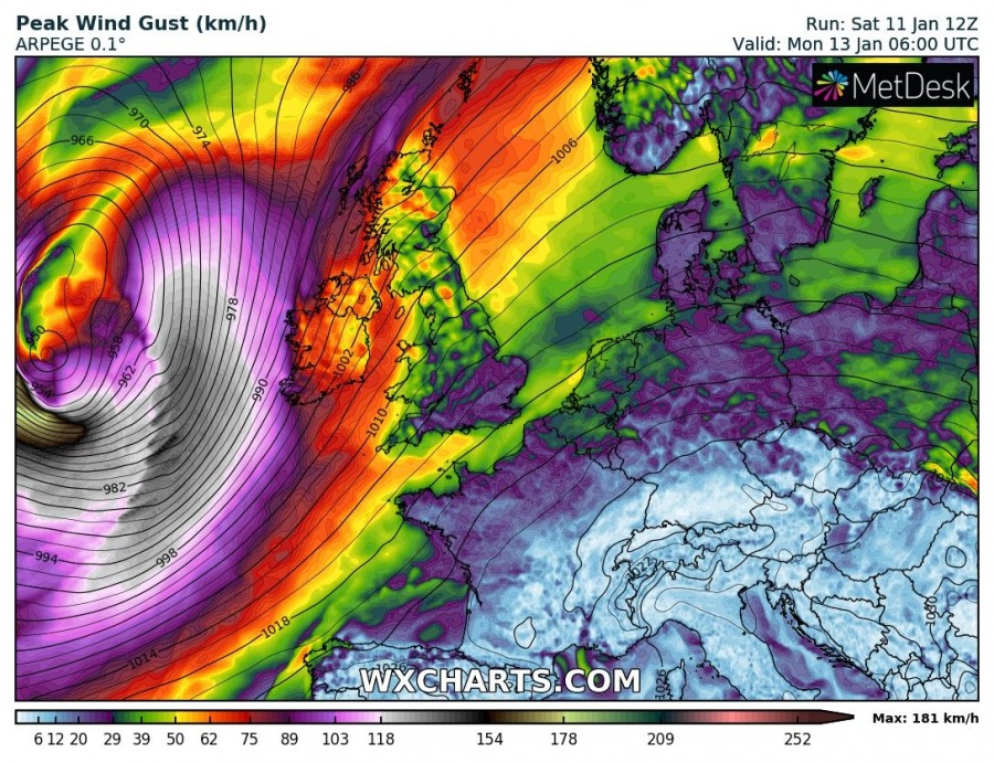
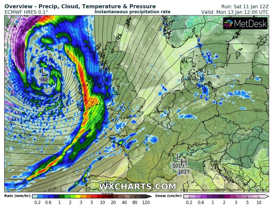
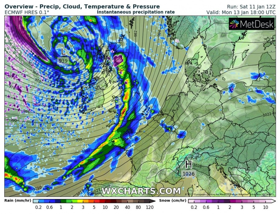
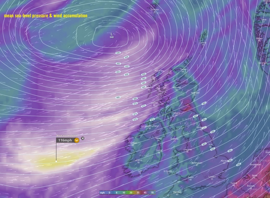
North Atlantic doesn’t want to stop this winter – wave after wave is developing intense surface cyclones and powerful windstorms. Another violent windstorm is expected to push towards western Europe, affecting Ireland and Scotland with extremely severe winds through Sunday night and Monday. Major swell and high waves with potentially being up to 15 meters will push towards the coastal western Ireland and Scotland as well!
*********************************************
*********************************************
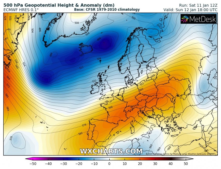
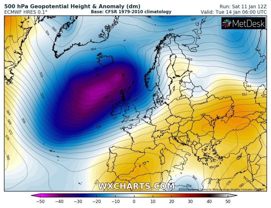
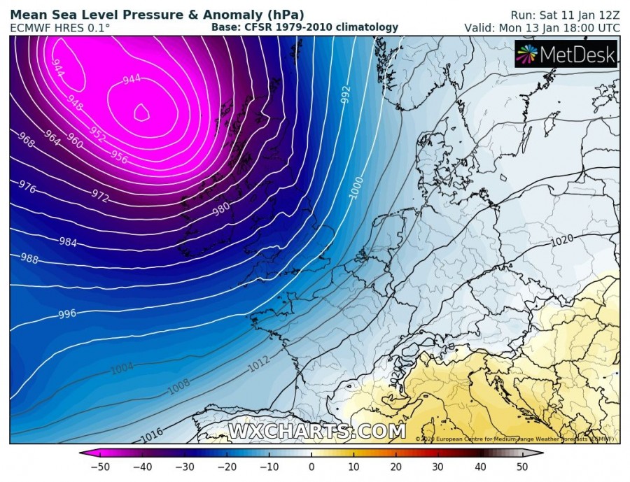
The pattern responsible for this another rapid cyclogenesis indicates an elongated upper-level trough over the southwest central and eastern Europ while a large long-wave trough dominates North Atlantic and northern Europe. Through the late Sunday, trough begins significantly deepening over the North Atlantic while moving towards the British Isles and Faroe Islands on Monday. At the surface, a rapidly intensifying cyclone moves along with the upper core.
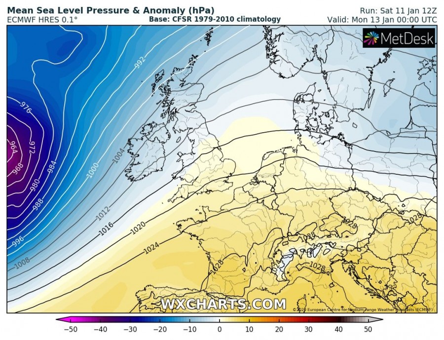
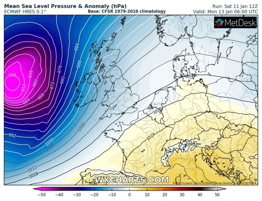
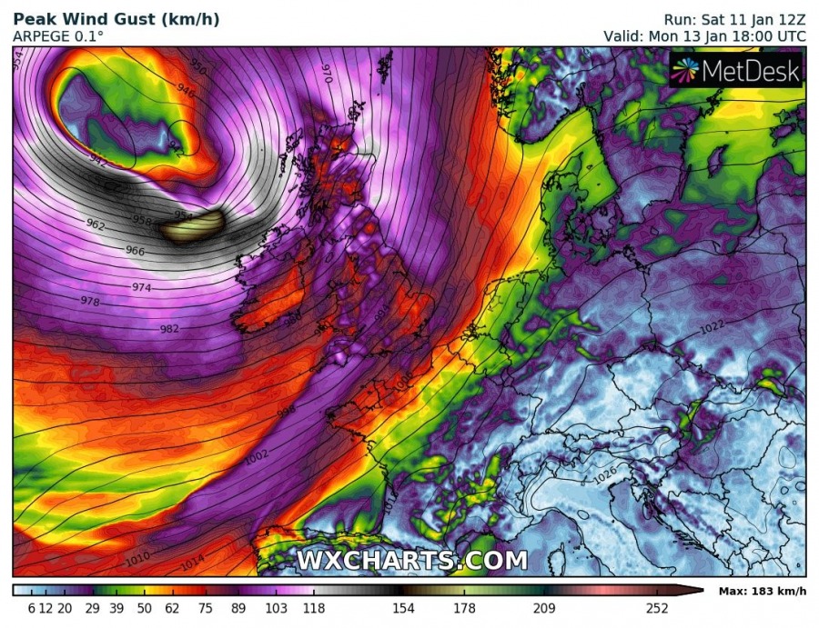
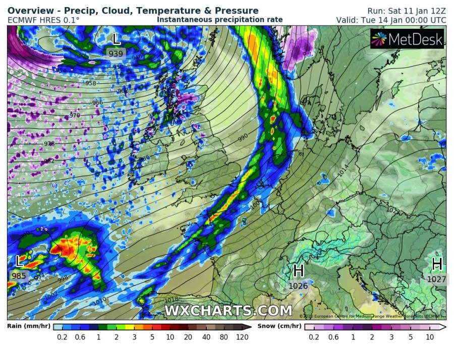
The 6-hour sequence indicates a very strong cold frontal boundary with intense precipitation will be associated with this deep cyclone. Cyclone starts approaching western Europe overnight from Sunday to Monday while rapidly intensifying. The central pressure will be dropping fast through Monday morning while the system with the cold front will be moving towards Ireland. Around midday Monday, the cold front with severe gusty winds pushes into Ireland, the cyclone should have central pressure already around 940 mbar! Violent winds will develop further west near the center low, likely in excessive of 150 km/h – a dangerous sting jet might occur! Towards the evening hours, the cyclone will continue deepening into the upper 930s while drifting northeast towards Scotland. The cold front will rapidly push east across Wales and England, already reaching the North Sea by the late evening hours.
Monday, Jan 13th, 00 UTC
Monday, Jan 13th, 06 UTC
Monday, Jan 13th, 12 UTC
Monday, Jan 13th, 18 UTC
Tuesday, Jan 14th, 00 UTC
Potentially very dangerous wind gusts will develop to the immediate south of the rapidly deepening cyclone while drifting northeast, moving with its center to the west of British Isles and Ireland. Sting jet phenomena could develop which usually brings even more violent peak gusts locally. Those could push into 160-180 km/h (100-110 mph) near the center low!
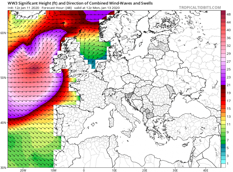
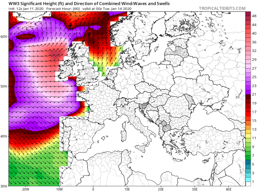
A broad area of major swell and huge waves is expected with the system, as the cyclone will develop a large windstorm towards western Europe. High 10-15 meter waves are likely!
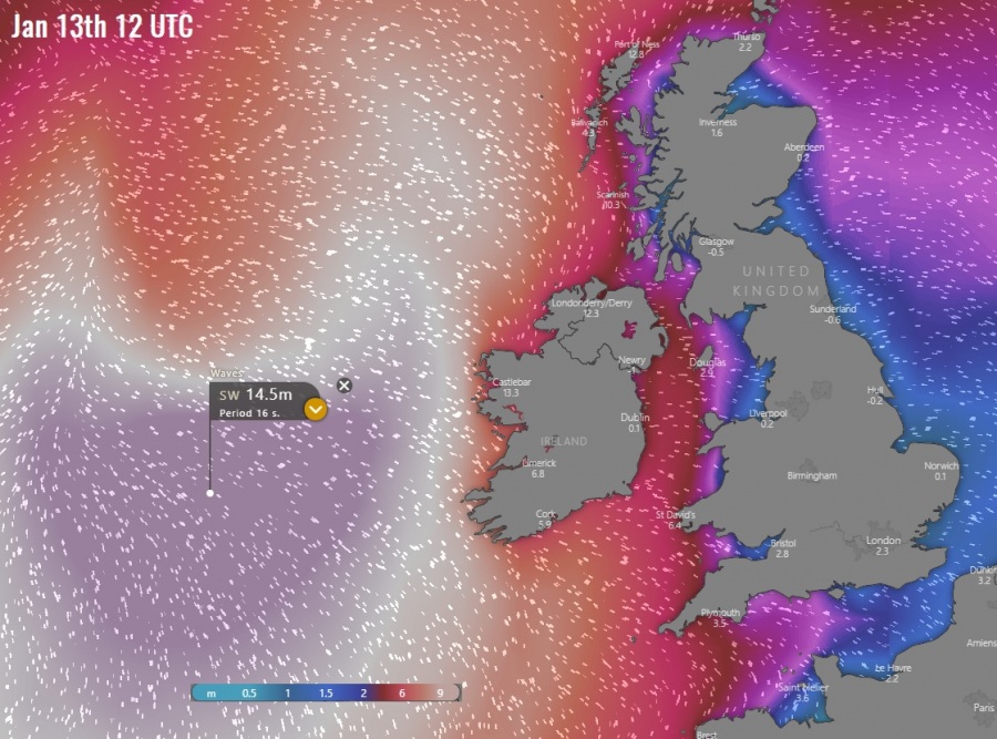
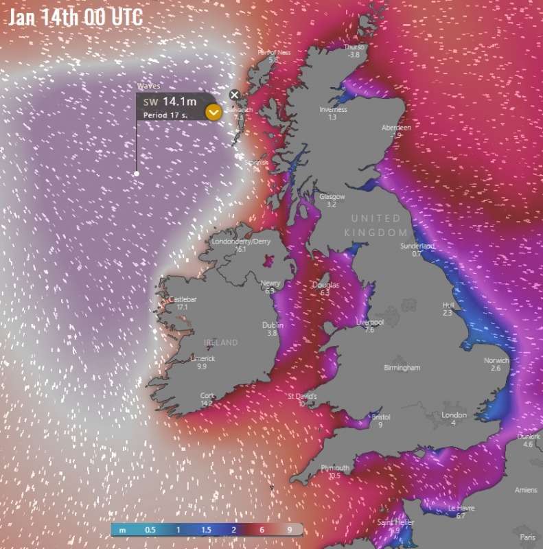
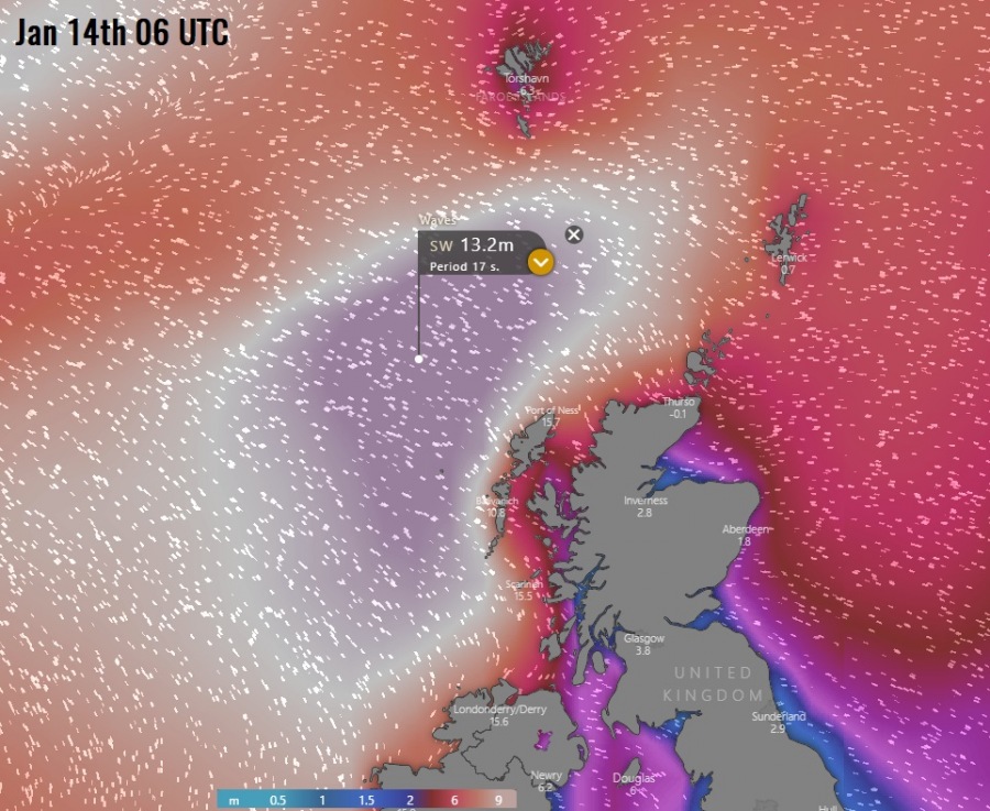
Zoomed-in view of the high sea waves / swell towards the UK and Ireland – the highest waves will push towards the western Ireland, Northern Ireland and western Scotland from mid Monday until Tuesday morning, likely reaching around 15 m height is some areas!
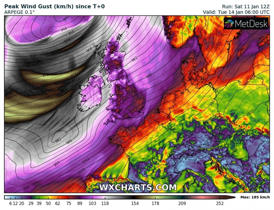
Overview of the wind gusts accumulation through the 3-day period (Sunday-Tuesday), up to around 190 km/h / 116 mph just west of Ireland:
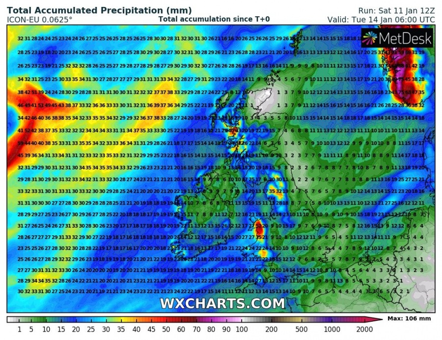
Persisting westerly-southwesterly flow will also introduce strong orographic rainfall, resulting in the high amount of rain sums over Wales and northern England, as well as western Scottish Highlands. Locally around 100 mm of rainfall is possible.
Stay tuned for further updates tomorrow!
See also – several deep cyclones occurred lately:
An extremely deep cyclone over Iceland produces the most epic satellite presentation of the season
Interested in our calendar? We are proud to present and promote the best weather photographers in Europe – see details:
