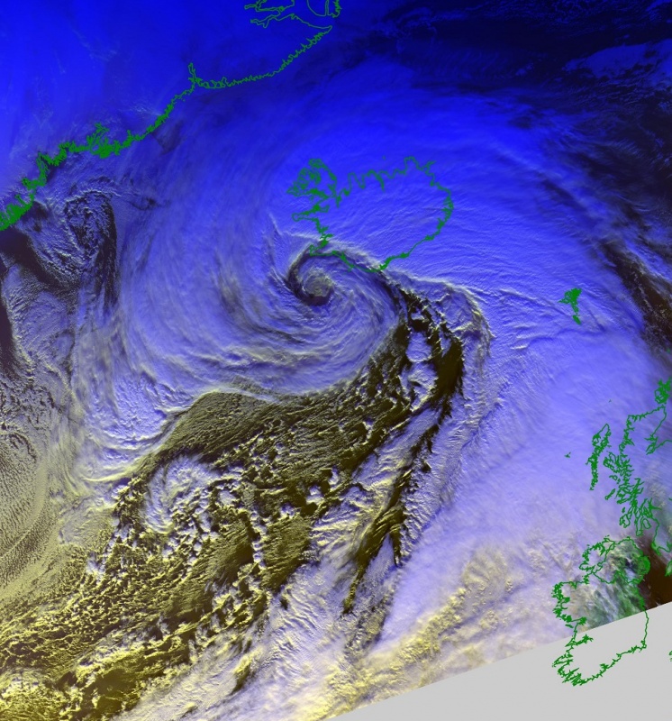
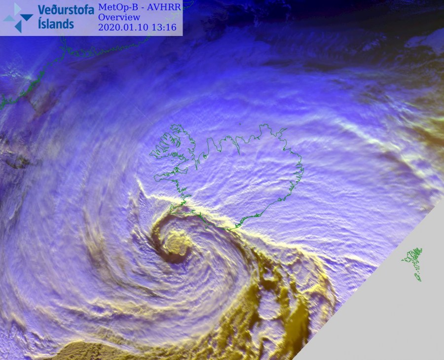
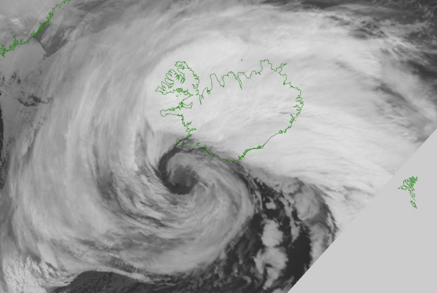
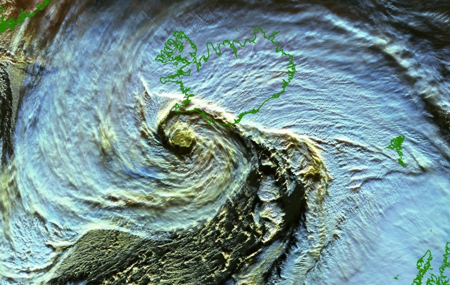
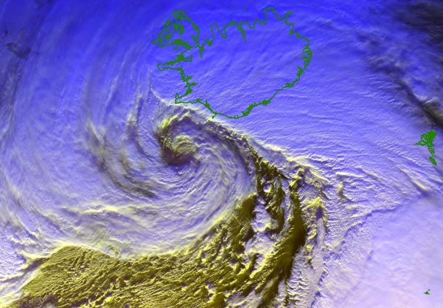
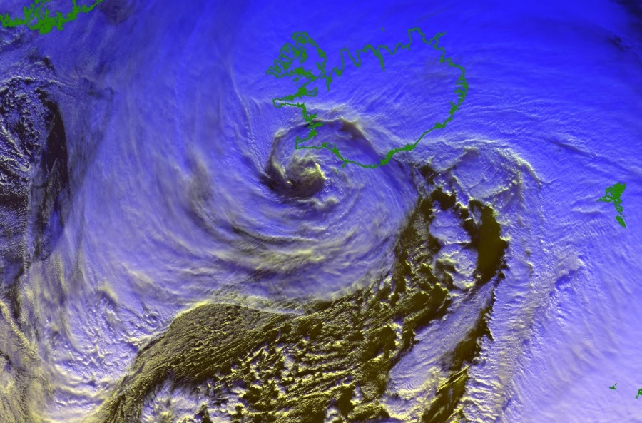
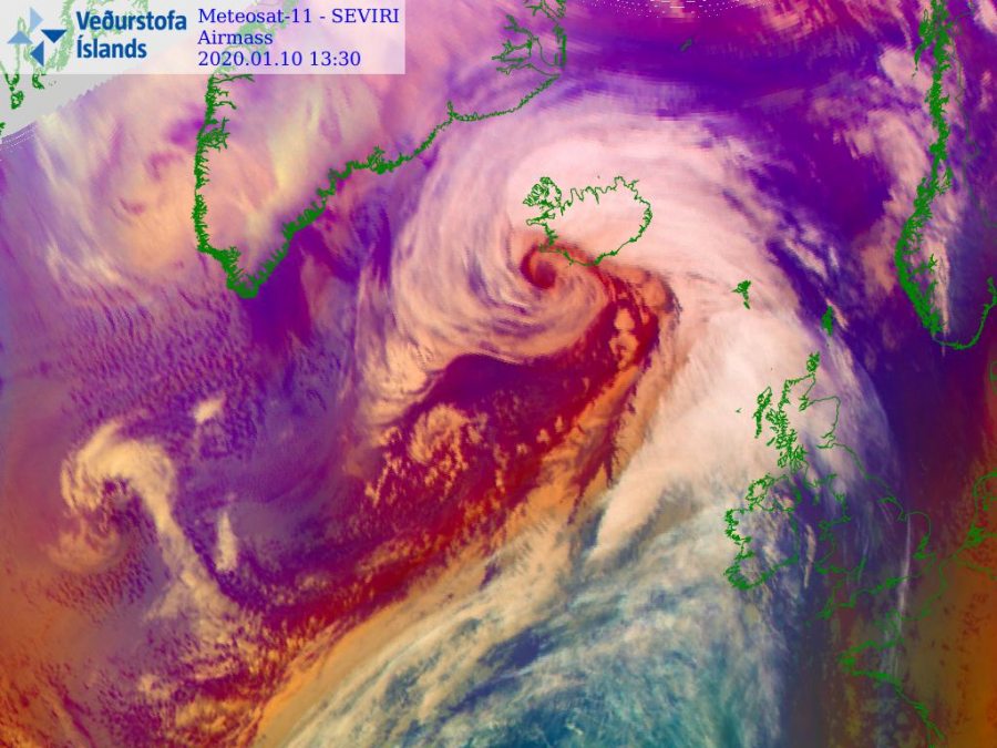
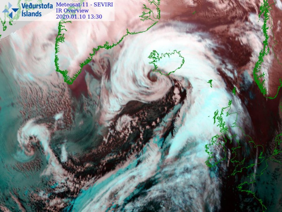
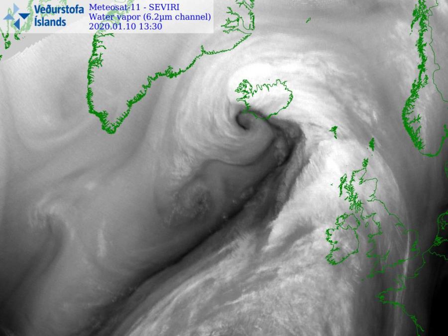
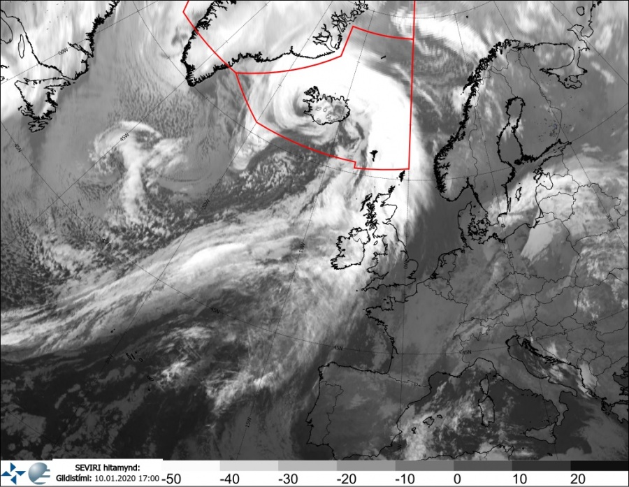
As we discussed this morning, an impressive rapid intensification of a very large extra-tropical cyclone was ongoing across the North Atlantic today, while moving towards Iceland. The satellite presentation was improving with every scan and during the late afternoon hours, spectacular imagery appeared! The cyclone has continuing strengthening and deepening its central pressure with around 8-10 mbar / 3-hour rate. This lead to an epic view from the satellites!
Usually, the system like this would need a lot of discussion and description… but what more to add besides the impressive imagery this cyclone delivered? The pressure gradient, while it was approaching Iceland, was very intense and the rainbands around the eye of the storm appeared as well.
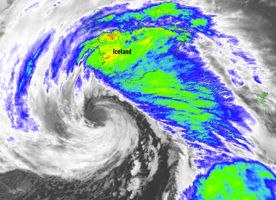
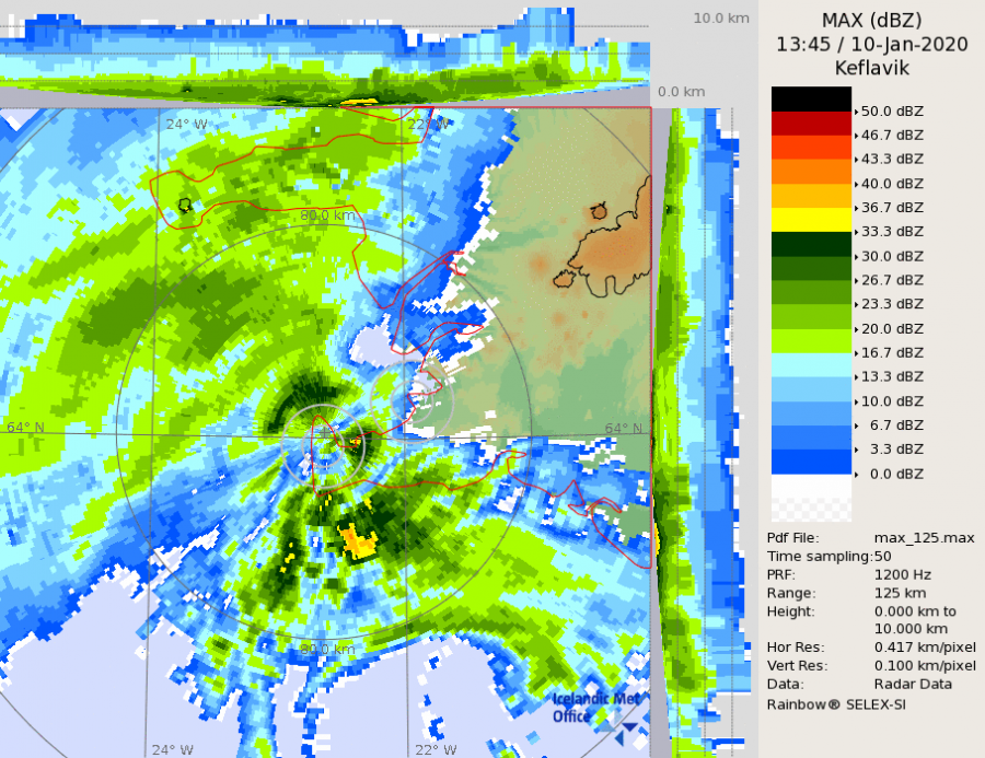
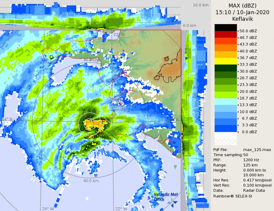
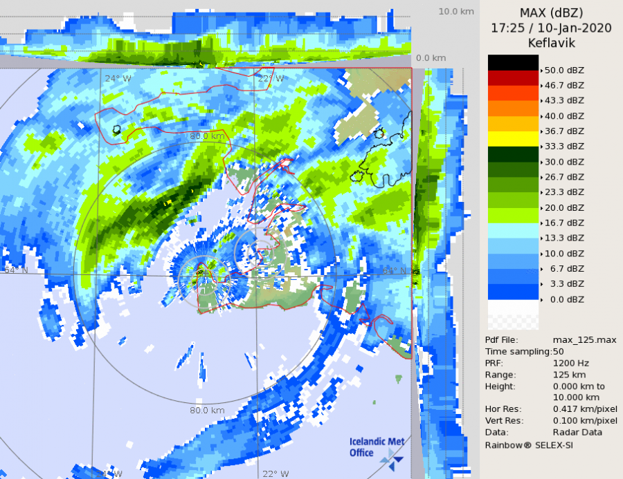
The eye and the wall of heavy rainfall was prefectly visible also on the radar imagery:
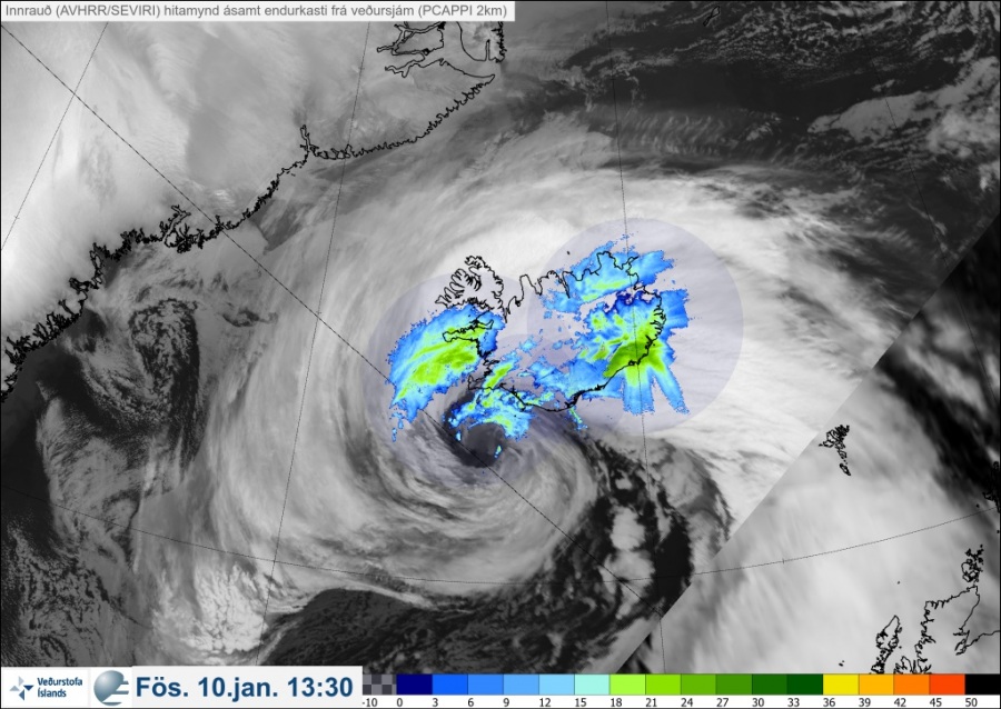
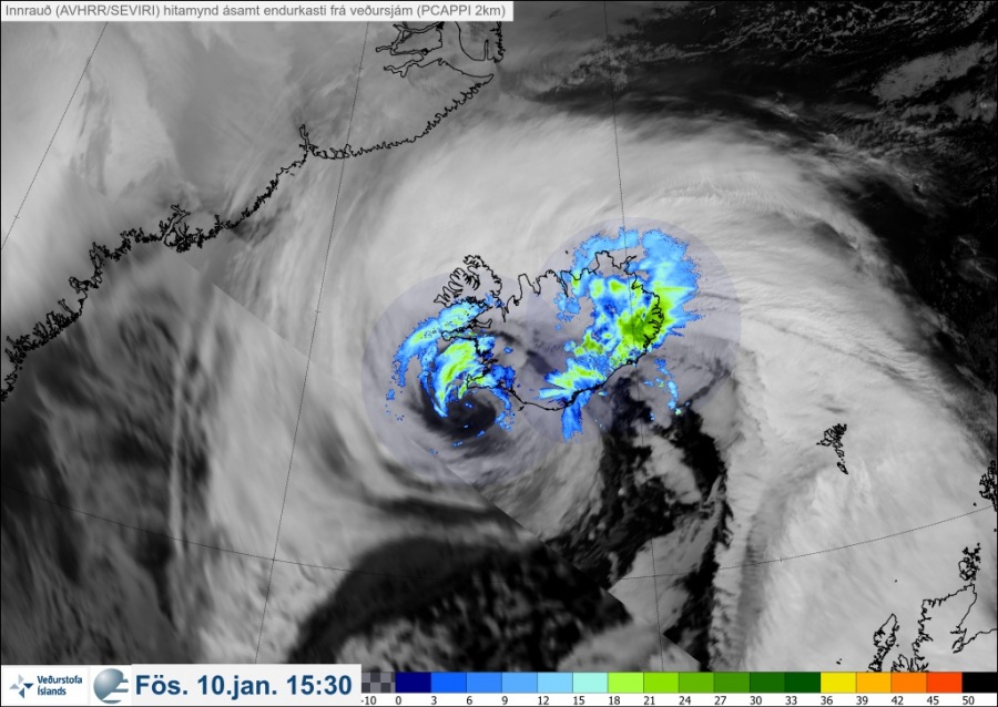
A composite image of Infrared satellite and radar images:
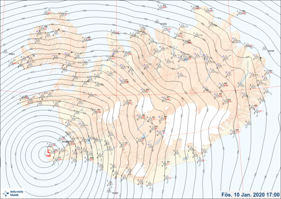
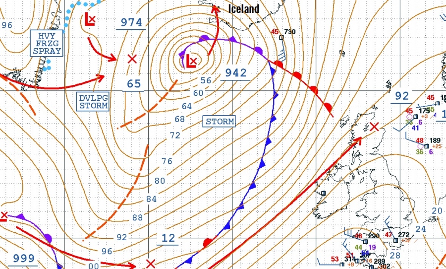
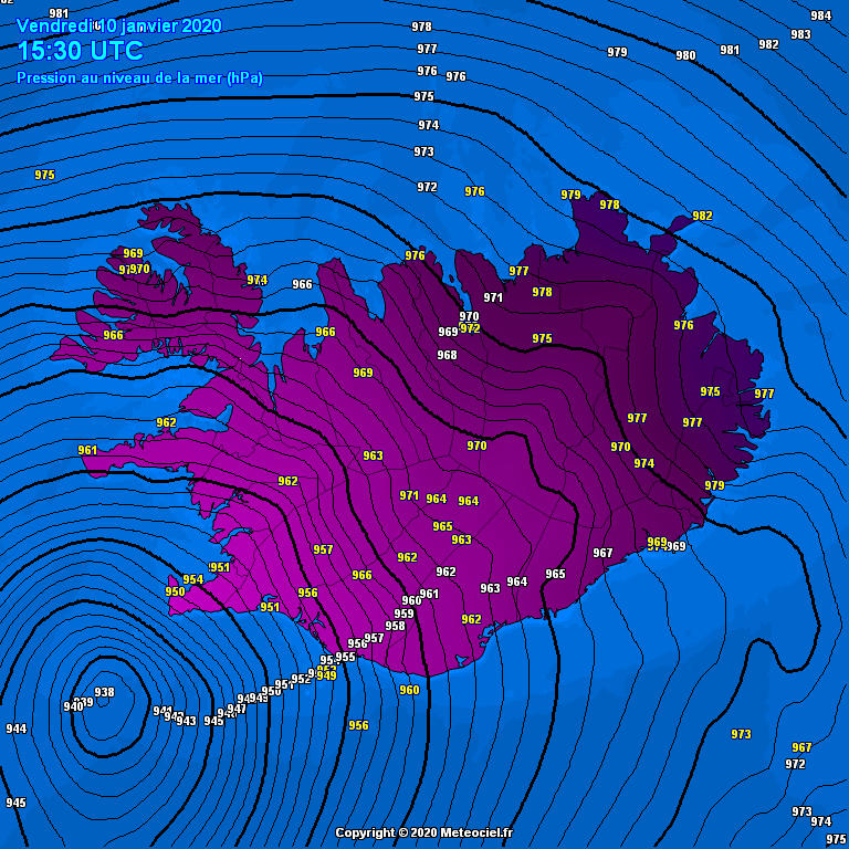
Surface analysis of the mean sea-level pressure is also pretty remarkable, the cyclone made landfall over the far western tip of Reykjanes peninsula in the early evening hours today – the minimum central pressure reached around 940 mbar or slightly lower, but is still dropping in the center of the low. Cyclone continues moving north towards the Snaefellsnes peninsula:
Animation of mean sea-level pressure over Iceland during the past 24 hours. Notice the rapidly deepening pressure and the extra-tropical cyclone approaching the Reykjanes peninsula in the SW Iceland. Map: @meteociel pic.twitter.com/SWWNLICLjF
— severe-weather.EU (@severeweatherEU) January 10, 2020
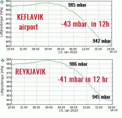
A textbook graphic view of a steady but rapidly deepening surface pressure on two stations – the capital Reykjavik and the main airport Keflavik. The pressure started falling rapidly this morning around 6 am when both stations were reporting around 985 mbar. 12 hours later, at 6 pm, the pressure has dropped to 942 mbar in Keflavik and 945 mbar in Reykjavik. That is a remarkable 41-43 mbar pressure change in just 12 hours period. That is EXTREME!
See the previous discussions:
Interested in our calendar? We are proud to present and promote the best weather photographers in Europe – see details:
