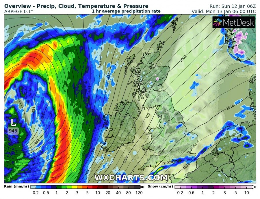
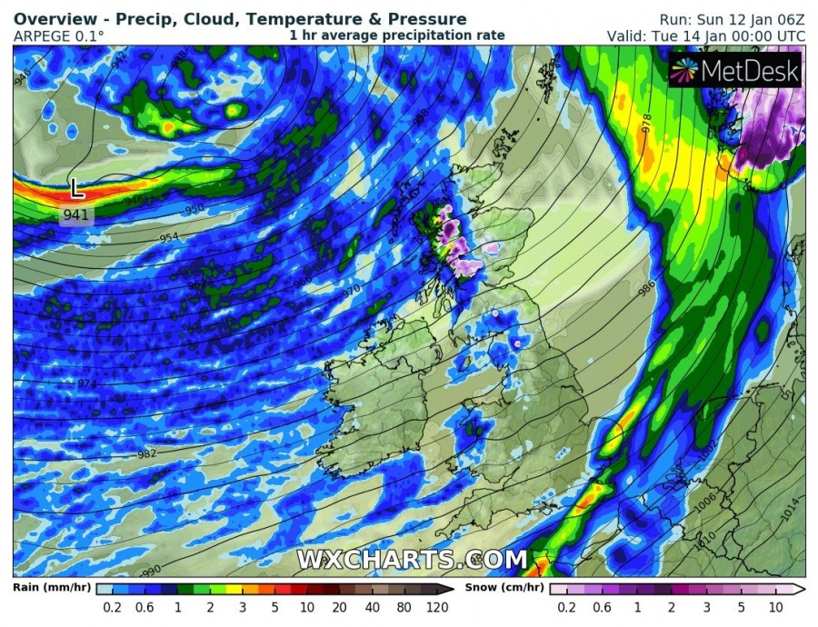
Here is an UPDATE on the potentially life-threatening windstorm for the UK and Ireland tomorrow, Jan 13th – another wave is entering Northwest Atlantic this morning with cyclogenesis taking place at the surface. This will develop a new monster extra-tropical cyclone over the North Atlantic and western Europe, delivering a violent windstorm with gusts 160-200 km/h. Extremely severe winds 120-150 km/h are also expected along the western parts of Ireland, Northern Ireland, Scotland and Faroe Islands. A broad cyclone will bring the central pressure to around 935 mbar with major swell pushed towards western Europe, likely bringing close to 15-meter waves to the coast.
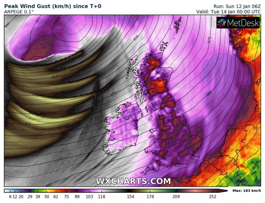
Here is a close-up view of the 3-hour sequence of the cyclone traveling just to the west the UK and Ireland, having around 945 mbar pressure in its center already tonight but continues deepening tomorrow into 935 mbar range. There will be intense rain squalls with violent gusts along the front first. The cyclone is very low and the result will be major swell and significant wave heights up to around 15 meters. What has to be pointed is the wind maximum comes behind the main cold front, as likely a sting-jet feature with violent wind squalls develops in the rear side, being pushes towards Ireland on Monday afternoon from the west. Through the evening hours, the wind maximum curves northeast and grazes into western parts of Northern Ireland and gradually spreading into Scotland ovenight to Tuesday. Peak gusts are likely to reach 120-150 km/h on the most exposed places, much higher towards the open waters near the sting-jet. The Scottish Highlands are likely to experience the brutal force of the low-level jet around this deep cyclone, probably pushing into 200-230 km/h overnight to Tuesday!
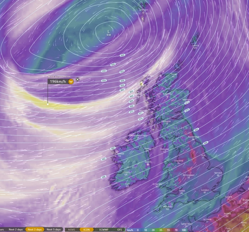
Overview of the peak wind gusts accumulation swaths across western Europe as seen by ARPEGE, ICON-EU and ECMWF models. What is the most impressive is that also the global weather model ECMWF is simulating extremely severe wind gusts – up to 115 mph = 180 km/h, although the wind maximum is placed more south than high-resolution ARPEGE and ICON-EU models are hinting (gusts close to 125 mph = 200 km/h), but this is remarkable. Meaning the windstorm will undoubtedly deliver EXTREME winds!
Stay alert for extremely windy and developing life-threatening conditions – we will keep you updated tomorrow with final details. Stay tuned!
Refer to the primary forecast discussion:


