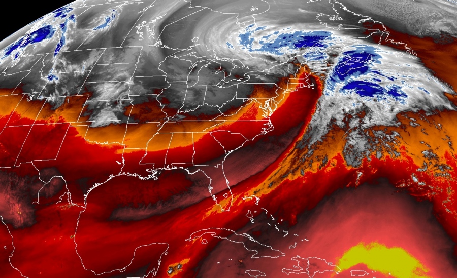
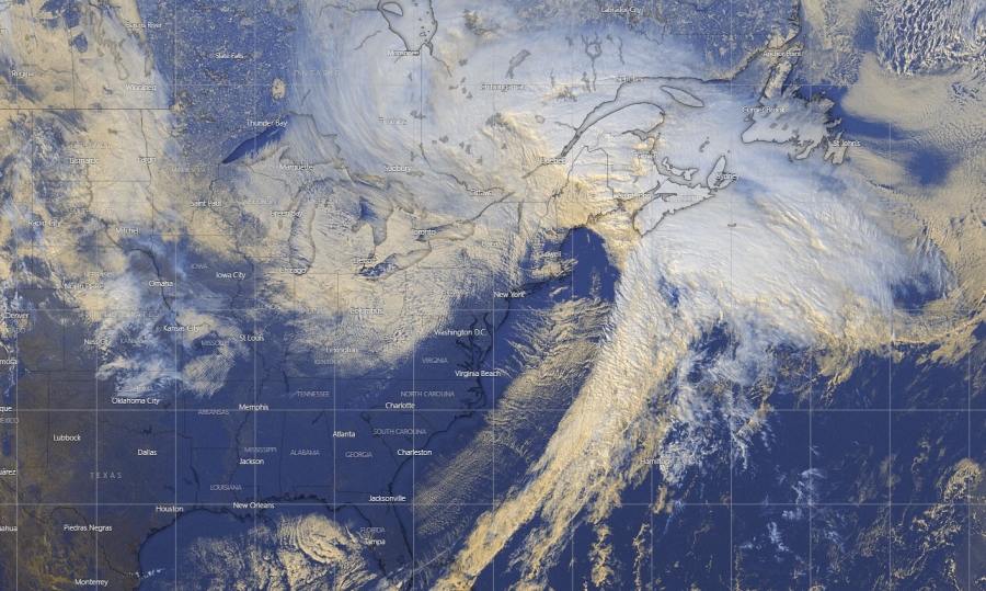
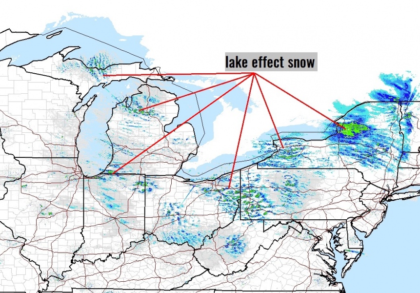
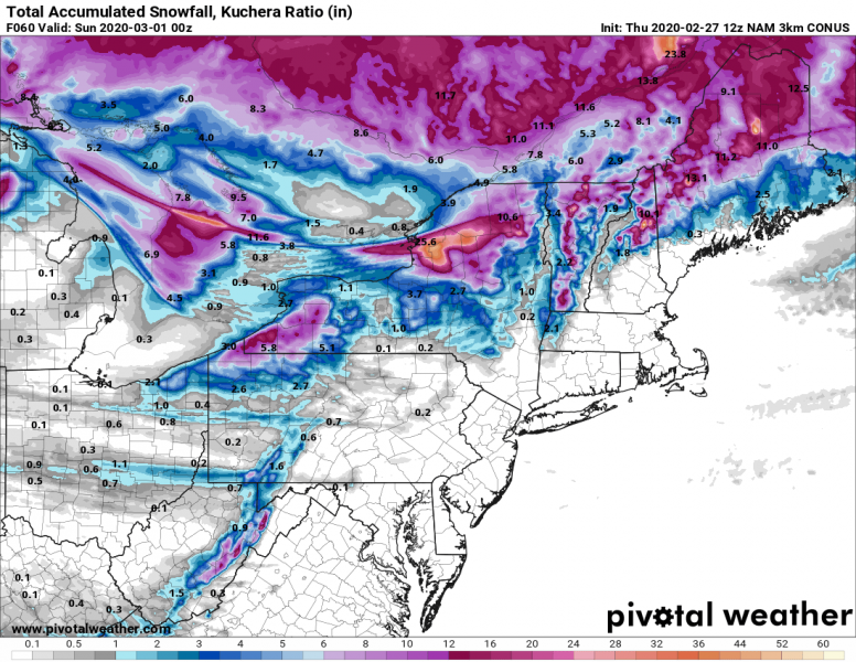
A powerful winter storm over the Northeast US is now already spreading into southeast Canada, developing heavy snowfall and intense blizzard there. On its wake, Arctic cold air mass advection is moving into the Great Lakes. This is gradually starting the lake-effect snow event with intensifying convective squalls/bands on the east and southeast shores of the lakes Superior, Michigan, Huron, Erie and especially Lake Ontario. Extreme amounts of snow are likely to be expected over the Tug Hill Plateau, probably approaching 50 inches (120 cm) by Sunday morning!
Afternoon (12 UTC today, Feb 27th) surface analysis revealed two centers with 985-990 mbar within the broad circulation over the northeast US, with a fully developed winter storm already ejecting the northern US and spreading into southeast Canada. The system will continue moving northeast tonight and tomorrow and should maintain similar intensity.
Here are various satellite channels of the very large and deep cyclone now centered over the northeast US. Notice the powerful dry intrusion push across the East Coast towards the center of the low with the Arctic cold airmass advancing from Canada into the Great Lakes region:
Latest radar imagery indicates the convective cloud streets are beginning to intensify on the east-southeast shores of all five Lakes now, while the most intense snowfall is already occurring to the east of Lake Ontario – over the Tug Hill Plateau. High snowfall rates have been reported lately.
Models are still in a good agreement some areas should receive 20-25 inches of snow, while the Tug Hill Plateau should prepare for 40-50 inches (80-120cm) until Saturday night.
Please refer to the primary forecast for further mesoscale details on the event:
See also – An impressive narrow (10 miles across) snow band extending 150+ miles across north-central Kansas on Feb 25th:
An impressive narrow (10 miles across) snow band extending 150+ miles across north-central Kansas


