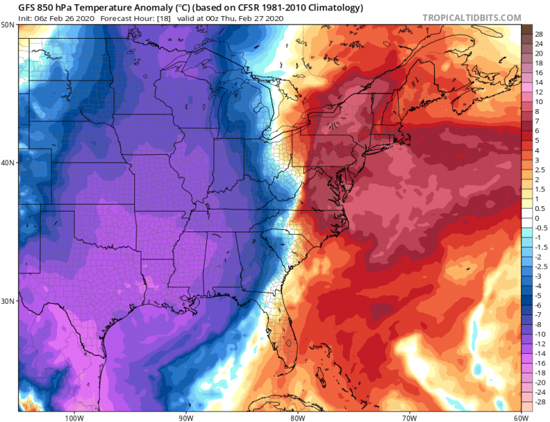
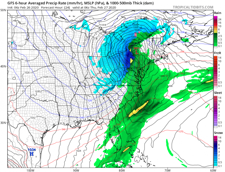
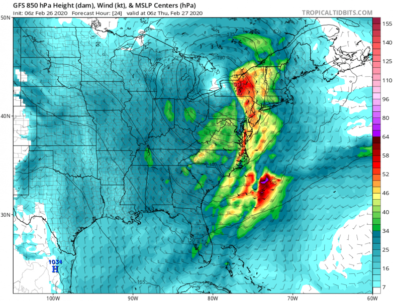
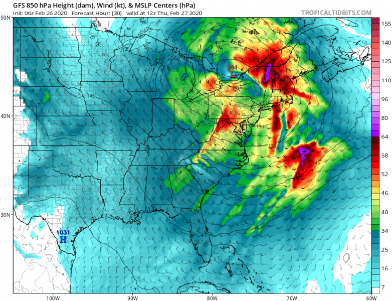
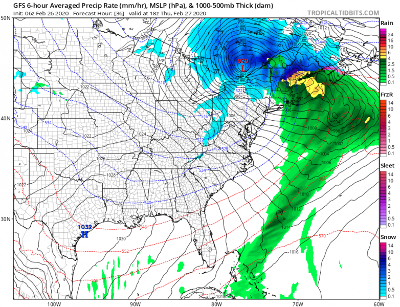
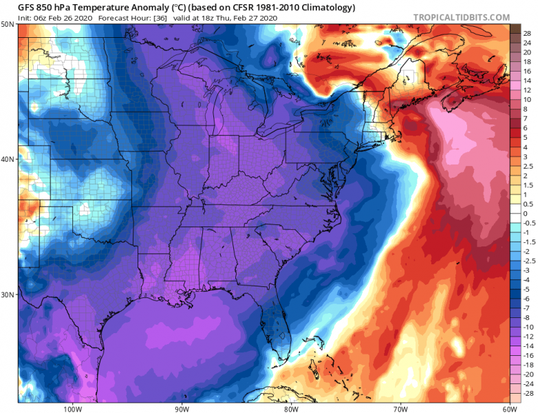
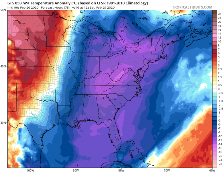
As discussed in the primary outlook for the North American continent earlier this week, one feature of interest is the developing deep low-pressure system tonight, rapidly moving across the East Coast and into the northeast US and southeast Canada tomorrow. Intense blizzard conditions are expected to develop to the north of the cyclone’s center track, but very intense rainfall and gusty winds across the warm sector – the coastal areas of East Coast and the northeast US. The much colder air mass will spread across the eastern half of CONUS through the last days of February and should also bring very cold mornings far south into south-southeast US.
*********************************************
*********************************************
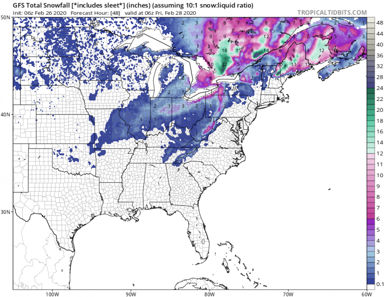
The low-pressure system develops this evening over the East Coast (approx. 1000 mbar in its center) and begins accelerating northeast tonight while deepening and organizing into a powerful winter storm. Very heavy rainfall is expected across the warm sector ahead of the moving cold front. And indeed heavy snowfall and blizzard behind the front, whiteout conditions and travel disruptions are likely across the eastern Great Lakes region tomorrow morning. The low-pressure system will likely reach below 980 mbar central pressure by 18 UTC on Thursday (tomorrow afternoon), resulting in a very tight pressure gradient that will support severe winds is some areas, strongly affecting the traffic. Conditions will gradually improve in the evening hours as system ejects further northeast into eastern Canada. Significantly colder air mass will spread behind the front!
Thursday, Feb 27th 00 UTC
Thursday, Feb 27th 06 UTC
Thursday, Feb 27th 12 UTC
Thursday, Feb 27th 18 UTC
Friday, Feb 28th 00 UTC
The snow amount should reach 15-25 inches in some areas, even more locally. Especially as after Thursday afternoon into Friday, favorable conditions develop for an intense lake-effect snowfall with the persistent west-northwest Arctic flow over the Lakes. Snow accumulations will locally approach or even exceed 50 inches in total there.
Much colder air mass will continue over the weekend, resulting in very cold daytime temperatures across the eastern US. Frosty mornings are expected also across the south and the southeast US.
Stay alert for developing dangerous conditions and stay tuned for updates!
See the primary discussion:
Also, dont miss our latest long-range outlook for Spring 2020!

