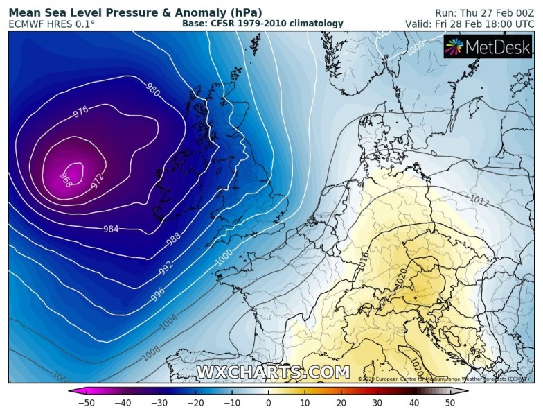
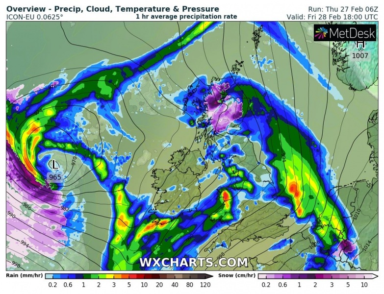
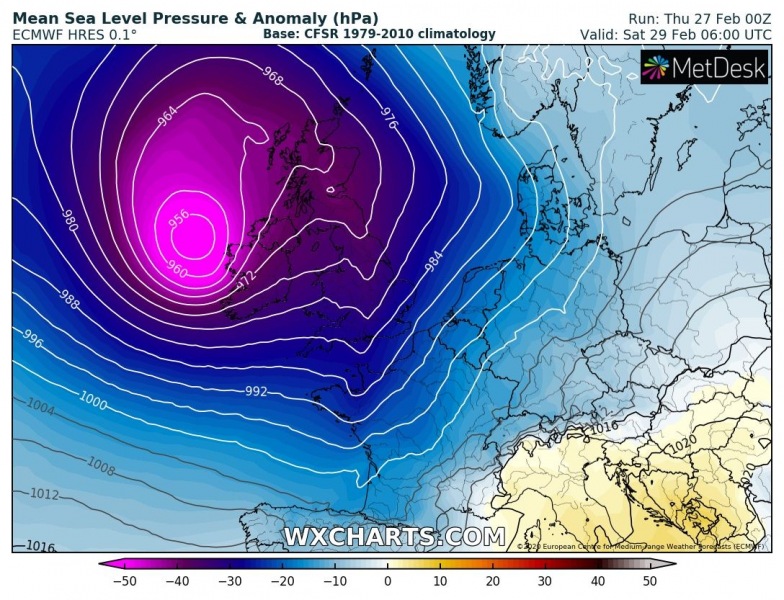
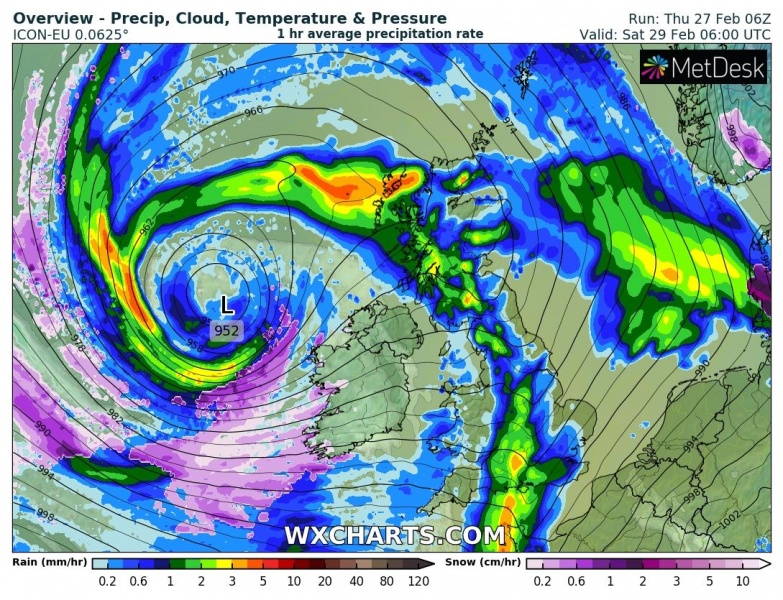
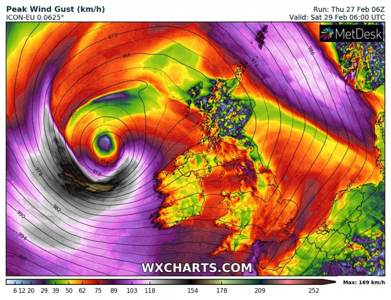
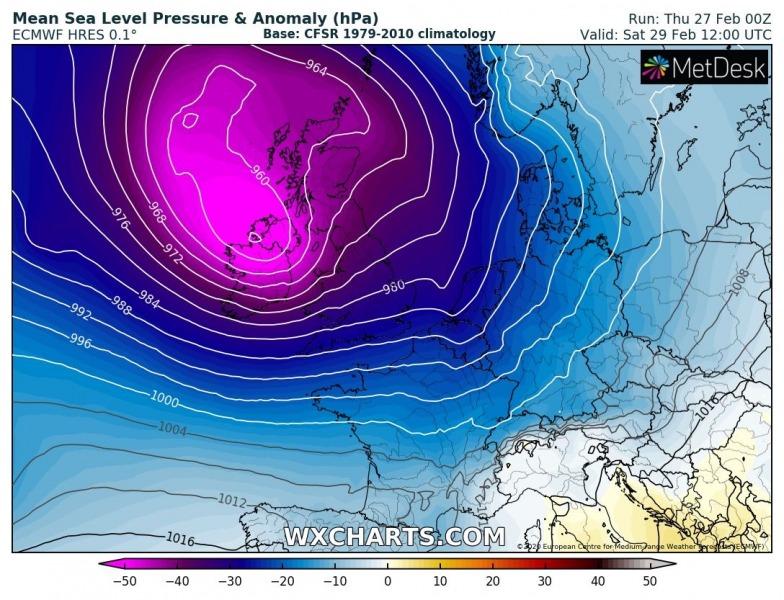
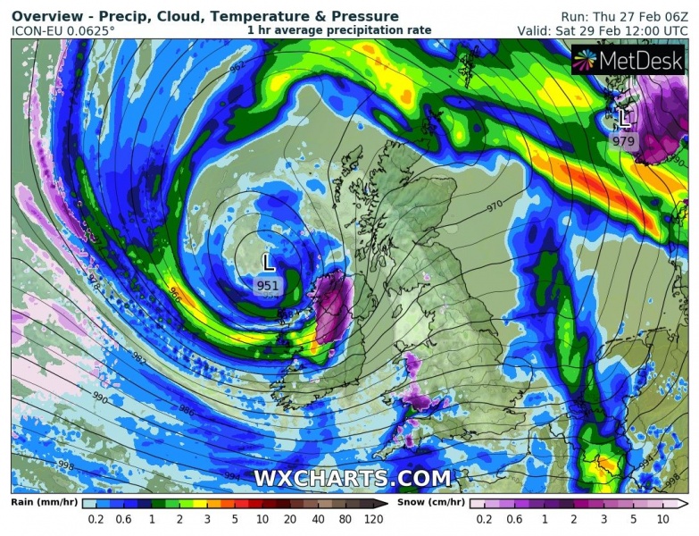
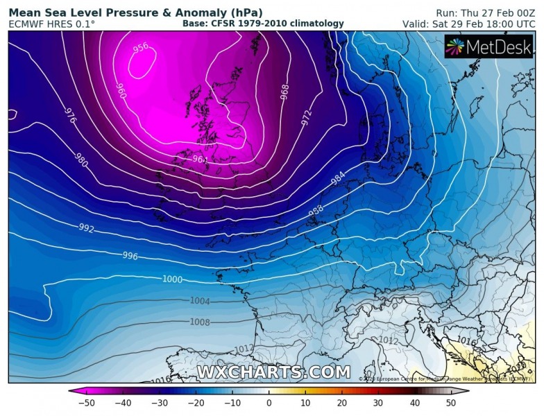
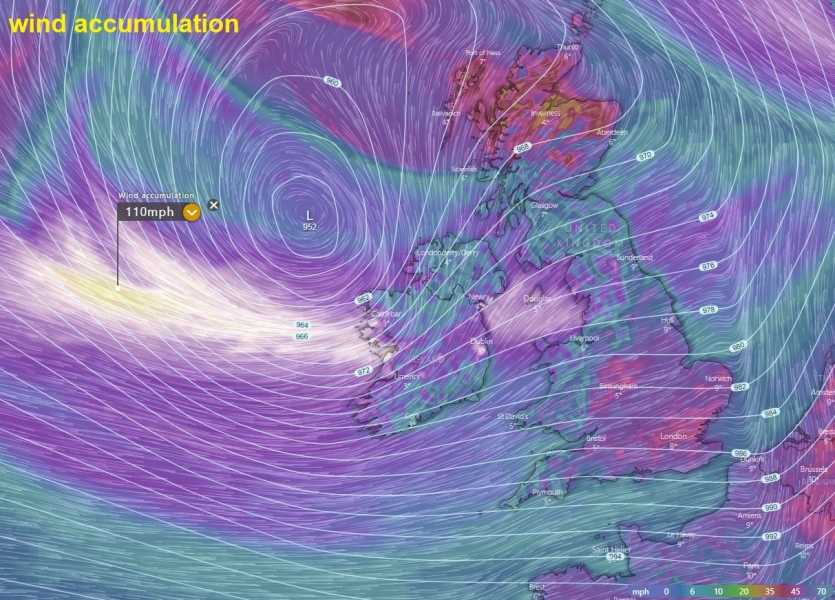
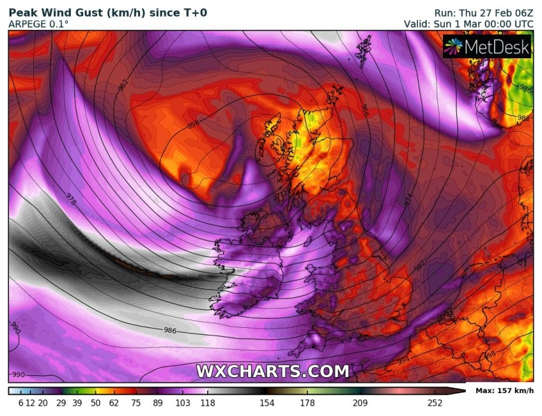
Dynamic Atlantic returns with another potentially dangerous North Atlantic storm to blast into western Europe this weekend. On the last day of February, Saturday 29th, a powerful storm #Jorge associated with the explosive development and rapidly intensifying surface (near 950 mbar) cyclone will blast across Ireland and the UK and introduce severe winds, heavy rain and major waves with potential coastal flooding. Storm #Jorge was named by the Spanish meteorological service Agencia Estatal de Meteorología (AEMET) and will also be used by UK / Ireland meteorological services.
*********************************************
https://www.severe-weather.eu/mcd/exceptional-satellite-presentation-jorge-ireland-mk/
*********************************************
Let’s see how the new system brings unsettled conditions this weekend.
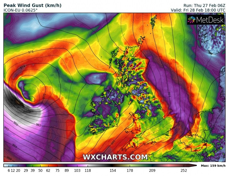
Here is the ICON-EU model animation of the wind gusts with windstorm #Jorge into western Europe:
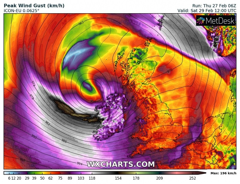
Storm #Jorge comes closer to western Europe on Friday evening, with its central pressure already a shy below 970 mbar, located west of Ireland. It will just begin its rapid intensification process and is expected to deepen to near 950 mbar while nearing Ireland on Saturday morning! This will undoubtedly result in violent hurricane-force winds around its center, likely introducing a sting-jet wind maximum with peak gusts in excess of 100 mph (160 km/h) to the south of the core!
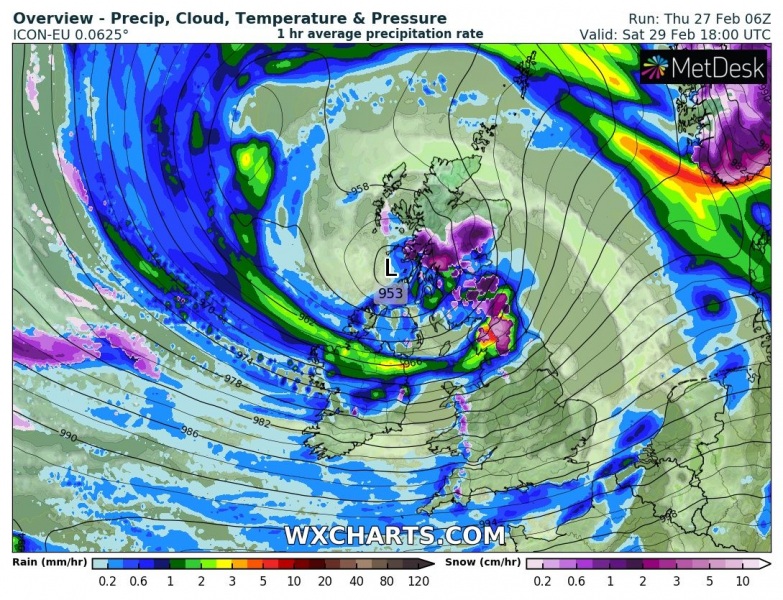
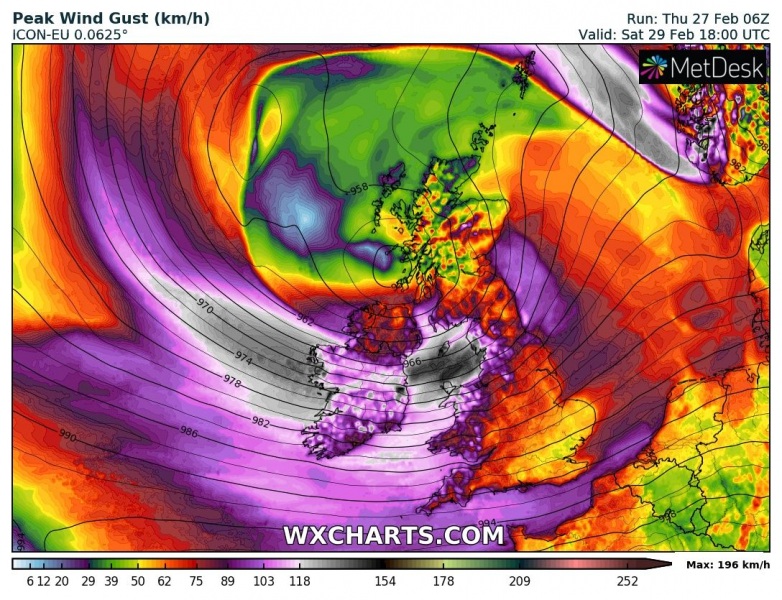
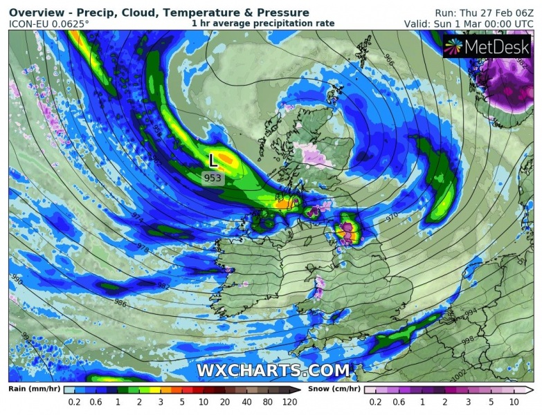
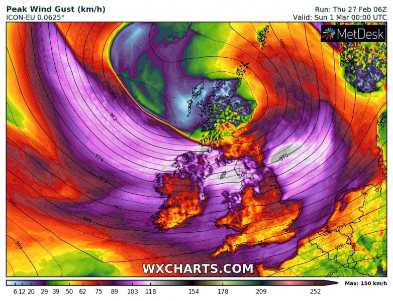
Although these violent winds will remain over open waters, a still severe to extremely severe winds and major waves will push towards Ireland in the late morning hours. The main cold front will move through overnight and already cross the UK in the morning hours, but the main, dangerous part of the storm, arrives behind the front – a very tight pressure gradient develops. The occluded front will blast into Ireland through midday Saturday, delivering intense rain squalls and severe winds up to 130 km/h. The core then continues northeast in the afternoon, spreading severe winds and rain squalls into Wales and the northern UK. There are also chances for some snow before the occluded front moves through. Below are the 6-hour sequence maps (surface pressure, preciptation and wind gusts) with the Jorge evolution:
Friday, Feb 28th 18 UTC
Saturday, Feb 29th, 00 UTC
Saturday, Feb 29th, 06 UTC
Saturday, Feb 29th, 12 UTC
Saturday, Feb 29th, 18 UTC
Sunday, Mar 1st, 00 UTC
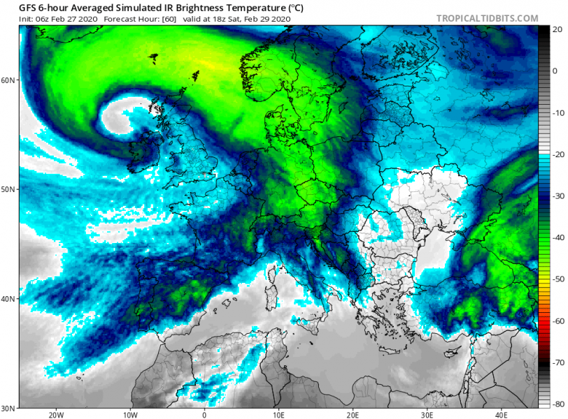
It appears likely the explosive development of the storm will also result in a well-structured system, so we can again expect an impressive satellite presentation on Saturday. Attached is the GFS model simulation of the IR brightness temperatures – in other words, this is how the IR satellites would look like. Model is hinting a textbook cyclone / frontal system appearance:
Major to significant waves are expected to result from the intense wind field, likely reaching up to around 40-45 feet (13-14 m), spreading mostly towards western Ireland on Saturday. Those could introduce dangerous coastal flooding.
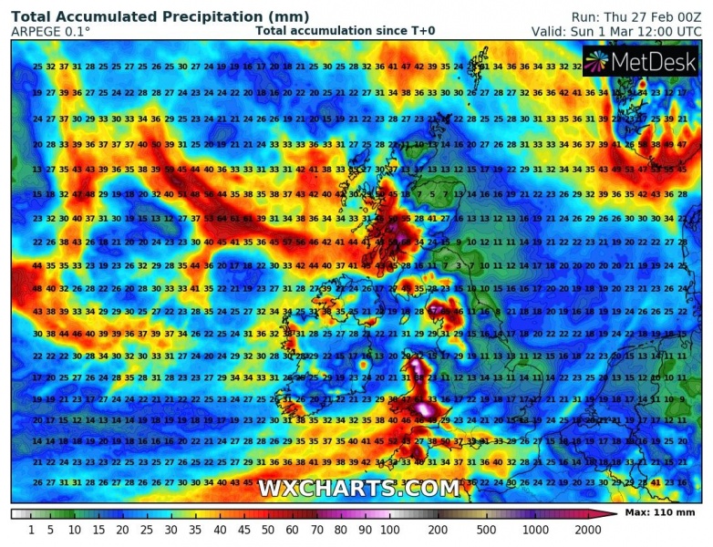
Again, quite a lot of rain is expected with this system. Locally, 80-100 mm of rainfall should accumulate until Sunday. Attached are ARPEGE, ICON-EU, and ECMWF rain accumulation maps.
Peak wind gusts swath graphics are obvious – both high-resolution models ARPEGE and ICON-EU agree that the whole western Europe will experience severe to locally extremely severe winds. Even violent (100+ mph / 160 km/h) hurricane-force winds are likely to the immediate west of Ireland!
As of today (Thursday) the UK Met Office has several ‘yellow warnings’ issued regarding the severe winds and heavy rain threat. Expecting wind gusts up to 70 mph (115 km/h). It is likely these will be upgraded into ‘orange warning’ sometime tomorrow when the system’s impact will become more clear. Warnings were issued for Southwest England, northern England, Northern Ireland, and Wales.
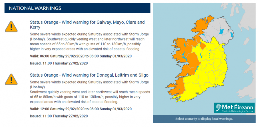
Met Éireann (the meteorological service of Ireland) has already issued the ‘Orange Alert’ for seven (westernmost) counties warning of high winds and flooding as Storm Jorge passes over Ireland. Counties Galway, Mayo, Clare, Kerry, Donegal, Leitrim and Sligo are covered by the alert from Saturday morning until Sunday morning. Severe winds are expected to bring peak gusts of up to 130 km/h and an elevated risk of coastal flooding as well. The ‘Orange alert’ warning means there will be ‘infrequent and dangerous weather conditions which may pose a threat to life and property’.
Stay alert for dangerous weather conditions! We will be closely monitoring the system’s evolution through Friday and will keep you updated – stay tuned!
See also:
https://www.severe-weather.eu/mcd/low-pressure-system-snowfall-central-europe-mk/
https://www.severe-weather.eu/global-weather/impressive-narrow-snow-band-kansas-mk/
