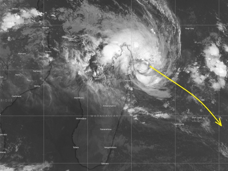
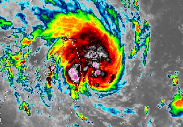
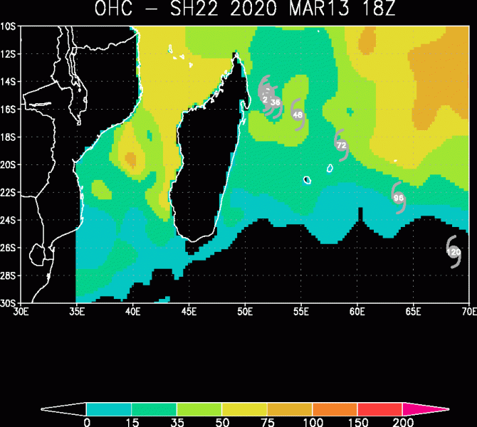
The former invest #22S is looking much healthier on the satellite imagery, it is now officially named Tropical Cyclone #Herold. Its explosive behavior lately suggests the system is likely ready to begin rapid intensification this morning as it heads towards the southeast, away from Madagascar. As ob 18 UTC on March 13th, Herold was packing maximum sustained winds of 45 knots with a central pressure around 999 mbar. Its future track should bring it between Mauritius and Rodrigues islands, where both islands are still not out of the potentially significant impact.
*********************************************
*********************************************
Satellite imagery indicates a very explosive nature of the deep convection around the virtual center of Herold, likely indication cyclone is ready for rapid intensification. The upper-level outflow ventilation remains very wide open.
https://twitter.com/xWxNetwork/status/1238626750168543234
https://twitter.com/jnmet/status/1238571894204489732
Tempête Tropicale Modérée #HEROLD 994hPa le 14/03 4h 15.0S/51.0E > ouest 6km/h ® 795km https://t.co/xTo7vXLJ8j pic.twitter.com/nDScv1Uscv
— Lionel (@meteo_reunion) March 14, 2020
75-100 miles winds radii of 34-knot winds are already expanding around the developing system, located just off northeast Madagascar. Conditions are expected to significantly worsen over the weekend with likely developing a hurricane-force 64-knot winds radii as well.
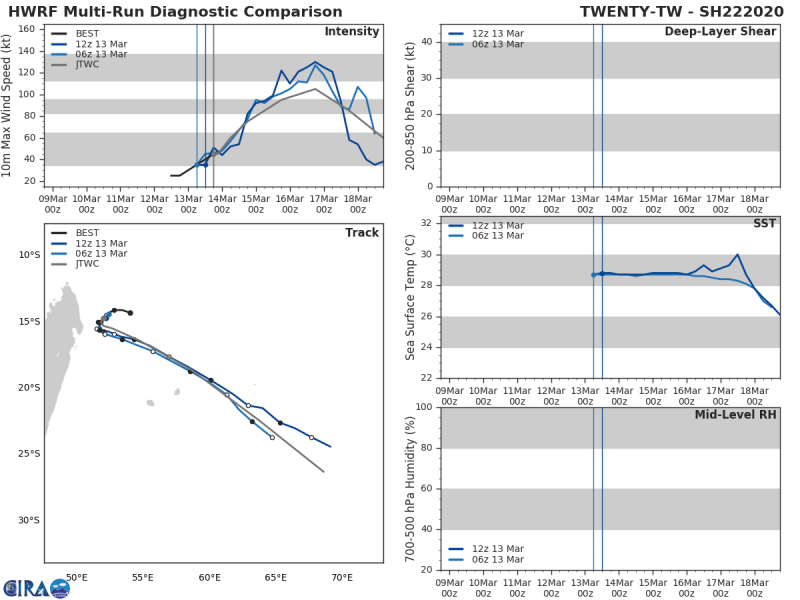
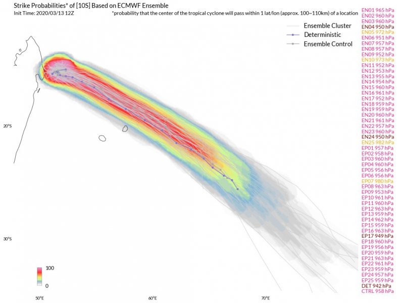
The future behavior and path of #Herold is more or less on track with the previous thinking, it will be moving southeast and rapidly intensifying over the next 48 hours. The system is coming into extremely favorable very warm sea waters and a low-shear environment, so a significant strengthening is expected. Herold is expected to peak on Monday afternoon while being located to the northeast of Mauritius.
Model trends suggest it will pass between the islands Mauritius and Rodrigues as an Intense Tropical cyclone on Monday.
The system’s violent winds are well-visible on the wind swath maps. Herold will remain a very powerful tropical system until mid next week when it gradually transforms into an extratropical cyclone and slowly dissipates:
Stay tuned for additional details this weekend!
Previous discussions:
There is another tropical cyclone ongoing near Australia now – #Gretel:
