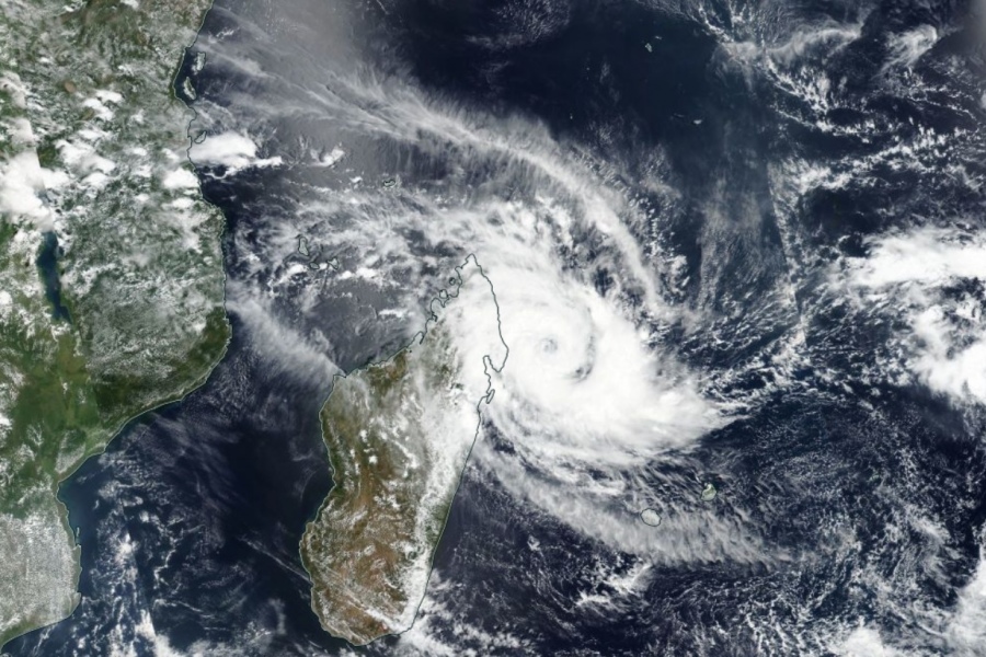
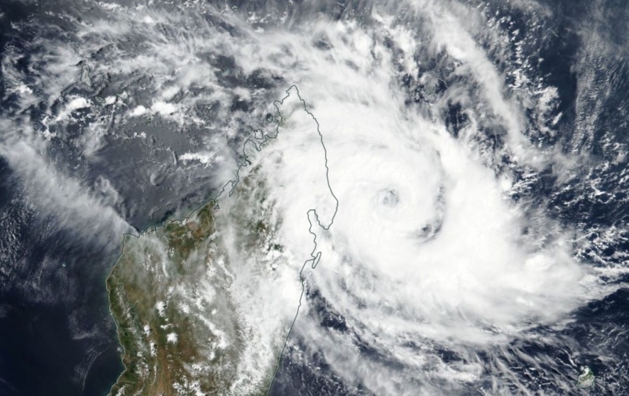
A rapidly strengthening Tropical Cyclone #Herold continues to churn just off the eastern coast of Madagascar, maintaining its almost stationary position. There is a small eye becoming visible lately. Herold is packing the maximum sustained winds of 70 knots (80 mph / 130 km/h) and a central pressure of around 979 mbar. Its movement is east at less than 5 mph. Herold is expected to accelerate towards southeast tomorrow and should intensify into a Category 3 system. It will become extremely dangerous while passing very near to Rodrigues island later this week!
Satellite imagery reveal an impressive rapidly intensifying tropical cyclone, rotating almost stationary along northeast Madagascar. A burst of deep convective rain bands is visible, organizing while the cyclone is deepening. A small eye is appearing!
عين الإعصار #HEROLD "هيرولد" .. pic.twitter.com/uV3ekcEF7n
— ابراهيم اللامي (@ibrahimallami1) March 15, 2020
#Cyclone #Herold continues to churn just off the eastern coast of Madagascar in the same exact spot as 24 hours ago. The storm’s outer core appears to be struggling to develop, but an ragged eye is clearly visible. It will begin finally moving east throughout the rest of the day. pic.twitter.com/cFlPqQttp7
— Storm’s Edge (@StormsEdgeWx) March 15, 2020
Advanced Dvorak Technique (ADT) analysis estimates these bursts of intense convection nicely. There is 50-knot winds radii extending 35-40 miles around the center of Herold now.
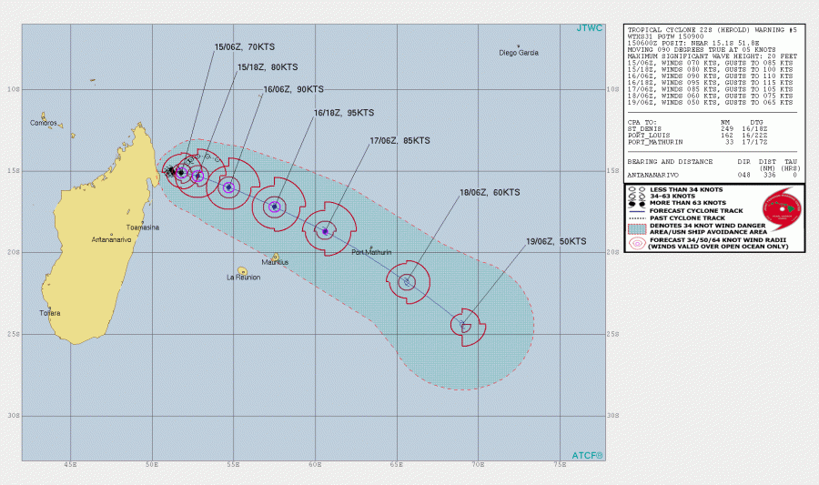
Tropical Cyclone Herold will likely maintain its current position tonight, then begin accelerating towards southeast on Monday. It will track further north and east of Mauritius and is likely to pass very near the Rodrigues island with intense strength. Destructive winds and flooding are possible! Lots of rain is expected near the center of Herold as well as hurricane-force winds!
المسار المفترض للإعصار #HEROLD "هيرولد" -جنوب المحيط الهندي.. pic.twitter.com/X4A98x2O9F
— ابراهيم اللامي (@ibrahimallami1) March 15, 2020
See the previous discussion and stay tuned for further updates!


