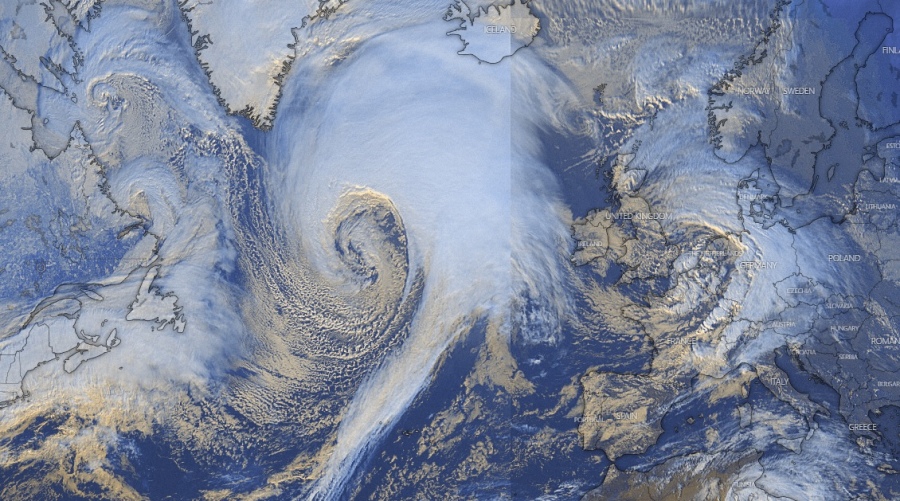
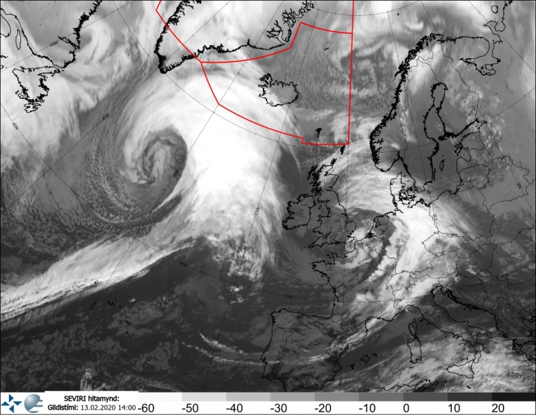
Seriously, although many are impressed by the exceptional satellite presentation of the ongoing explosive cyclogenesis over the North Atlantic (or the deep extra-tropical cyclone over the North Pacific), tomorrow will be far from a nice day in Iceland! The intense, near 935 mbar, North Atlantic cyclone is expected to introduce a violent life-threatening windstorm with potentially destructive winds over the island, with peak gusts locally reaching 180-220 km/h! Heavy snowfall is also expected in some areas, creating whiteout conditions and impassable roads due to severe blizzards.
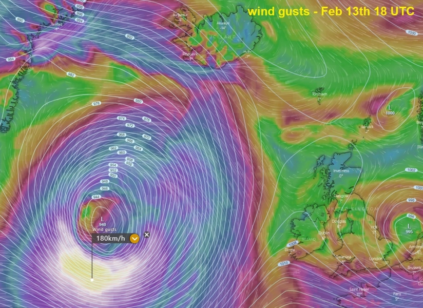
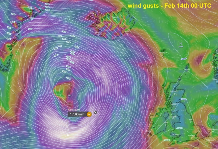
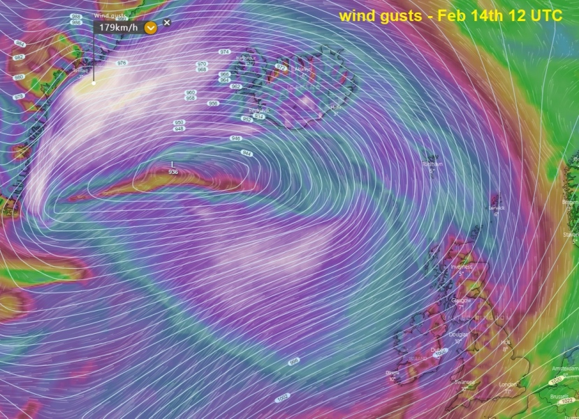
First, here is the animation of wind gusts by ICON-EU model, expected to spread across much of the North Atlantic in the coming days:
The latest satellite images of the approaching system indicate that it continues with the extremely rapid intensification, revealing a textbook structure of the extra-tropical cyclone.
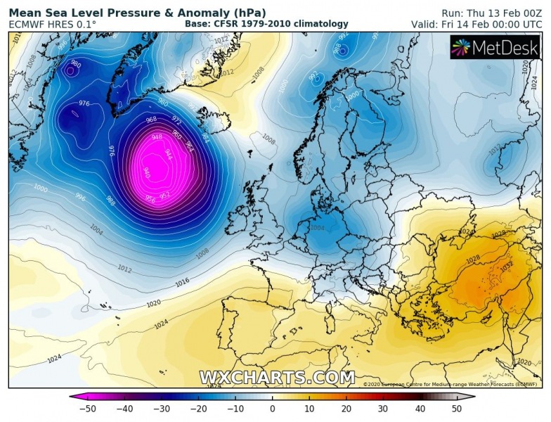
The explosive development will continue while the cyclone gradually deepens to around 935 mbar tonight and tomorrow morning, maintaining its strength and low pressure near or slightly below 935 mbar. The system grows much bigger with time tomorrow, literally dominating much of the North Atlantic. Through the morning hours, conditions across Iceland and along southeast Greenland will begin significantly worsening. As center of the low arrives closer, the pressure gradient will become very strong. And therefore result in a violent windstorm spreading across Iceland. Conditions will improve in the afternoon hours when cyclones become more elongated and drifts west again, causing a stronger pressure gradient towards Greenland and introduce violent windstorms there. Severe winds will remain across much of the North Atlantic further into Friday’s night and over the weekend.
Feb 13th, 18 UTC
Feb 14th, 00 UTC
Feb 14th, 06 UTC
Feb 14th, 12 UTC
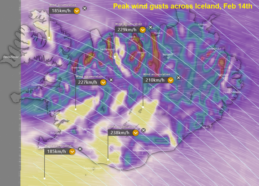
Here is the close-up view of the peak wind gusts, based on the ICON-EU model tomorrow, Feb 14th. The most exposed areas, mostly along the mountain slopes where violent downslope winds will develop, are likely to experience 180-220 km/h wind gusts, locally even close to 240 km/h. These winds would be life-threatening!
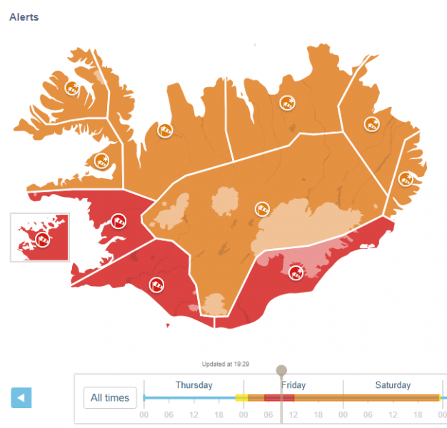
The whole Iceland is under the orange warning for dangerous conditions, while the southern half is already in the highest, red warning. Here are some highlights from the Icelandic Met office warning discussion:
South
Hurricane-force winds (Red condition)
14 Feb. at 06:00 – 13:00
East 28-35 m/s. ( 125 km/h) Dangerous wind gusts, possibly exceeding 200 km / h in the whole area. Snow and blowing snow and poor visibility. Traffic and service temporarily shut down. No travel is advised and people should stay indoors. Elevated sea level with high waves and dangerous conditions ad the coast. Damages due to flying debris are likely and construction workers are encouraged to secure construction sites. Higher sea levels are anticipated due to storm surge with the possibility of small boats being damaged or detached from the dock. People are advised to secure their neighborhood, fasten loose items and show caution. Traveling is not advised while the weather warning is in effect.
Faxaflói
East violent wind, possibly hurricane force (Red condition)
14 Feb. at 07:00 – 13:00
Violent east winds expected with sustained wind speed 28-35 m/s and violent and dangerous wind gust which may exceed 55 m/s near mountains south of Borgarfjörður, but somewhat calmer winds in the north part of the forecasting region. Also, snow and blowing snow expected with very poor visibilty. Transport disturbances are expected. Higher sea levels are anticipated due to storm surge. Risk of damages due to flying debris can be expected and people are advised to secure their surroundings, fasten loose items, and show caution. Traveling is not advised while the weather warning is in effect.
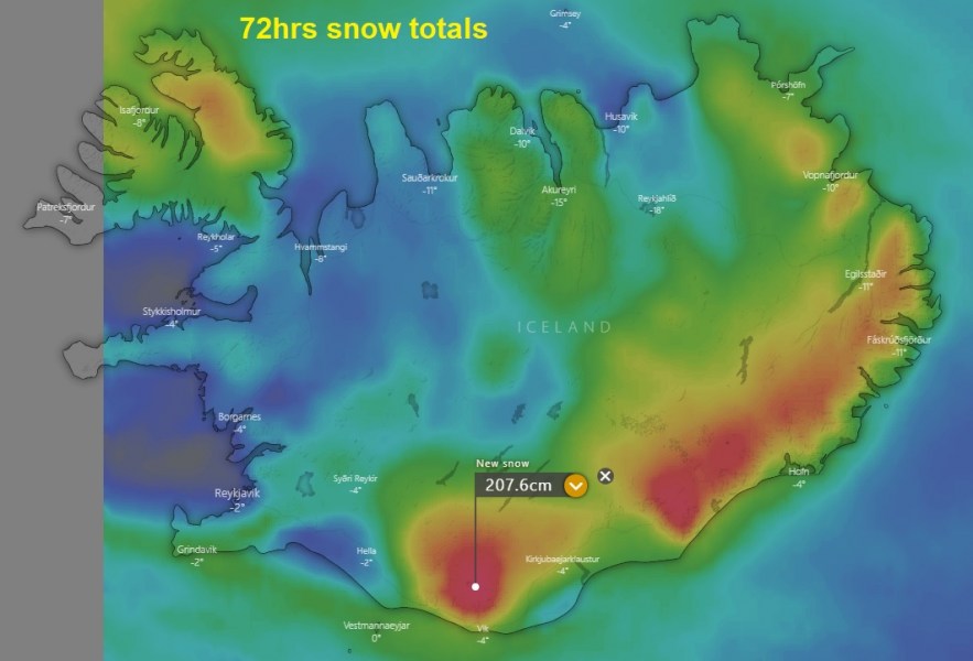
And to make things even worse across Iceland, quite significant snowfall is expected. Creating intense blizzard and impassable roads due to snowdrifts and whiteout conditions in heavy snow and winds.
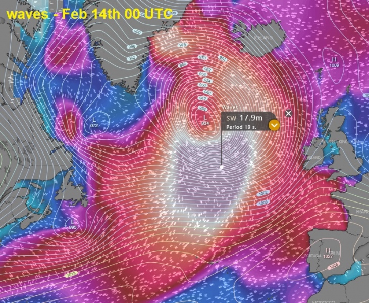
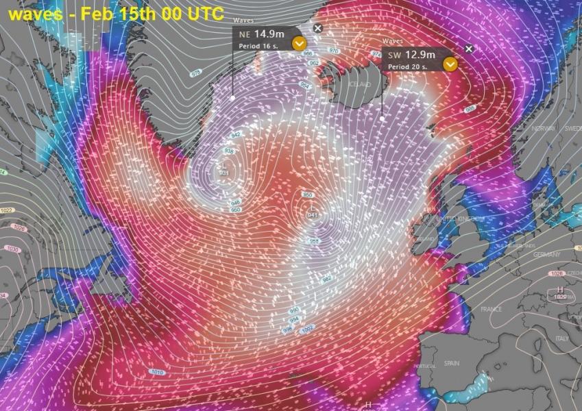
Waves will be significant, even extreme as models are predicting that 15-18 meter waves are likely ahead of the deep low tonight, spreading towards Iceland and Greenland tomorrow. High waves will also spread towards Ireland and Scotland due to the very broad wind field with this system:
Stay alert for the expected life-threatening conditions tomorrow, mostly during the daytime hours. The heavy snowfall will also develop extremely dangerous blizzard conditions. Impassable roads and whiteout conditions are expected. We are monitoring the evolution, so stay tuned for updates!
See the primary forecast discussion:
This morning, there was actually a tandem of twin cyclones over the North Atlantic – the satellite presentation was impressive!
North Atlantic *update* – Impressive satellite presentation of twin cyclones
The beginning of the explosive cyclogenesis across the Northwest Atlantic last night:
Meanwhile in the North Pacific – the perfect storm!
The perfect storm – monster extra-tropical cyclone over the North Pacific today
