It’s been a relatively fast return of warm weather into a large part of Europe since Sunday. It was a very warm day today (Monday) and many more to come this week. A strong blocking high is resulting in stable and dry weather for many, worsening the drought conditions in some areas as well.
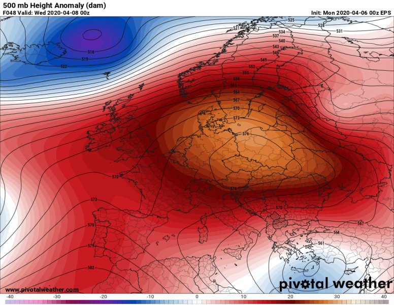
The established pattern over Europe indicates the extensive upper-level ridge is now dominating much of our continent, meaning we can expect further stable and very warm weather this week. Only the far North Atlantic and northern Europe will see some dynamic weather. And also the Eastern Mediterranean where an upper low will be ongoing for several days.
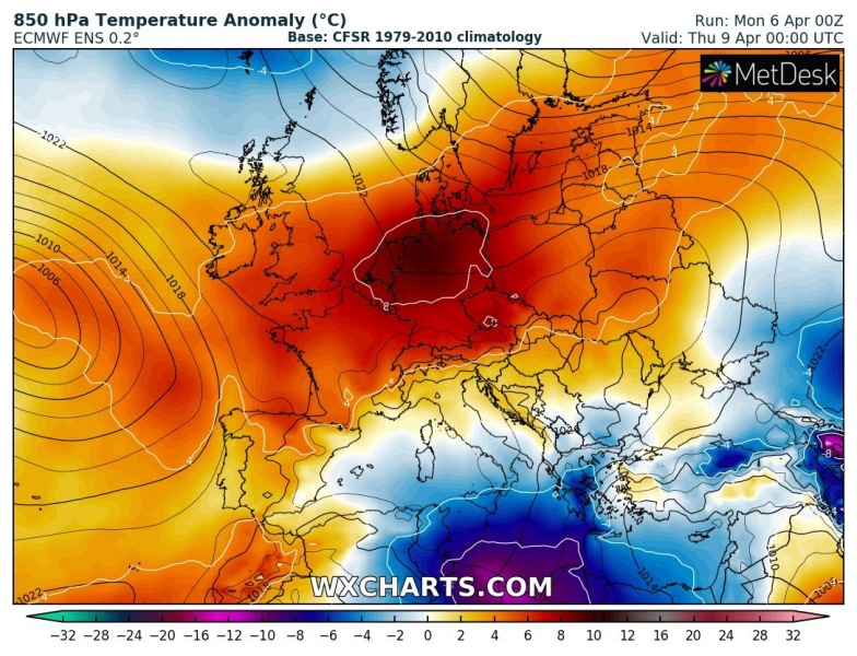
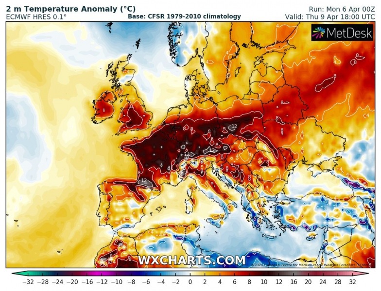
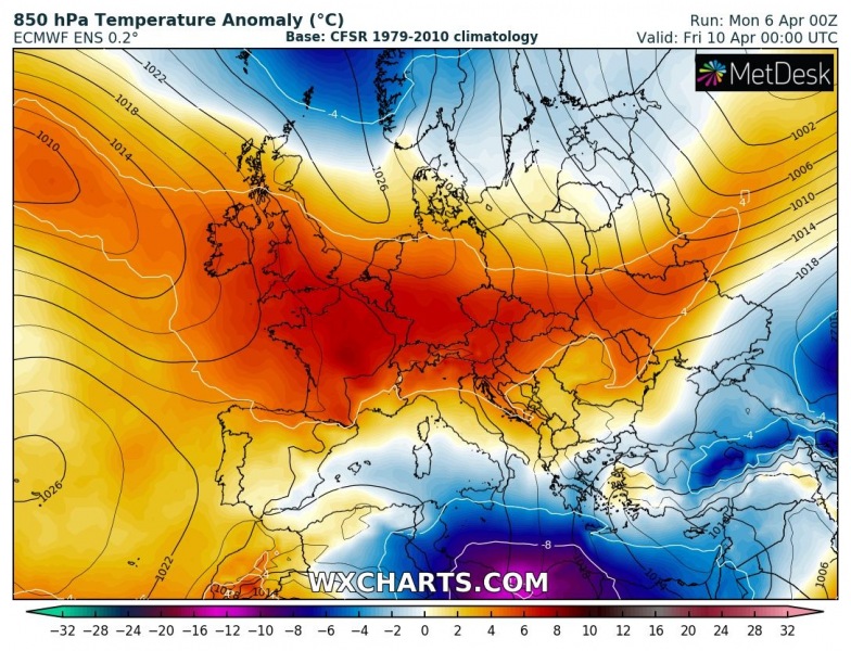
The temperature picture across Europe remains similar as over the past two days, it will be very warm across a large part of the continent. Some areas even more than 10 °C warmer than normal for early April. Stations are reporting low to mid 20s and so it will remain at least until the weekend:
Tuesday, Apr 7th
Wednesday, Apr 8th
Thursday, Apr 9th
Friday, Apr 10th
Unfortunately, Europe is fighting with the COVID-19 outbreak and is on lockdown, so we can’t really enjoy the spring weather. For now the most important thing is – #STAYHOME!
The previous forecast discussion:
Very *high* values of dangerous Particulate Matter (#PM10) air pollutants across Europe this weekend
Meanwhile in the tropics – a powerful Category 5 tropical cyclone hit Vanuatu:
A rapidly strengthening Tropical Cyclone #IRONDRO in the South Indian Ocean


