While Europe is having unusually warm autumn, as a dynamic pattern is established, the other side of the Atlantic will again get into an extreme Arctic cold blast tonight through Tuesday. The most intense outbreak of Arctic cold air mass of the season is expected to push across a large part of US and bring frost also the Gulf Coast this week.
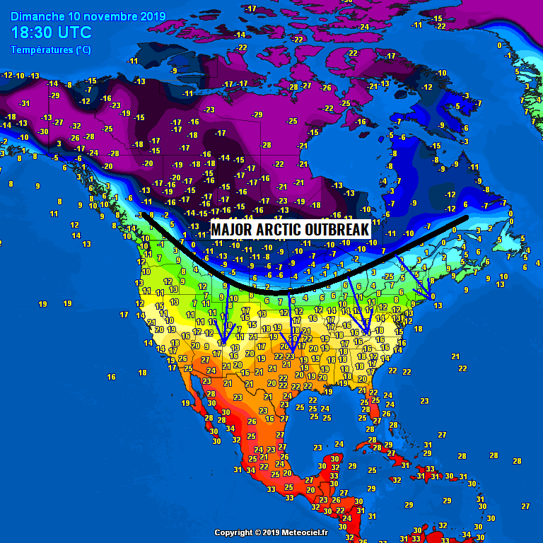
Temperature analysis across North America as of today, Nov 10th 18 UTC – a very cold airmass is spread across the northern US (and indeed Canada) while the Great Plains are still enjoying more than 20 °C. This will change into strongly negative values through the next 24 hours as a very intense Arctic front rapidly pushes south tonight.
The pattern supporting this evolution reveals strong upper-level ridging across the W-NW North America with a very deep upper-level trough moving from the Arctic region into the east-central US. This will establish a strong meridional flow from Arctic Canada down south across the American plains all the way to the Gulf Coast and East Coast, including Florida by Wednesday.
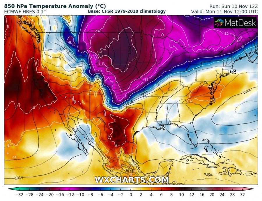
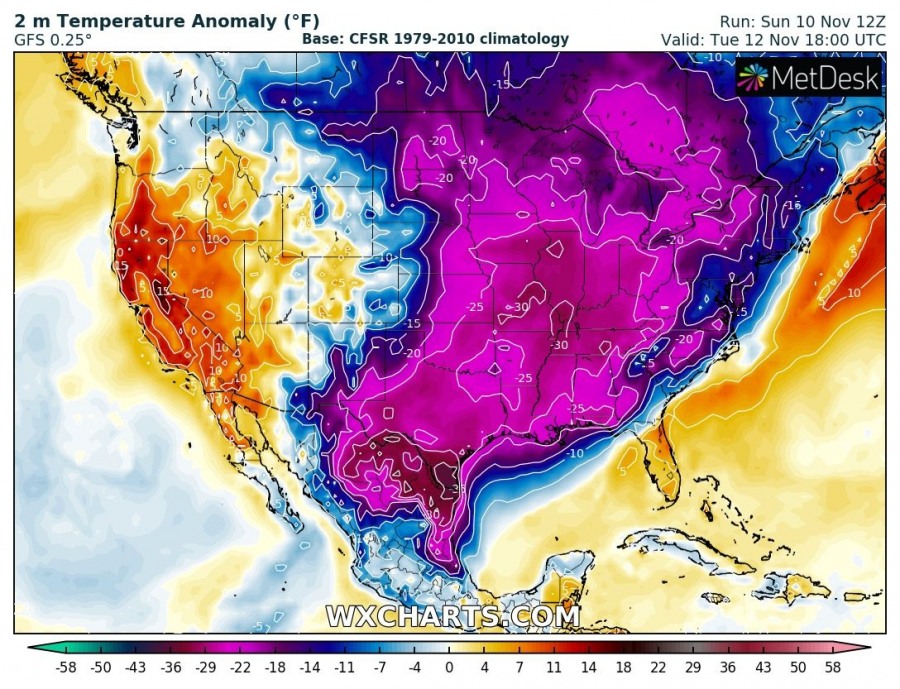
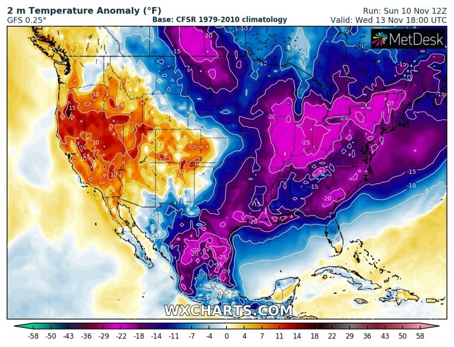
The outbreak has started over southern Canada and the northern US today with already very cold temperatures, snowing and extreme windchills over Montana, Dakotas and Minnesota. The cold blast is expected to intensify tonight while rapidly spreading into the Great Plains and Midwest by tomorrow. Models are indicating an exceptional temperature anomaly through the near-surface layers – attached is the sequence from today through Wednesday morning.
Sunday, Nov 10th – the very cold airmass is spreading into the northern US with the very cold air mass moving into Dakotas and Montana. Notice more than 10 °C warmer airmass ahead of the front, across the Central Plains.
Monday, Nov 11th – a brutal anomaly of more than 20 degrees C below normal at 850 mbar (approx 1200m ASL) with even more extreme 2m anomaly of more than 30 °C below normal for mid November spread across the Great plains, with cold front already reaching Texas by the afternoon. Extreme cold will be even more intense with the northerly winds and create dangerous windchills.
Tuesday, Nov 12th – Arctic outbreak continues spreading towards the Gulf Coast, bringing extreme temperature anomaly across the Ohio Valley, Dixie Alley and deep south Texas and northern Mexico – again even more than 30 degrees C below normal for this time!
Wednesday, Nov 13th – Arctic outbreak finally vanishes from the WNW while the cold blast continues towards Florida and East Coast. Very strong advection of Arctic cold air mass (15-20 °C below normal) spread over these regions as well.
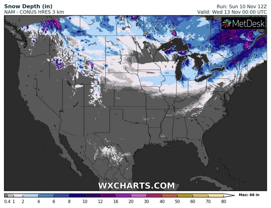
Some snow is also expected with the moving front, mostly confined to the Northern Plains and Great Lakes on Monday – most of the snow over North Dakota and Montana) with additional snowfall for the NE US through Tuesday, including lake-effect snowfall around the Great Lakes.
An exceptional windchill will spread into the Northern Plains tomorrow, Monday, Nov 11th, as well. Likely pushing well below -20 °F (below -30 °C) across Montana and Dakotas.
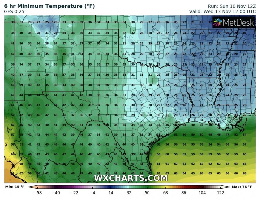
Tuesday will bring cold front already deep south into Texas, resulting in the frosty morning. On Wednesday, another very cold frosty morning for south/east Texas while frost seems possible also across deep south Louisiana and Mississippi near the coast of the Gulf of Mexico.
Stay alert for dangerous extreme cold conditions!
See also – the previous intense Arctic outbreak across the US two weeks ago:
*UPDATE* on the developing Arctic outbreak across the United States until the end of October
Interested in our calendar? We are proud to present and promote the best weather photographers in Europe – see details:
