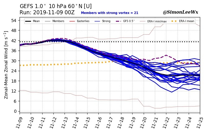
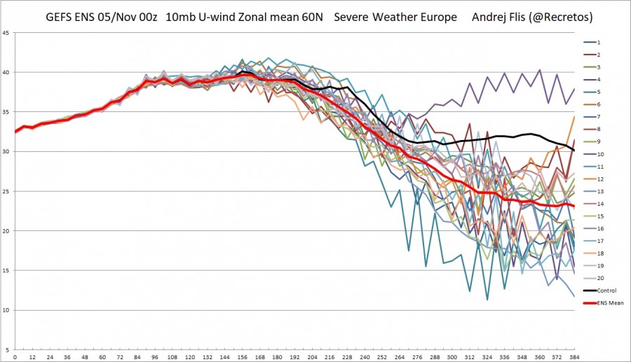
The stratospheric polar vortex is reaching its peak strength early next week. It will be the strongest mid-November vortex in the past 40-years. But that power will soon vanish, as consecutive warming/pressure phases will start to attack the polar vortex.
WHAT IS THE POLAR VORTEX, AND WHY IS IT IMPORTANT?
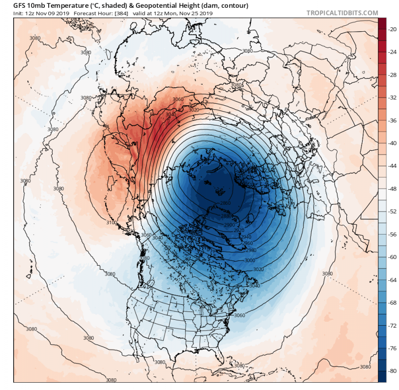
As we wrote in our previous article, the stratospheric polar vortex is currently at a 40-year record high strength for this time of year at the 10mb (~30 km) level. The power is estimated by the strength of the stratospheric “jet stream”, also called the polar night jet. We can see the current forecast, that shows the weakening of the polar night jet, as the polar vortex weakens.
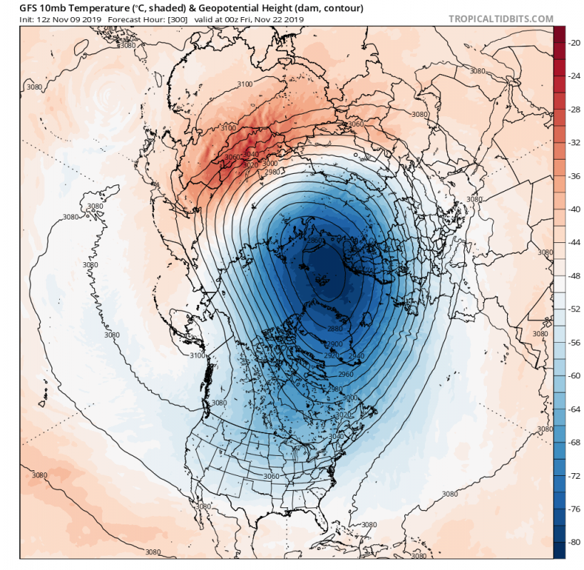
The vortex will first start to weaken due to the increasing pressure on its edges, which is called a pressure wave. Depending on the number of these waves, we call it a wave 1 or wave 2 event. On the image below we can see that we will get a wave 2 event, one over the Pacific and one over the the Atlantic, being slightly stronger.
GFS 10mb forecast. Image by: TropicalTidbits
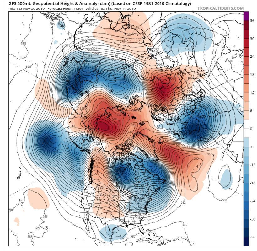
These stratospheric waves are a direct result of the very dynamic weather pattern lower in the troposphere. A dynamic pattern is when we have a lot of strong high/low pressure areas across the hemisphere. Such a pattern exhibits a lot of energy, and some gets deflected upwards into the stratosphere, causing pressure and temperature waves onto the polar vortex.
We can see the stratospheric temperature wave appearing and strengthening the week after, starting over east Asia. The temperature wave, combined with a pressure wave can keep the polar vortex from re-strengthening, which is very important, since a strong polar vortex is in a lot of cases the main driver behind a mild winter pattern.
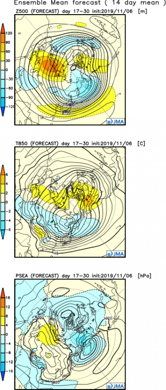
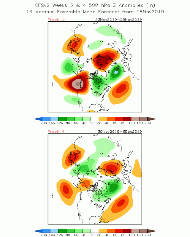
Looking at the extend range forecasts, we see the dynamic patter is expected to continue, which is an optimistic sign, as that means more temperature and pressure waves in the stratosphere. If that were the case, a major Sudden Stratospheric Warming is likely to occur by the end of the year. That would greatly increase the chances for more proper winter weather, and the “beast from the east” as they call it in UK.
Current forecasts show pressure changes over the Northern Hemisphere. Those pressure changes will send energy waves upwards into the stratosphere, which will cause warming and pressure stress on the stratospheric polar vortex. That is a good thing, because if these energy waves were to continue for a certain period of time, it might be enough to trigger a Sudden Stratospheric Warming event towards the end of the year, which could disrupt the polar vortex and change the global circulation, releasing the Arctic hounds down into Europe and North America.
We will keep you updated, but while you wait for more stratospheric warming, check out the latest long range winter forecasts, from various models around the world:
WINTER 2019/2020 MODEL FORECAST
Interested in our calendar? We are proud to present and promote the best weather photographers in Europe – see details:
