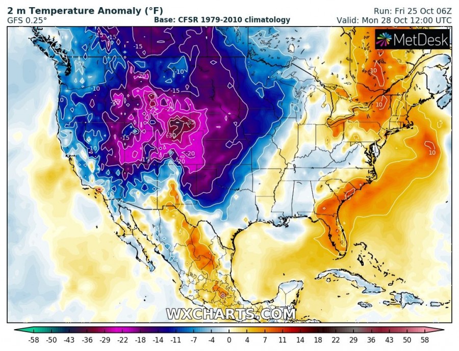
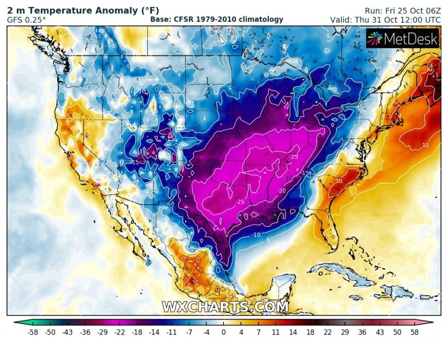
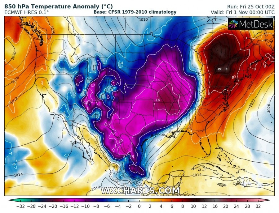
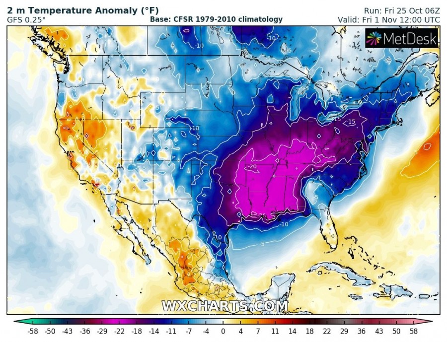
Another powerful cold blast is shaping up to push from Arctic region across Canada into the United States after Sunday this weekend and continue spreading towards the Gulf of Mexico and Southeast US until the end of October. An intense cold with 20-30 °C colder weather than average is expected, also with quite a lot of snow in the Rockies!
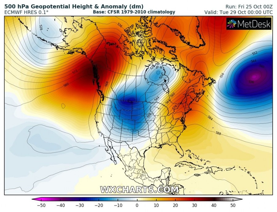
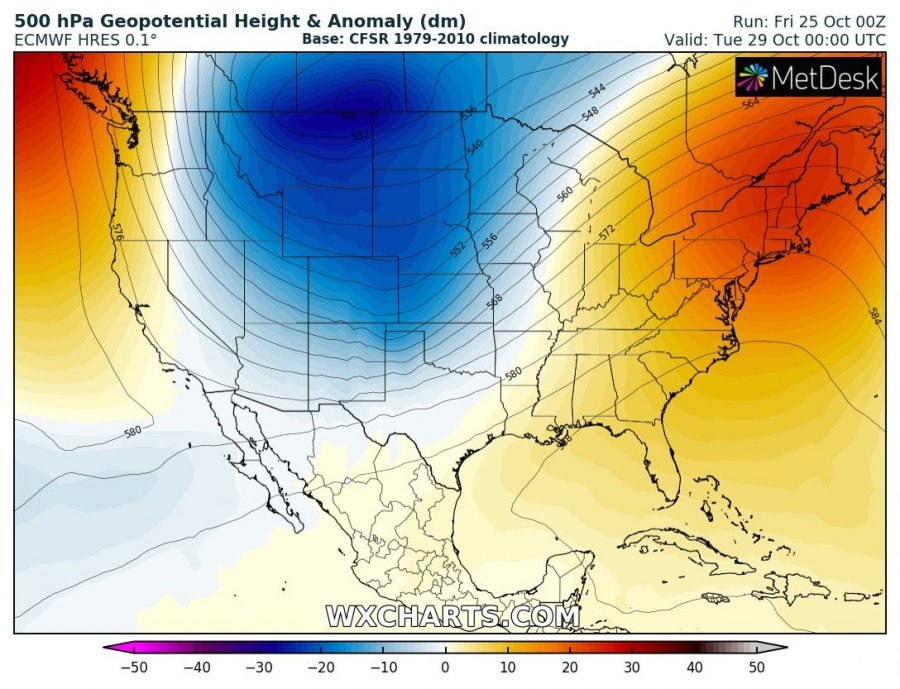
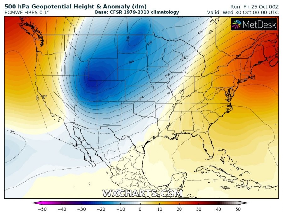
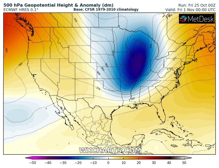
The pattern supporting this evolution indicates a very strong and persisting upper-level ridge across the north Pacific, resulting in the advection of Arctic trough with extremely cold weather towards the south with the meridional flow on its eastern flank.
Below is day-to-day evolution of the Arctic outbreak across the Continental United States (CONUS):
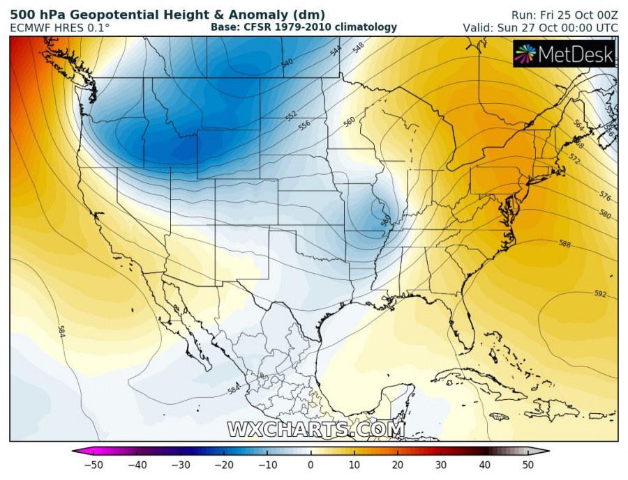
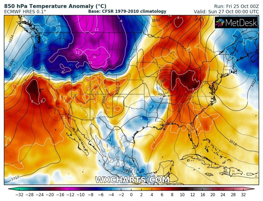
Sunday, Oct 27th
An upper trough pushes into the NW US while a short-wave is moving across the central CONUS and result in some severe weather across Dixie Alley. Very cold airmass with more than 20 °C below average 2 m temperatures starts spreading from SW Canada into Montana, Wyoming and western Dakotas. Orographic snowfall continues behind the system into the northern Rockies.
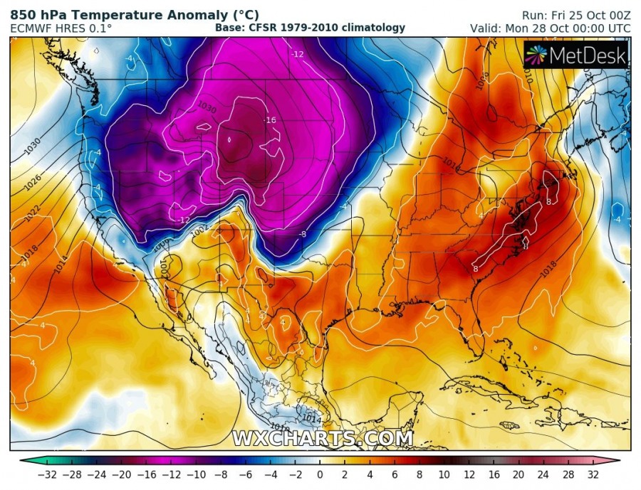
Monday, Oct 28th
An upper trough over NW US deepens while continue moving south, the trough axis reaches the western CONUS as well. Very cold airmass with 15-30 °C below normal 2 m temperatures advect into Utah, Nevada, Colorado and TX/OK Panhandle. Orographic snowfall continues behind the system into the Rockies.
Tuesday, Oct 29th
Still deepening and intensifying upper trough with deep upper-level core low is centered near the international border above Montana and Saskatchewan. At the surface, extremely cold airmass advection continues south/southeast and reaches Oklahoma, Missouri, Arkansas and Texas. Arctic front arrives at the Gulf of Mexico during the morning hours on Tuesday. Orographic snowfall is still ongoing across the Rockies.
Wednesday, Oct 30th
The upper low over NNW US finally begins to weaken through mid-week but remains intense further south. Its core moves into the High Plains, centered over Utah, Wyoming and Colorado. This results in the peak of the Arctic cold outbreak with temperatures of even more than 30 °C colder than normal for the end of October there! Surface Arctic front continues further southeast and reaches Mississippi and Tennessee, spreading into the Midwest and Ohio valley as well.
Thursday, Oct 31st
Ridging begins strengthening across the NE US while the upper trough / low is moving further south into Central Plains. A very cold airmass continues across the central US while much colder weather develops over the Gulf Coast, Midwest and Dixie Alley as well. Further north, outbreak vanishes and near-normal temperatures gradually return into the northern Rockies and Dakotas.
Friday, Nov 1st
Into the first days of November, the Arctic outbreak vanishes across the western half of US while the upper trough / low again intensifies while moving east across the Midwest. A strong surface frontal system develops across the northeast US. As a result, extremely cold airmass continues across the Gulf Coast, south and the southeast US, but also advect into the East coast. But with a warm advection in the mid-levels – this could lead into potentially dangerous ice storm development as well.
Over the weekend, trough pushes further east and the cold outbreak finally diminishes also across the southeast US.
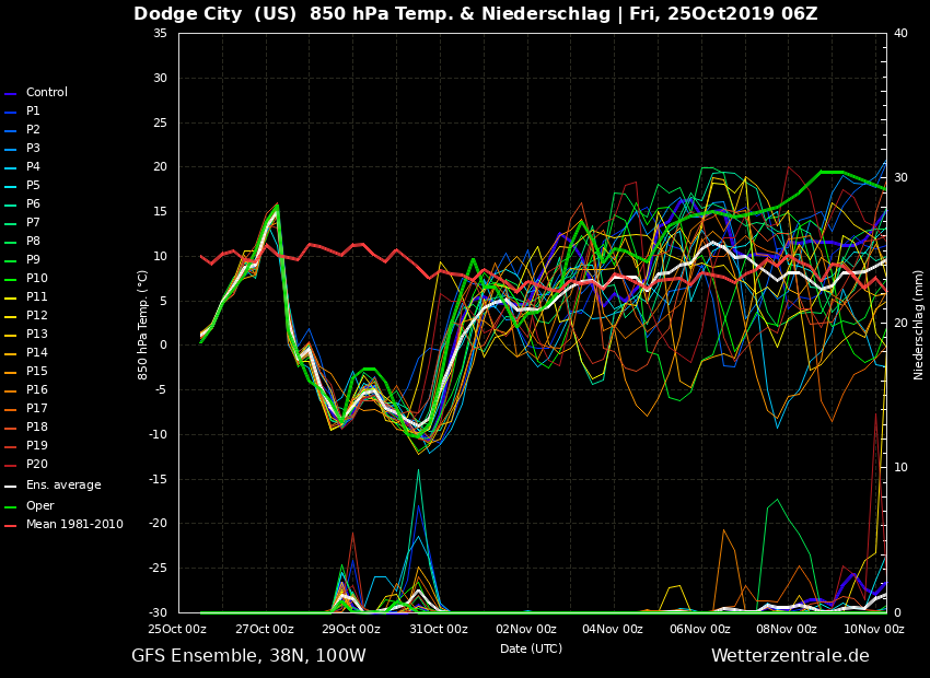
The scale of the intensity of the cold outbreak is perfectly visible on the ensemble forecasts, here are a few for Cheyenne (WY), Dodge City (KS), Chicago (IL) and Nashville (TN).
A good amount of snow will also result across the northern and central Rockies (Colorado, Wyoming, Montana) early next week when NE winds result in orographic intense snowfall in the wake of the trough axis / surface low.
Stay tuned for the follow-up updates until the Arctic outbreak unfolds!
See also – Arctic outbreak is also expected across Europe next week:
