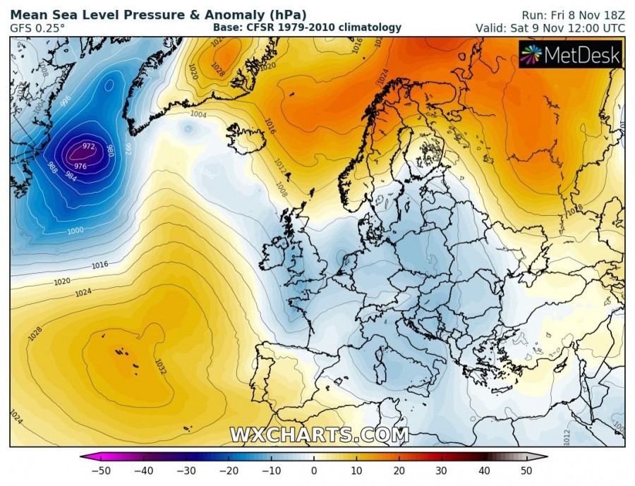
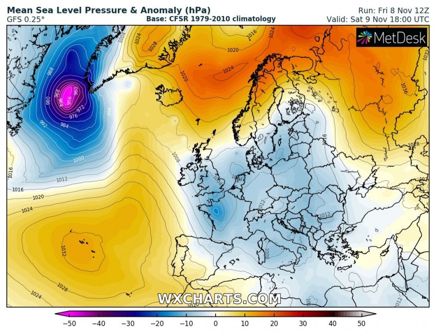
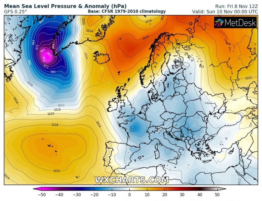
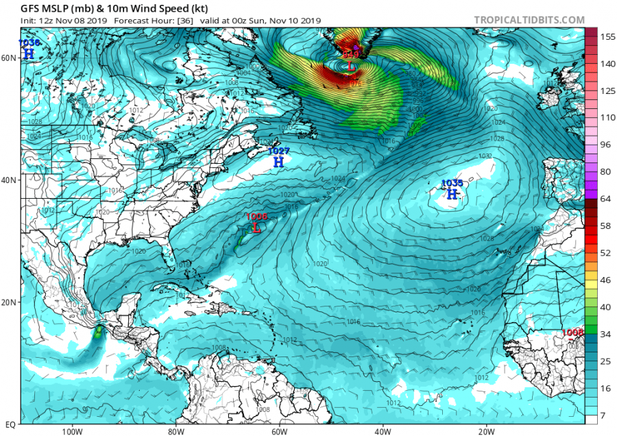
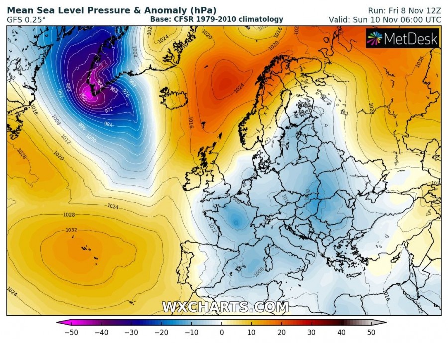
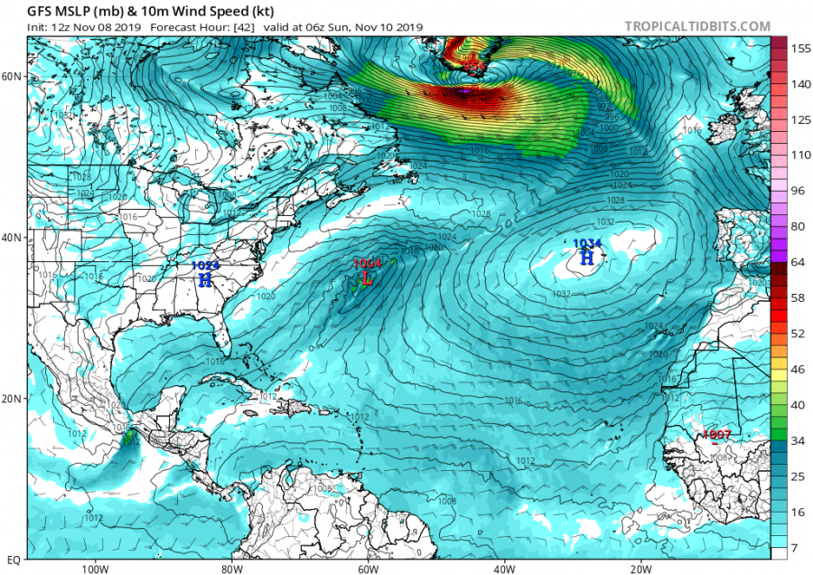
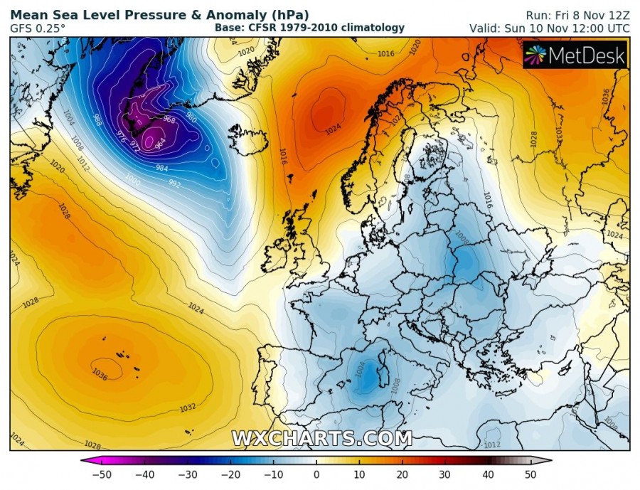
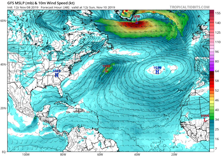
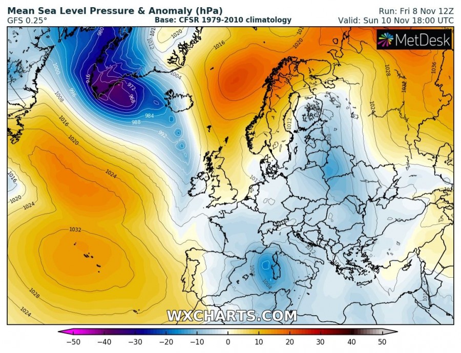
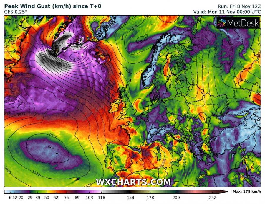
Autumn is usually very active over the North Atlantic where cold Arctic outbreak push over the still warm seas and result in explosive cyclogenesis and violent windstorms. Yet another bombogenesis* cyclone will develop over the Labrador Sea tomorrow, Saturday, Nov 9th and turn east towards the extreme southern tip of Greenland on Sunday while rapidly deepening. An intense windstorm is expected around the cyclone’s core and also across the southern Greenland where a combination of the cyclonic wind field and downslope winds should result in extremely severe winds, locally reaching 150-200 km/h, or even higher in the most exposed areas.
*Bombogenesis, a popular term used by meteorologists, occurs when a midlatitude cyclone rapidly intensifies, dropping at least 24 millibars over 24 hours.
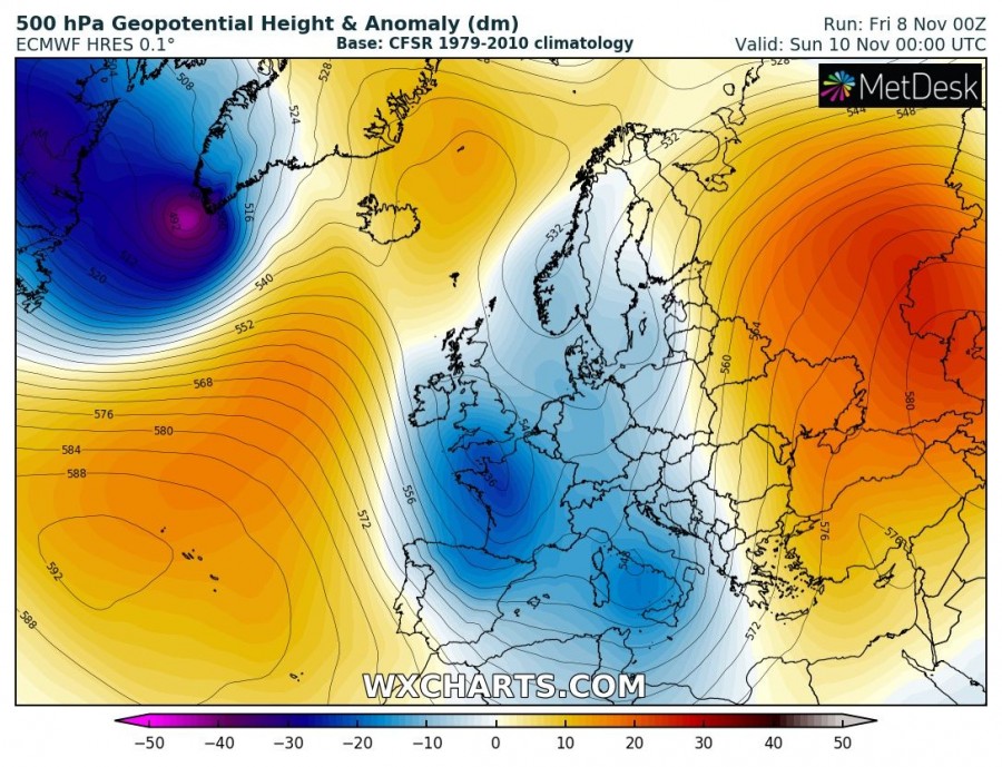
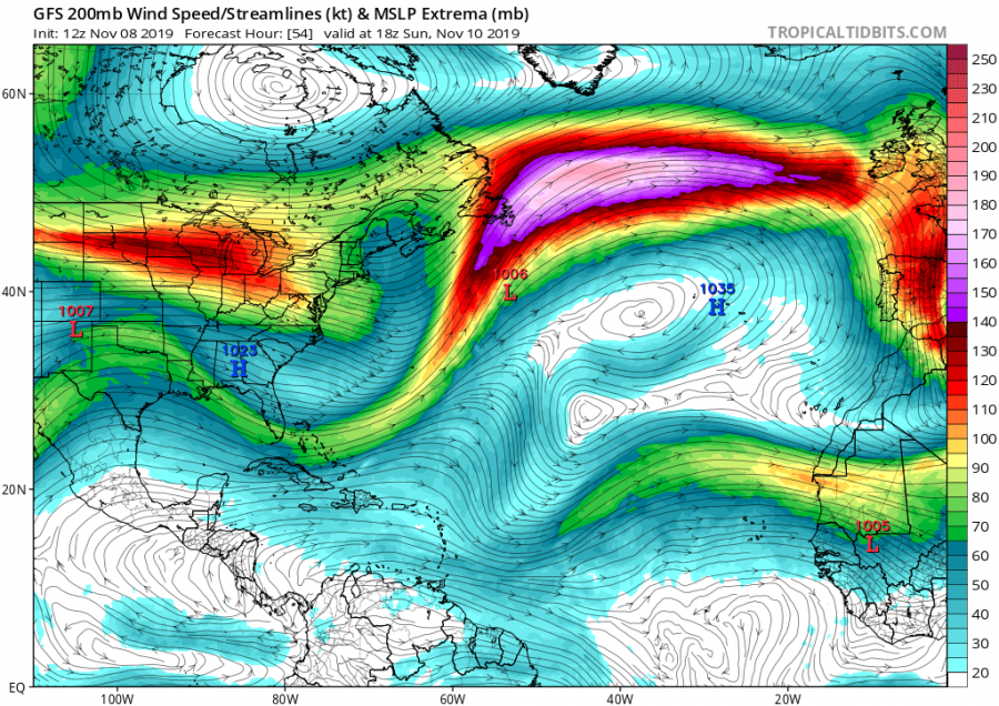
The classic pattern supports this evolution, as a very deep upper trough pushes into the Labrador Sea from the Arctic region, resulting in cyclogenesis over the region.
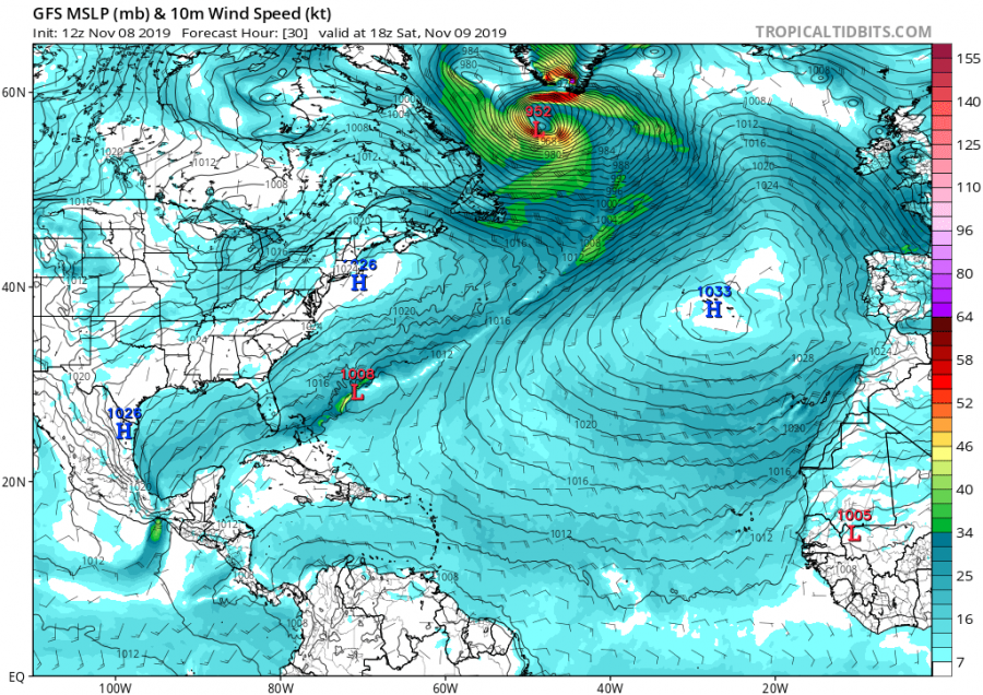
Cyclone will begin rapidly deepening on Saturday, Nov 9th around 12 UTC and continue for 24 hours, becoming a very intense cyclone. Notice the very tight pressure gradient around the low, resulting in hurricane-force winds just south of the cyclone’s center and also over the SW Greenland terrain slopes. Central pressure should drop below 950 mbar!
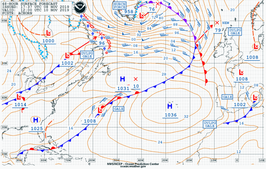
NOAA OPC forecast for the North Atlantic on Sunday, Nov 10th 12 UTC – a very intense windstorm with hurricane-force winds is expected. The center of the low will be just to the east of the southern tip of Greenland.
Overview of the peak wind gusts until Sunday’s night – the highest speeds develop over the south Greenland where local topography could support peak gusts approaching or even exceeding 200 km/h, while another wind maximum is the classic wind field just south of the cyclone’s center track.
Additionally, an intense jet-stream develops along the southern flank of the deep upper trough and between a strong upper ridge over the Azores. This will surely be quite a challenge for the flights going from Europe into the United States on Sunday, while the opposite direction will be a bonus and flights will be shorter departing from Canada / US towards Europe.
We are monitoring the evolution and will be posting updates with the satellite imagery this weekend – stay tuned.
See also – another deep cyclone was ongoing over the Labrador Sea and S Greenland on Thursday and Friday, Nov 7-8th:
Interested in our calendar? We are proud to present and promote the best weather photographers in Europe – see details:
