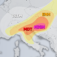
Outlook DAY 1 (valid: 24/06/2019)
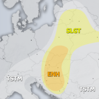
Severe Weather Outlooks FAQ SYNOPSIS The ridge is strengthening over much of Europe with two features of interest for convective activity. A large upper low …
Severe Weather Outlooks FAQ SYNOPSIS The ridge is strengthening over much of Europe with two features of interest for convective activity. A large upper low …
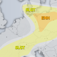
Severe Weather Outlooks FAQ +++ A severe weather outbreak appears likely across parts of the northern Balkan peninsula – intense supercells with very large to …
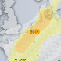
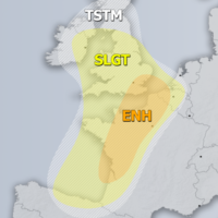
Severe Weather Outlooks FAQ SYNOPSIS Large long-wave trough persists across N Atlantic and W europe with two lows embedded, over over the Bay of Biscay …
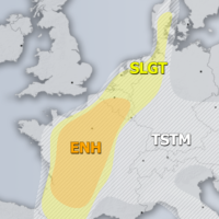
Severe Weather Outlooks FAQ SYNOPSIS Strong upper ridge remains over E-CNTRL Europe with a weakening upper low over the E Mediterranean. Deep trough is located …
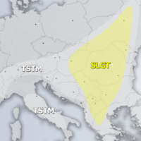
Severe Weather Outlooks FAQ SYNOPSIS Strong ridge persists across E-CNTRL and N Europe while upper low over E Mediterranean finally weakens. A large trough over …
Severe Weather Outlooks FAQ SYNOPSIS A weakening large upper trough / low is located over the N Atlantic and W Europe while upper ridge persists …
Severe Weather Outlooks FAQ SYNOPSIS A large deep trough / low remains over N Atlantic while ridge is strengthening across the ENE Europe. A weak …
Severe Weather Outlooks FAQ SYNOPSIS Strong trough / low persists across W Europe and N Atlantic while upper low remains over the N Mediterranean. A …