SYNOPSIS
Large long-wave trough persists across N Atlantic and W europe with two lows embedded, over over the Bay of Biscay and another N of UK. Strong ridge persists across east-central Europe.
DISCUSSION
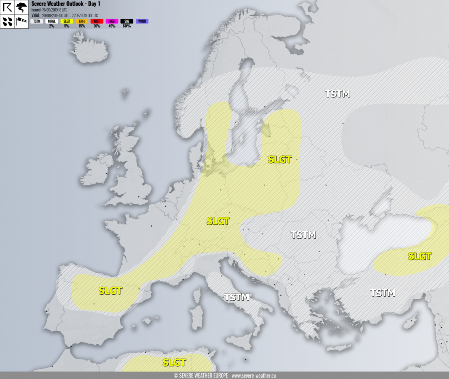
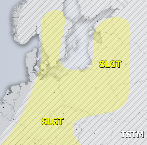
SLGT risk has been issued for S Sweden, E/S Germany, Czechia, Poland into W Belarus and Baltic states with threat for severe storms, capable of producing severe winds, torrential rainfall and marginally large hail. Moderately MLCAPE and shear should support organized severe storms, including isolated supercells with locally large to very large hail possible. Storms could cluster into a larger system towards the evening hours, enhancing threat for severe damaging winds as well.
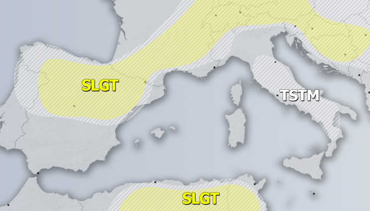
SLGT risk has been issued for S France, N Spain, Alps into N Balkans with isolated threat for severe storms, capable of producing severe winds, torrential rainfall and large hail. Scattered convective activity is again expected under a moderately unstable but weakly sheared environment. So, slow moving storms are the primary threat which could locally produce hail accumulation and flash floods.
SLGT risk has been issued for NE Algeria into N Tunisia with threat for severe storms, capable of producing severe winds, torrential rainfall and large hail.
SLGT risk has been issued for NE Turkey into Georgia with threat for severe storms, capable of producing severe winds, torrential rainfall and large hail.
TSTM risk areas have been placed where convective storms are likely to occur but should remain sub-severe.


