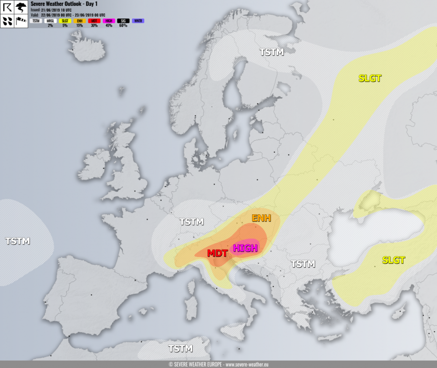
+++ A severe weather outbreak appears likely across parts of the northern Balkan peninsula – intense supercells with very large to giant hail, torential rainfall, severe damaging winds and tornadoes are expected to develop! +++
SYNOPSIS
While most of the European continent is dominated by a strong upper ridge, a shallow but well-defined upper low / wave crosses N Italy and continues towards N Balkans during the day and support widespread convective activity. A very deep trough / low is located over the N Atlantic, resulting in strong SW warm advection into the continent. Another shallow upper low is centered over E Mediterranean.
DISCUSSION
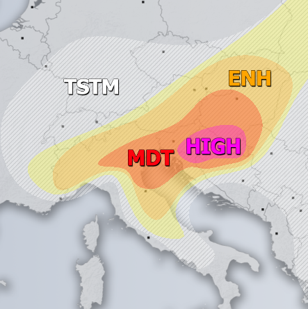
HIGH risk has been issued for SE Slovenia into Croatia with threat for severe storms, capable of producing severe damaging winds, torrential / excessive rainfall, very large to locally giant hail and tornadoes. The environment appears conductive for explosive development of discrete convective storms as good overlap of strong to extreme instability (MLCAPE 2-3000 J/kg) with moderately strong shear (DLS of 30-40 knots) exists. Intense supercells with very large hail, damaging winds and extreme rainfall will be the primary mode while tornadoes are possible as well due to enhanced easterly inflow and SR helicity resulting in strongly looped LL hodographs across the risk area. Storms should merge into a large cluster towards the evening hours while spreading across SE Croatia into N Serbia and SSW Hungary with primary threat for large hail and severe damaging winds.
MDT / ENH risks have been issued for areas surrounding the HIGH risk across Hungary, Croatia, Slovenia, Bosnia, Austria, Slovakia into N Italy and N Adriatic sea where severe storms are expected as well, but should be less robust than over the HIGH risk area. However, strong instability with moderate shear will support organized supercells, especially over the Po valley delta region where very large hail and tornado threat seems the most elevated due to locally strongly enhanced LL shear and helicity with moist influx from the Adriatic sea. Elsewhere, excessive rainfall could lead to flash floods as well, due to relatively slow-moving storms with torrential rainfall. Morning elevated storms within a large cluster should continue with excessive rainfall threat as well over Slovenia.
SLGT risk has been for areas surrounding the HIGH / MDT / ENH risks across N Italy and N Balkans as well as across E Europe into NW Russia with more isolated threat for severe storms, capable of producing severe winds, torrential / excessive rainfall and large hail.
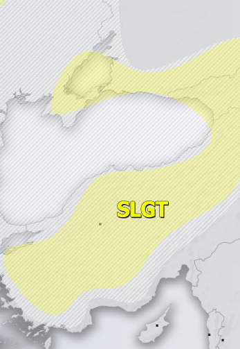
SLGT risk has been issued for NE Turkey into Georgia with threat for severe storms, capable of producing severe winds, torrential rainfall and large hail.
TSTM risk areas have been placed where convective storms are likely to occur but should remain sub-severe.


