Outlook DAY 1 (valid: 29/07/2019)
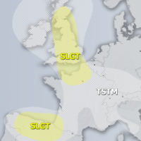
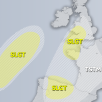
Severe Weather Outlooks FAQ SYNOPSIS A deep cyclone is moving across the Bay of Biscay towards the English Channel. A weakening upper low is moving …
Severe Weather Outlooks FAQ SYNOPSIS A deep cyclone is moving across the Bay of Biscay towards the English Channel. A weakening upper low is moving …
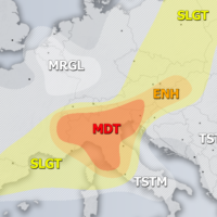
Severe Weather Outlooks FAQ +++ On Sunday, July 28th, 2019 a severe weather outbreak is expected across the E-NE Adriatic region and along the western …
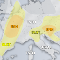
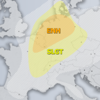
Severe Weather Outlooks FAQ SYONPSIS A deep trough / large upper low pushes from west towards central Europe and N Mediterranean with an intense cold-core …
Severe Weather Outlooks FAQ SYNOPIS An upper ridge across central Europe collapses as two features of interest will gradually result in the pattern change. A …
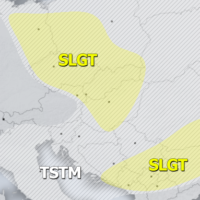
Severe Weather Outlooks FAQ SYNOPSIS The core of the upper ridge across Europe gradually moves north while its southern part begins to weaken. A deep …
Severe Weather Outlooks FAQ SYNOPSIS A strong upper ridge persists across the large part of continental Europe while deep low and an associated surface cyclone …
Severe Weather Outlooks FAQ SYNOPSIS A strong ridge is located across west-central Europe with a deep trough across N Atlantic and the Bay of Biscay. …
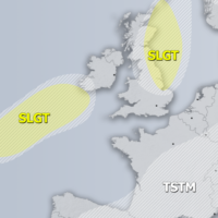
Severe Weather Outlooks FAQ SYNOPSIS A large trough is located over the N Atlantic and W Europe with a sharp short-wave crossing Benelux and NW …