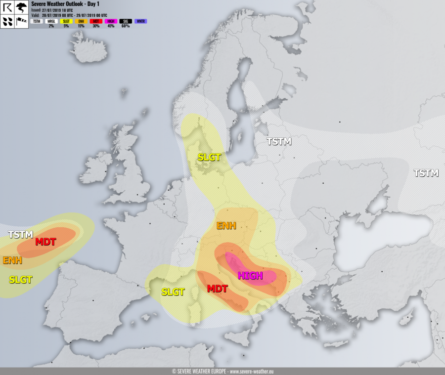
+++ On Sunday, July 28th, 2019 a severe weather outbreak is expected across the E-NE Adriatic region and along the western Balkans with threat for intense supercells and storm clusters, resulting in destructive winds, large to very large hail, torrential rainfall with flash floods and (strong) tornadoes. +++
SYNOPSIS
A large deep trough with several embedded upper cores is dominating western, central and southern Europe. One deep upper core with a well-defined frontal system is crossing Italy and Adriatic sea, while another low / wave is moving / retreating across N Germany and Denmark towards west. Another deepening cold-core is entering the Bay of Biscay with intense cyclogenesis taking place. The upper ridge over N Europe and Arctic region begins weakening while a very deep upper low forms over NW Russia.
DISCUSSION
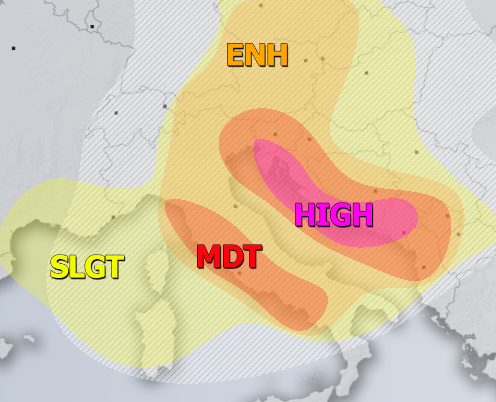
HIGH risk has been issued for W, NW and S Croatia into S Bosnia and Montenegro with threat for severe storms, capable of producing severe damaging winds, large to very large hail, torrential rainfall with flash floods and tornadoes. A rather dangerous setup is shaping up for the eastern Adriatic region as unusually deep 995 mbar summer cyclone crosses the region during the daytime and early evening hours. Widespread robust convective activity is expected already from the morning hours onwards due to a large scale ascent associated with the deep upper core / cyclone entering the region from the west. Strong to extreme instability (MLCAPE of 2500-3000 J/kg) combined with moderately strong 30-50 knots bulk shear should favor supercells as a primary storm mode and therefore severe damaging winds, large to very large hail and torrential rainfall threat. In addition, quite impressive near-surface winds are present along the coastal areas, therefore resulting in strongly enhanced LL shear and 0-3 km SR helicity. A threat for tornadoes exists, possibly even strong tornadoes due to around 15-20 knots of LL shear and locally 200+ ms^2/s^2 of 0-1 km SR helicity – these parameters are best overlapped across the Dalmatia region (Croatia). Dangerous flash floods and excessive rainfall will also be quite likely due to training cells under an extreme 40-45 mm PWAT throughout the whole HIGH risk area. For this reason, the higher risk has also been expanded into NW Croatia, SW Slovenia and Montenegro – these areas could potentially see high amounts of rainfall, probably locally reaching 100-150mm in 12-24 hours period! Storm activity will have a tendency for clustering into the bigger system(s), likely producing MCS / QLCS along the main cold front racing across the E Adriatic sea.
MDT risk has been issued for W Italy and the central Apennines with threat for excessive rainfall, large hail and severe winds. While more isolated / discrete storm activity is expected, the environment remains moderately to strongly unstable under 30-50 knots of bulk shear. Supercells are likely. Training cells should strongly enhance excessive rainfall and flash floods threat towards the higher terrain of central Apennines.
MDT / ENH risks have been issued for areas surrounding the HIGH risk including Slovenia, Austria, SE Germany, Czechia, W Slovakia, W Hungary, Croatia, most of Bosnia, S Serbia into NW North Macedonia, Albania and most of Italy with threat for severe storms, capable of producing severe winds, torrential / excessive rainfall and large hail. While damaging severe storms are most likely across the southern parts of MDT / ENH risk areas, northern parts and over the N Alpine flank should experience excessive rainfall threat on the wake of the trough / low.
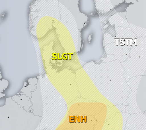
SLGT risk has been issued for areas surrounding the HIGH / MDT / ENH risk areas across north-central Mediterranean, the W-CNTRL Balkans, Alpine region and across Czechia into NE Germany, W Poland towards Denmark, SW Sweden and S Norway with isolated threat for severe storms, capable of producing severe winds, large hail and torrential rainfall. Organized storms including a few supercells are possible near the upper core moving over Denmark.
SLGT risk has also been extended towards S France and across NW Mediterranean into Corsica and Sardinia islands with threat for severe non-convective downslope (Bora) winds in the backside of the Italian cyclone. Peak gusts could locally exceed 100-110 km/h.
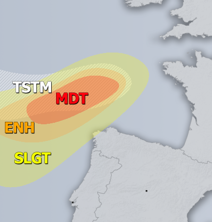
MDT / ENH / SLGT risks have been issued for the Bay of Biscay towards extreme NW Spain with threat for severe to extremely severe winds and heavy rainfall. Peak gusts in excess of 120 km/h are likely near the center of a deep low moving towards France. Some low-topped convective storms are also possible due to marginal instability present, therefore gusts could be even stronger.
TSTM risk areas have been placed where convective storms are likely to occur but should remain sub-severe.


