SYNOPSIS
The core of the upper ridge across Europe gradually moves north while its southern part begins to weaken. A deep trough over N Atlantic pushes into WSW Europe. Shallow upper low remains over the far E Europe. At the surface, deep cyclone moves north just west of Ireland. Strong high pressure remains over N Europe.
DISCUSSION
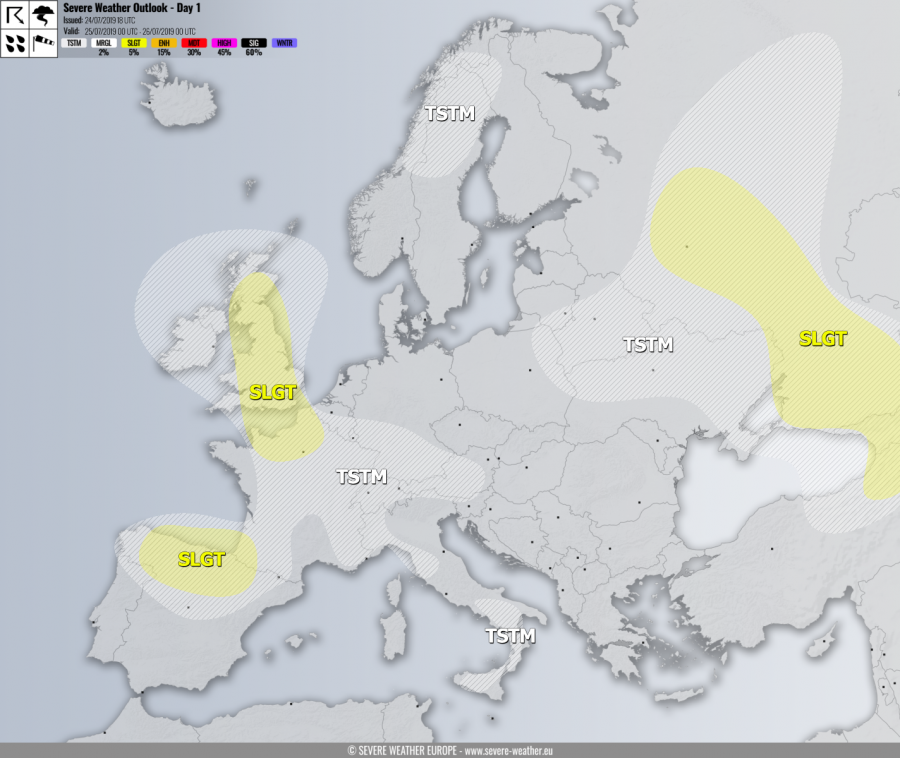
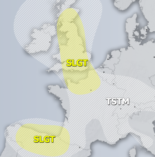
SLGT risk has been issued for N France into England and Scotland with threat for isolated severe storms, capable of producing severe winds, torrential rainfall and large hail. Inverted-V forecast soundings indicated an enhanced threat for severe convective gusts.
SLGT risk has been issued for N Spain into SW France and SE Bay of Biscay with threat for severe storms, capable of producing severe winds, torrential rainfall and large hail.
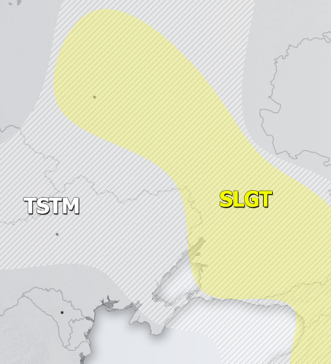
SLGT risk has been issued for NE Turkey across Georgia into W Russia with threat for severe storms, capable of producing severe winds, torrential rainfall and large hail. Slow-moving storms across the W Russia could bring local flash floods and hail accumulation.
TSTM risk areas have been placed where convective storms are likely to occur but should remain sub-severe.


