*TROPICAL UPDATE* Final hours before #DAMIEN’s landfall near Karratha in Western Australia – rapid intensification is underway!

Tropical Cyclone #Damien looks a lot better organized this evening, with a large eye starting to clear out, and continuing to strengthen. Dvorak estimates give … Read more
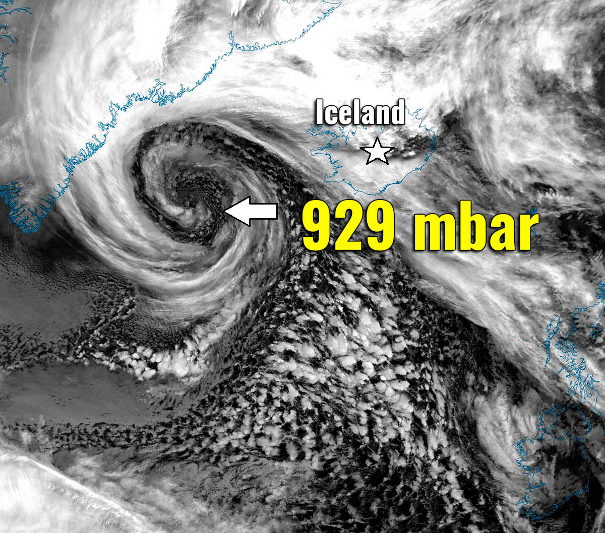
Let’s get back to #weatherp0rn – A spectacular satellite images of *monster* and extremely deep 929 mbar cyclone near Iceland tonight

The former rapidly intensifying North Atlantic cyclone we’ve discussed earlier, has reached its mature stage this evening. The system is also very large, as its … Read more

Tropical Cyclone #DAMIEN becomes a Category 3 cyclone – will intensify into a Category 4 prior to landfall in Western Australia – expected in less than 24 hours

After a brief period of stagnation due to dry air intrusion last night, the latest satellite imagery suggests the Tropical Cyclone #Damien is now beginning … Read more

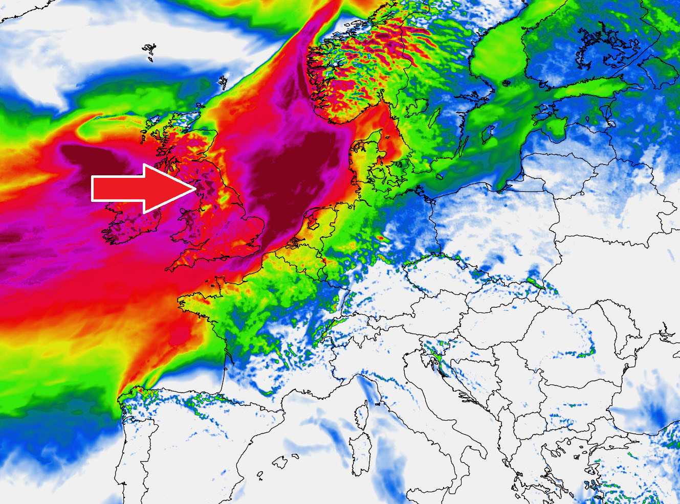
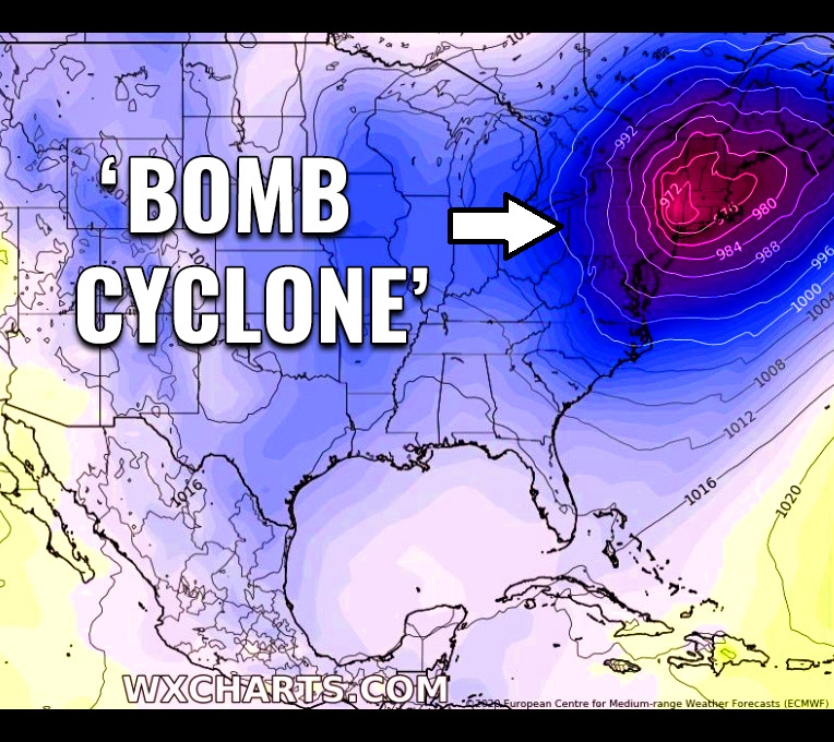
The former ‘bomb cyclone’ along the northeast USA tonight is set to batter the UK and Ireland with 75-80 mph #StormCiara on Sunday, Feb 9th

As as discussed earlier this month, the North Atlantic Oscillation (NAO index) reach near-record values – meaning North Atlantic cyclone activity literally explodes! The first, … Read more

An Arctic trough moves into the East Coast – A powerful ‘bombogenesis’ (rapid cyclogenesis) brings an intense snowstorm across the northeast United States

The intense winter storm which brought quite a significant amount of snow and ice storm into parts of Texas and Oklahoma, also lots of rain … Read more