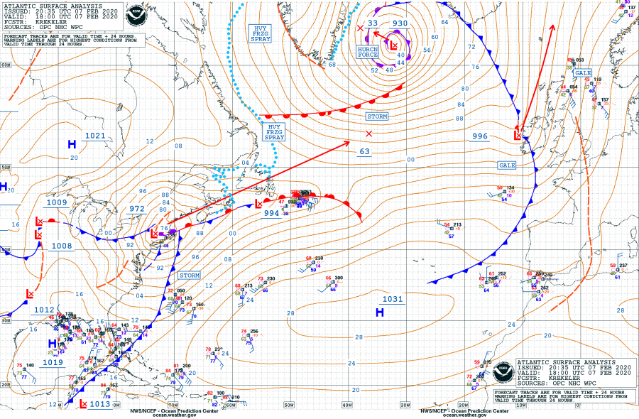
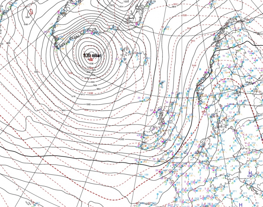
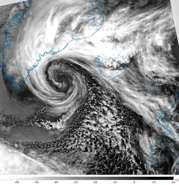
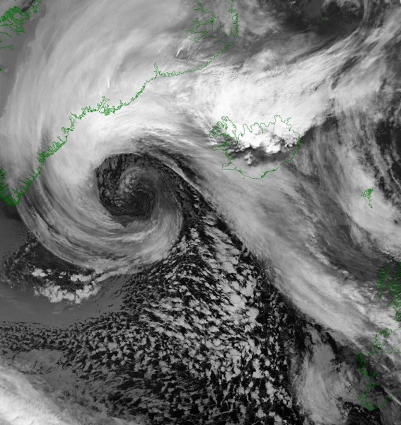
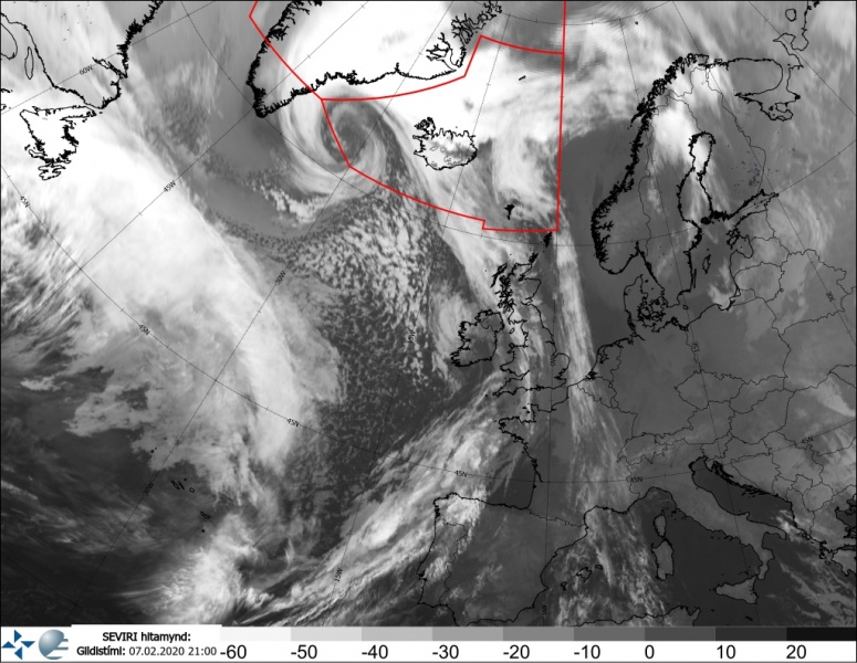
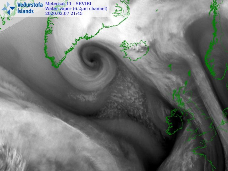
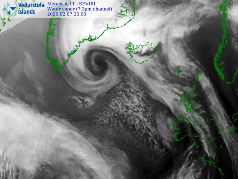
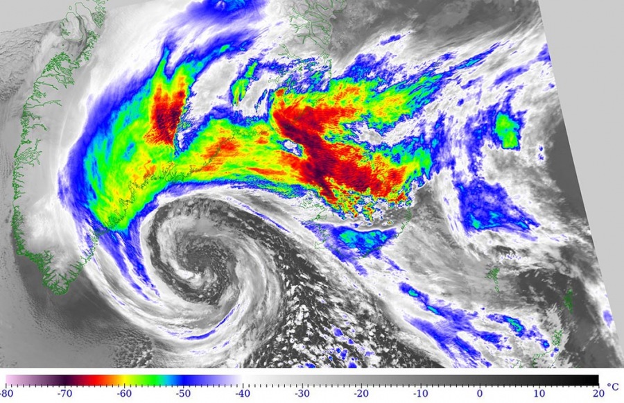
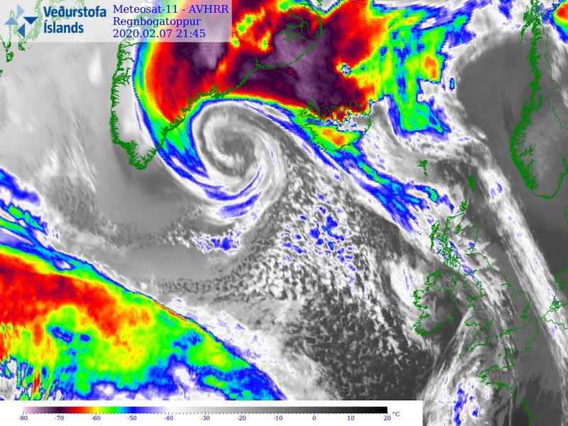
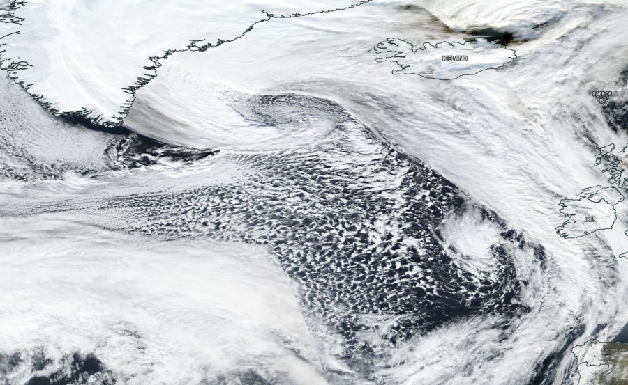
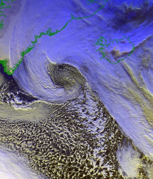
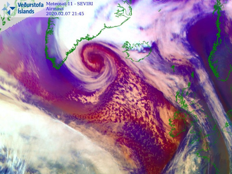
The former rapidly intensifying North Atlantic cyclone we’ve discussed earlier, has reached its mature stage this evening. The system is also very large, as its pressure field is literally dominating the North Atlantic while its presentation is remarkable. It is likely very close to its peak now. The central pressure has now slipped below 930 mbar, but only a few mbars deeper it can go overnight, then remains steady trough Saturday while its center will be very slowly drifting west towards the extreme southern tip of Greenland.
An overview of the peak wind gusts by ICON-EU model, expanding across the North Atlantic and western Europe through several days:
Friday’s 18 UTC analysis update revealed the cyclone had a central pressure of 930 mbar – a pressure change of 44 mbar during the past 24 hours (within 18-18 UTC period and also 12-12 UTC period) – a truly remarkable ‘bomb cyclone’ (threshold is 24 mbar change in 24 hours). Violent hurricane-force winds are ongoing around the center.
- 930 mbar at 18 UTC, Feb 7th
- 944 mbar at 12 UTC, Feb 7th
- 959 mbar at 06 UTC, Feb 7th
- 972 mbar at 00 UTC, Feb 7th
- 974 mbar at 18 UTC, Feb 6th
- 981 mbar at 12 UTC, Feb 6th
- 988 mbar at 06 UTC, Feb 6th
If you’re a fan of satellite images and data, this outstanding satellite presentation simply leaves you out of words. Let the photos speak a thousand words as this remarkable detail is simply epic! Attached are several images in various satellite channels, revealing many details of the dynamic cyclone.
Infrared satellite channel:
Water vapour satellite channel:
Enhanced Infrared satellite channel:
Visible satellite channnel:
Airmass satellite channel:
ECMWF wind field is relatively large around the cyclone tonight, effecting mostly only the seas of extreme North Atlantic and only the coastal areas of southern Greenland. Also over Iceland, but the main jet will remain a shy west of the island.
See the forecast discussion:
https://www.severe-weather.eu/mcd/explosive-cyclone-west-of-iceland-mk/
Meanwhile in the tropics… a Category 4 Tropical Cyclone #Damien is soon to make a destructive landfall in Western Australia:
Further southwest of North Atlantic cyclone is the ‘bomb cyclone’ rapidly deepening across the northeast US and eastern Canada tonight:
