The intense winter storm which brought quite a significant amount of snow and ice storm into parts of Texas and Oklahoma, also lots of rain and floods into the south US, continues east with the advancing deep upper-level trough. When the system arrives over the southeast US and East Coast, rapid surface cyclogenesis takes place and significantly worsening conditions develop. A violent winter storm spreads across the northeast, introducing very heavy rain and severe winds across the region, but also very dangerous conditions in the cyclone’s wake where violent blizzards develop!
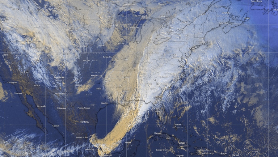
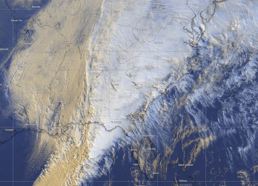
The frontal system is quite spectacular on satellite imagery, indicating a broad warm sector spreading across the east-northeast USA while a strong cold front with severe storms is moving across the southeast US:
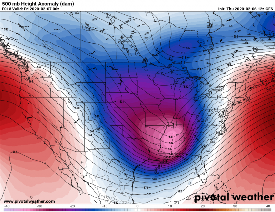
The overall pattern reveals a very deep trough progressing east across the CONUS tonight, gradually losing its strength while drifting northeast through Friday. But, an associated surface frontal system – ‘bomb surface cyclone’ blasts across the East Coast and northeast US.
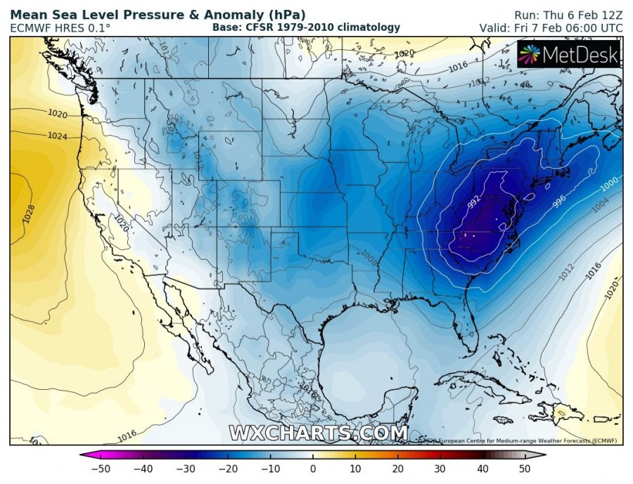
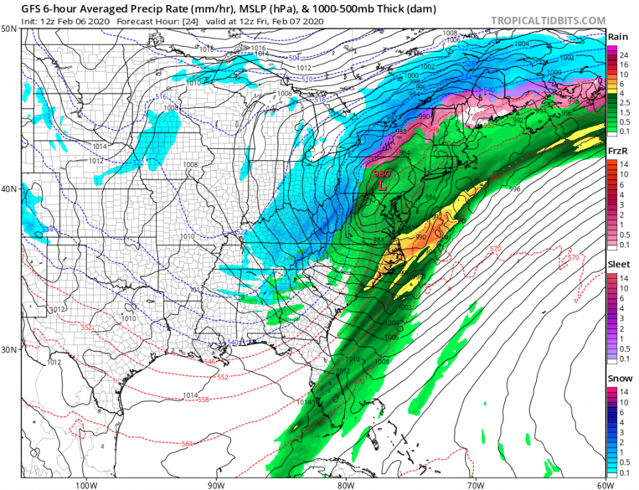
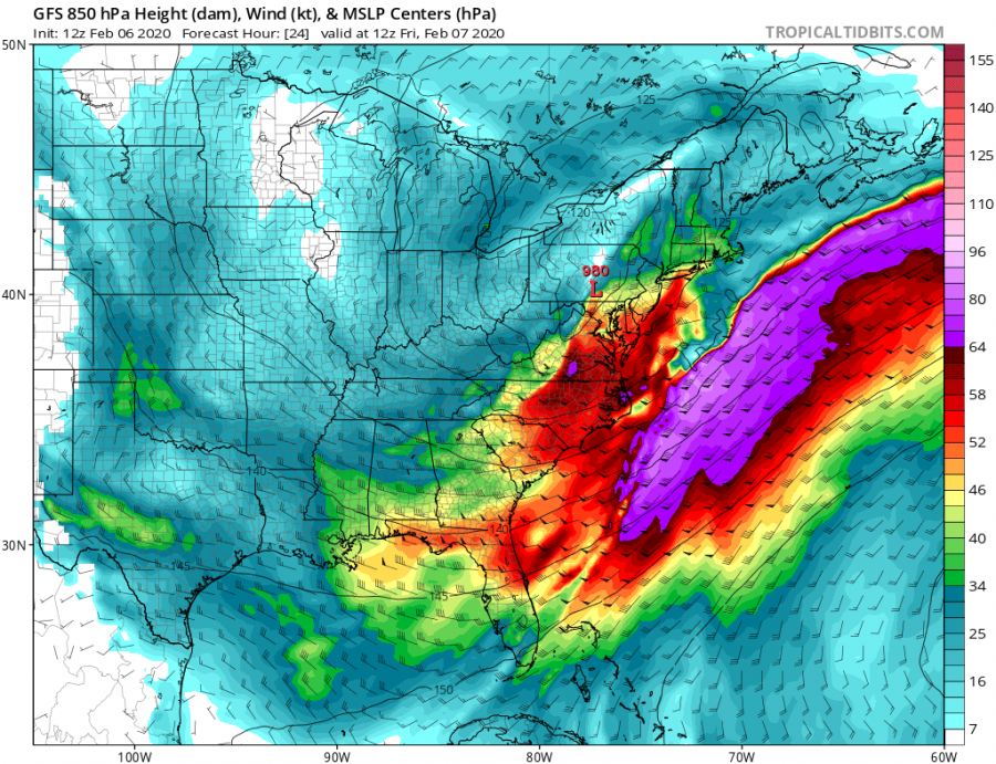
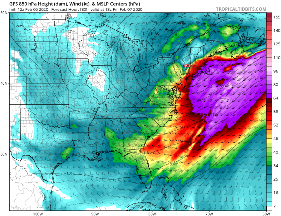
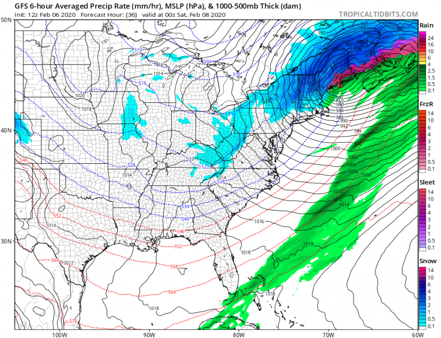
The frontal system starts organizing tonight as rapid cyclogenesis takes place over the eastern US, in response to the very deep upper trough moving east. By early Friday, very heavy rain and severe storm-force winds will be ongoing along the cold and warm front across the southeast US, East Coast and further into the northeast US. The surface low-pressure system begins deepening from the low 990s. By late Friday morning into afternoon hours, surface cyclone gets into the rapid intensification phase while drifting into the northeast US. The central pressure continues rapidly deepening into the evening hours with a pressure drop of more than 25 mbar since early morning – a ‘bomb cyclone’ (pressure drop of more than 24 mbar during the past 24 hours). In response to a deepening and strengthening low-pressure and the frontal system, precipitation increase as well. While heavy rains are expected over the warm sector, violent blizzard conditions develop on the northern side of the deep low across Pennsylvania and New York states! Very tight pressure gradient develops severe winds and therefore extremely dangerous blizzard conditions during heavy snow. Threat spreads into eastern Canada through Friday’s night while cyclone continues deepening.
Friday, Feb 7th 06 UTC
Friday, Feb 7th 12 UTC
Friday, Feb 7th 18 UTC
Saturday, Feb 8th 00 UTC
A quite spectacular dipole pattern is currently visible on the temperature maps, with an Arctic outbreak continuing across the south US behind the frontal system, but an intense warm advection ahead of the front. With the frontal system rapidly moving towards the northeast tonight, warm advection will spread across the eastern US and gradually advecting into the northeast US and eastern Canada as well. Extremely high temperatures are expected before the front pushes through. While behind the front, cold advection spill across most of east-central US as soon as the frontal system ejects towards northeast.
The excessive rainfall which occurred across the southern US in the past two days, will also continue across the southeast US and East Coast, likely resulting in 3-5″ of total rainfall in some areas.
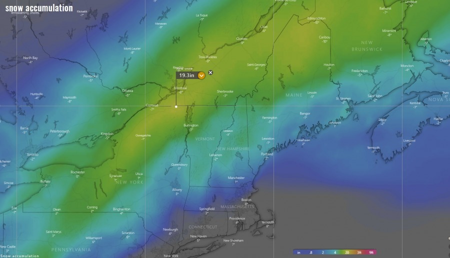
Quite some snow will also accumulate on the northern side of the intense cyclone, also with huge snowdrifts due to intense blizzard conditions expected. Locally 15-20″ is possible, especially across parts of New York state, northern Vermont and Maine. Some areas might receive even more than 20 inches of snow. And indeed further north across the international border across eastern Canada.
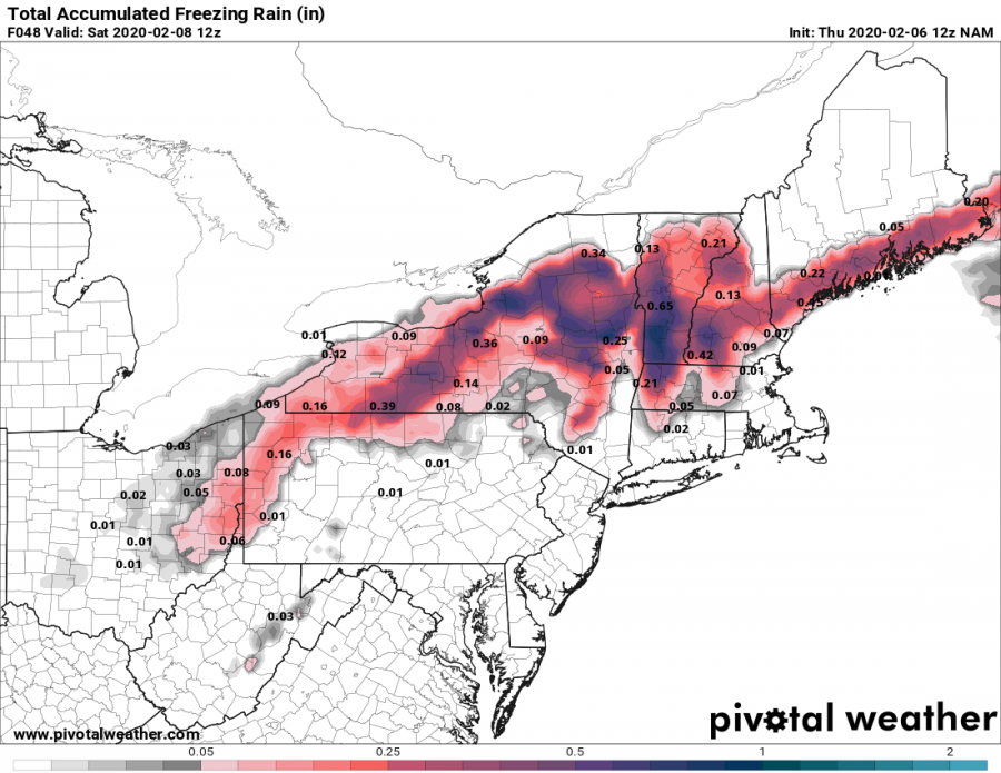
Again, there will be a narrow band along the moving fronts where ice storm is likely, so up to around 1 inch of ice could accumulate. A remarkable warm advection above the persisting cold air near the surface will create dangerous ice storm conditions.
See how this Arctic trough developed an intense winter storm across the southern Plains on Wednesday:
And also – don’t miss the tropical activity as tropical cyclones are ramping up around Australia!
