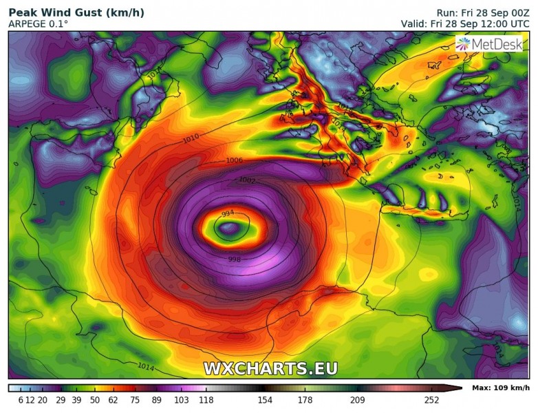
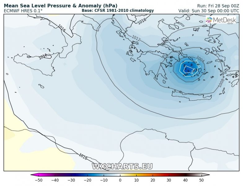
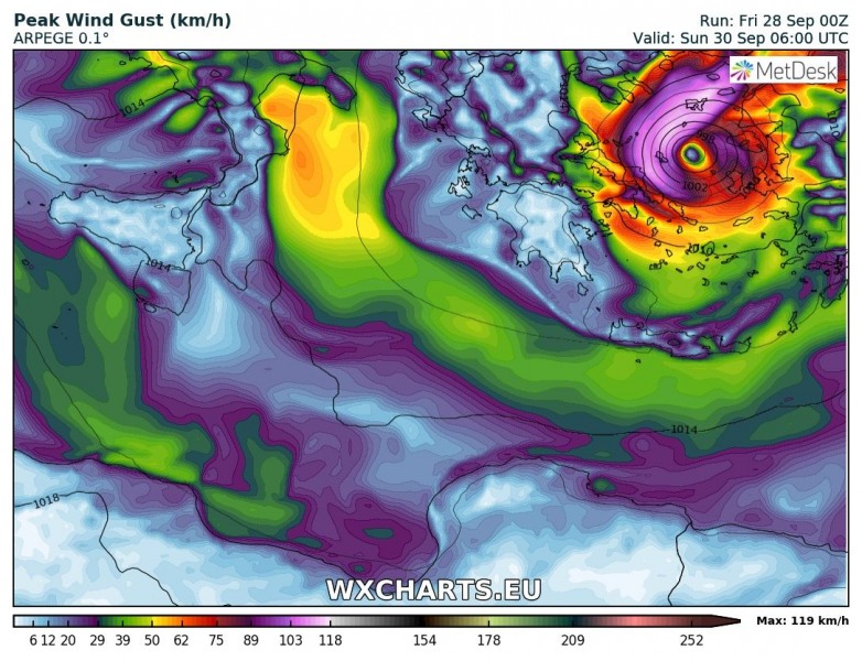
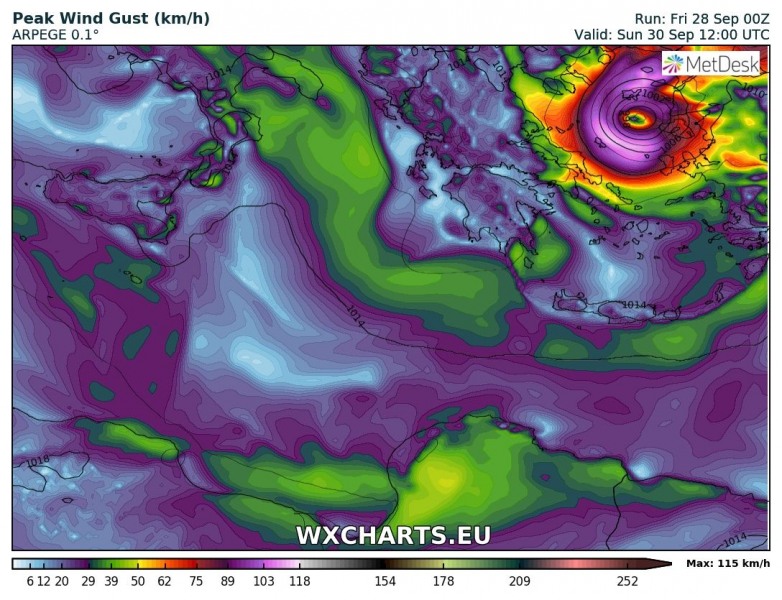
Morning model runs are perfectly on track regarding the Medicane intensity and its path this weekend. The cyclone continues deepening in the south Ionian sea this morning and is moving due north. It is expected to turn sharp ENE this evening and head towards SW Greece tomorrow morning. It will then continue across southern Greece and effect both Peloponnese and Crete island with extremely severe winds and storms with flash floods threat. Medicane will be then traveling across Aegean sea on Sunday and make landfall in western Turkey. High risk for extreme rainfall amounts remains in place.
Pressure analysis across Europe this morning reveals a high pressure across much of our continent, one deep low over NW Russia while the deep cyclone / Medicane is perfectly visible in the Ionian sea. Central pressure is around 994 mbar and still deepening.
Infrared and visible satellite animations this morning – a quite spectacular presentation of deepening cyclone!
IR satellite animation of #medicane developing in Ionian sea. An impressive structure of the convective bands around a nicely visible centre of the cyclone. It continues strengthening in these hours. @meteociel
Forecast of medicane's track this weekend: https://t.co/Jhcuv0kOcA pic.twitter.com/3UnjOCEbcs— severe-weather.EU (@severeweatherEU) September 28, 2018
Early morning view of the rapidly forming #medicane in the south-central Mediterranean! Rapidly organizing, on track with model guidance. Note the detached frontal boundary across Crete Island. Images: @SAT24_WEATHER -follow them for more satellite imagery of Europe and the world pic.twitter.com/LCU6gHkNf5
— severe-weather.EU (@severeweatherEU) September 28, 2018
Here is this morning’s 00 UTC run model guidance by ARPEGE and ECMWF, the track of the Medicane is well simulated by both models. It is expected to continue organizing and strengthening today, reaching peak intensity tomorrow morning while nearing SW Greece and then tracking across south Greece until the evening hours. The Medicane enters Aegean sea on Sunday morning. It could eventually strengthen slightly more there (as Aegean sea is quite warmer than average) and continue towards landfall in the western Turkey later in the day.
Friday, Sept 28th, 12 UTC
Saturday, Sept 29th, 00 UTC
Saturday, Sept 29th, 06 UTC
Saturday, Sept 29th, 12 UTC
Saturday, Sept 29th, 18 UTC
Sunday, Sept 30th, 00 UTC
Sunday, Sept 30th, 06 UTC
Sunday, Sept 30th, 12 UTC
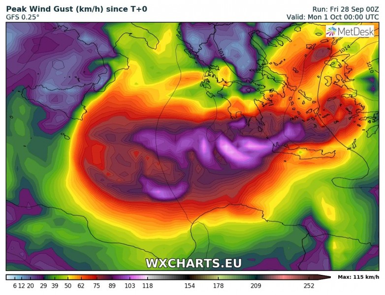
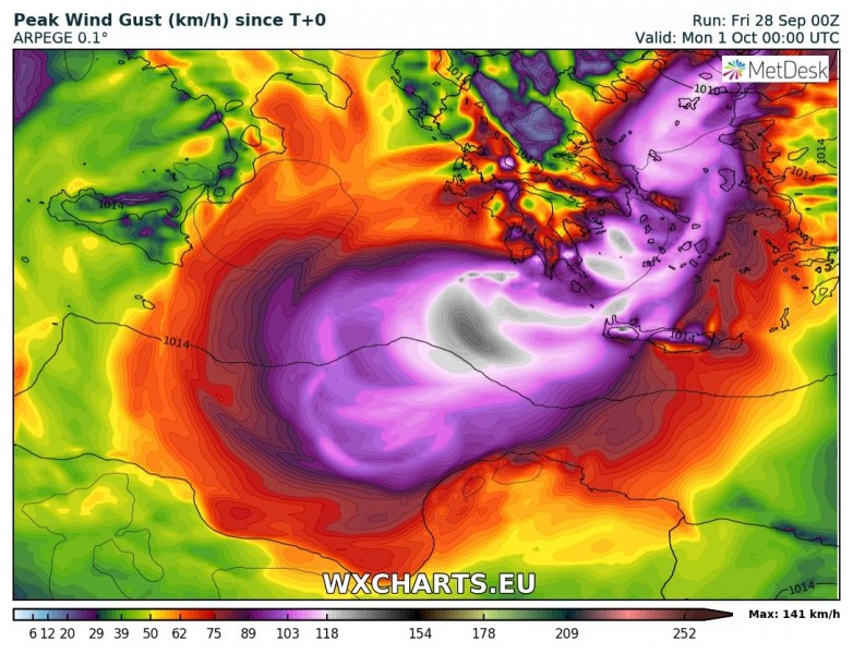
Peak wind swath are quite well aligned per main models, from eastern Ionian sea across south Greece and Aegean sea into western Turkey. Peak wind gusts 120-150 km/h can be expected along the Medicane’s track.
Rainfall accumulation maps until Monday morning, based on GFS, ARPEGE and ICON-EU models. 250-500 mm remains possible in some areas, so life threatening flash floods threat is at the highest risk and confirmed by all models. ICON-EU model is fairy aggressive with tremendous amount of rainfall across the eastern Peloponnese with more than 700 mm possible!
We will continue monitoring the evolution of the Medicane this weekend, so stay tuned for further updates!

