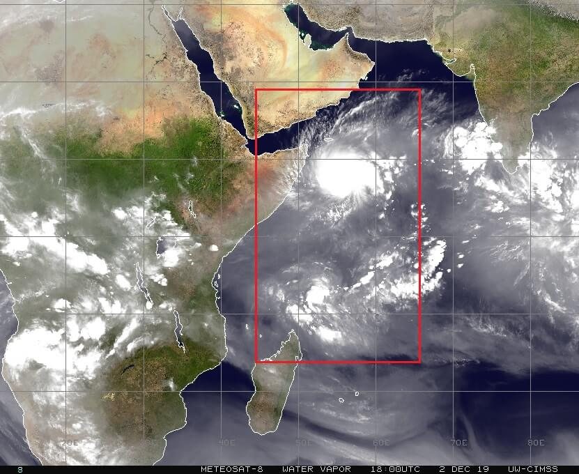
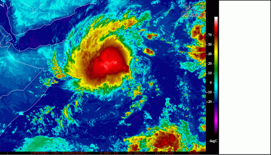
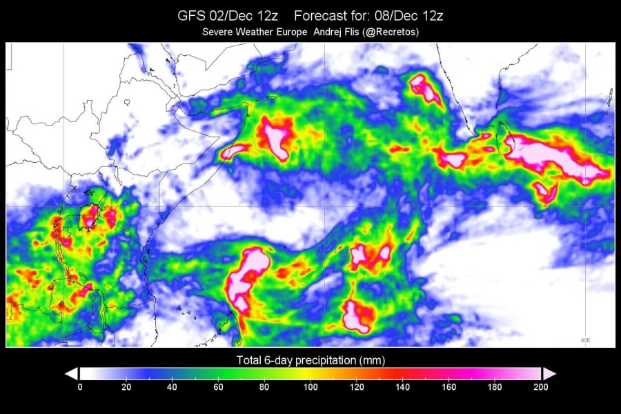
A rare situation that we wrote about two days ago, is now developing further. Twin tropical systems will form in the western Indian ocean, on each side of the equator at the same time.
Tropical convection seen in the western Indian Ocean is now starting to organize. A tropical storm has already formed north of the equator. Currently, the area is officially called Storm 06A Six, and is generating tropical-storm-force winds. The images below from Meteosat shows the organizing tropical storm north of the equator.
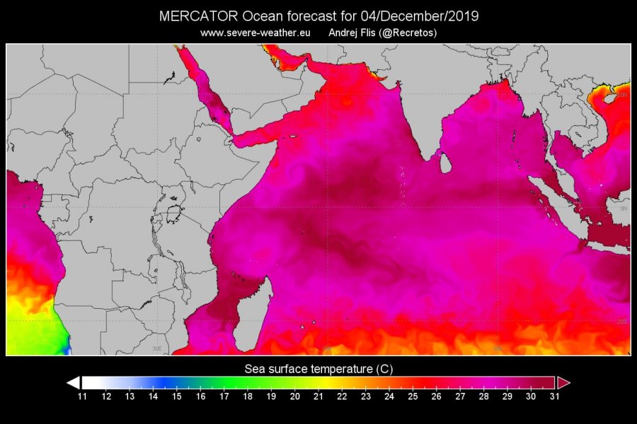
Sea surface temperatures in the region are around or over 30°C, and are supportive for further development.
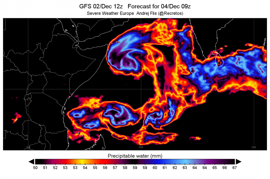
This is a rather rare situation, as twin tropical cyclones will spin up, on a similar longitudinal line (55°E), but on opposite sides of the equator. This is not something we can witness every year or even every few years. The graphics from GFS data reveals the spiral structure of the two systems spinning in opposite directions, and total precipitation on the second graphic indicates vigorous convection in both systems. The southern system can be seen tracking towards Madagascar.
GEFS Ensemble forecast reveals the track for both systems. The northern system is expected to reach tropical storm status at maximum strength, and going west. But the southern system is forecast to go south, strengthening along the way, and moving directly towards Madagascar.
Wind forecasts for the southern system, currently called Invest 91S, shows possible landfall in Madagascar with hurricane-force winds. As seen on the ensemble forecasts above, this system is very unpredictable for now, as the true tropical depression has not yet formed. That means that the models are still mainly guessing the track based on limited starting data. Once the system forms, the forecasts will become more accurate and we will have a better idea of the path and strength of the system. Below are two examples of model forecasts from HWRF and CMC-GEM. The respected ECMWF model also shows the landfall of this system into north Madagascar, with hurricane-force winds.
We will keep you updated on any important further development. While you wait for more updates, make sure to check out the full 365-day animation of Atlantic ocean currents, seasonal cooling and warming, and tropical systems leaving cold trails in the warm tropical waters:
https://www.severe-weather.eu/global-weather/atlantic-ocean-currents-animation-temperature-fa/
