A rather unique situation is setting up, where we will witness twin tropical cyclones, on both sides of the equator!
UPDATE 04.December: 5 Systems are now live in the Indian Ocean:
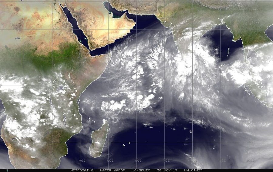
Tropical convection is currently ongoing in the western Indian ocean, seen on the METEOSAT image below. In the coming days, more organized convection is expected. As current models indicate, double tropical cyclone formation is likely by mid next week.
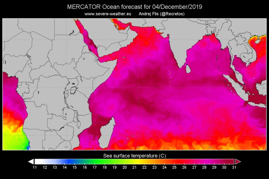
Conditions will become more favorable, and two tropical cyclones are expected to form. Sea surface temperatures will be over 30°C in the western Indian Ocean, with relatively modest wind shear conditions. Tropical depression formation is expected within 48-72 hours, early next week.
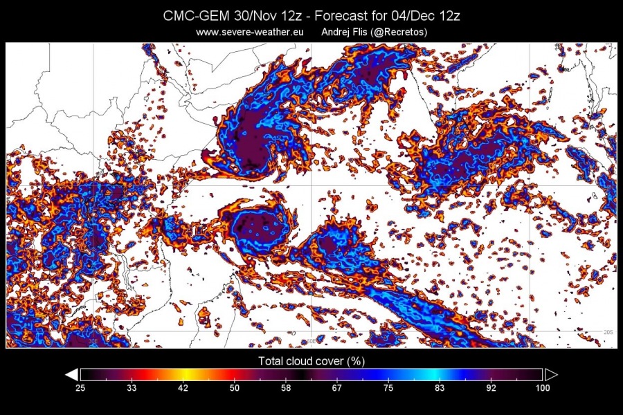
This is a rare situation, as we would witness twin tropical cyclone formation, looking at each other across the equator and spinning in opposite directions. The examples below are from the global Canadian model, which is similar to the ECMWF global model output. Obviously notable are developed tropical cyclones.
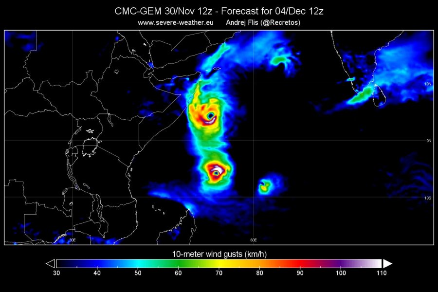
Wind forecasts also reveal twin cyclone formation, with the southern cyclone being in more favourable conditions, and is expected to become stronger. Some forecasts take it south into Madagascar as a tropical cyclone as strong as a category 3 hurricane!
We will keep you updated on any important further development. While you wait for more updates, make sure to check out the latest ongoing drought emergency in Australia:
Australia drought emergency and wildfire crisis
Interested in our calendar? We are proud to present and promote the best weather photographers in Europe – see details:


