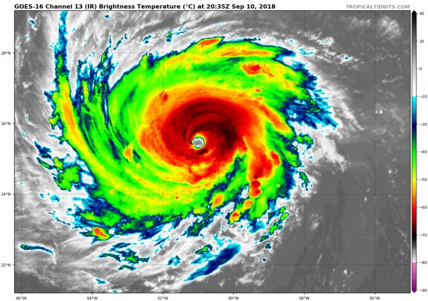
As expected in our morning update on the dangerous hurricane heading towards the Carolinas (US), Florence now continues with rapid strengthening and is already a very dangerous Category 4 hurricane – officially with sustained winds of 138 mph and central pressure of 939 mbar. Florence is expected to remain a major hurricane in the next 3 days and chances are it gets upgraded into a Category 5 within the next 48 hours due to very favorable conditions for further intensification. Very low shear is supporting upper-level outflow while extremely warm sea surface temperatures give huge amount of ‘fuel’ for intense thunderstorms in the eyewall.
Latest satellite imagery is revealing an impressive structure of powerful eyewall with textbook stadium effect presentation during the last 2 hours of daylight over the hurricane. The structure is compact with NE and NW quadrants being the most intense for now, but likely these intense storms will spread into SW and SE quadrants through the next 12-24 hours when Florence gets into even better conditions further west.
Below are the latest NOAA Hurricane Hunters aircraft mission graphics through the hurricane, revealing three separate passes through the eye/eyewall – central pressure was even below 940 mbar with surface winds of around 140 mph, supporting a solid Category 4 strength.
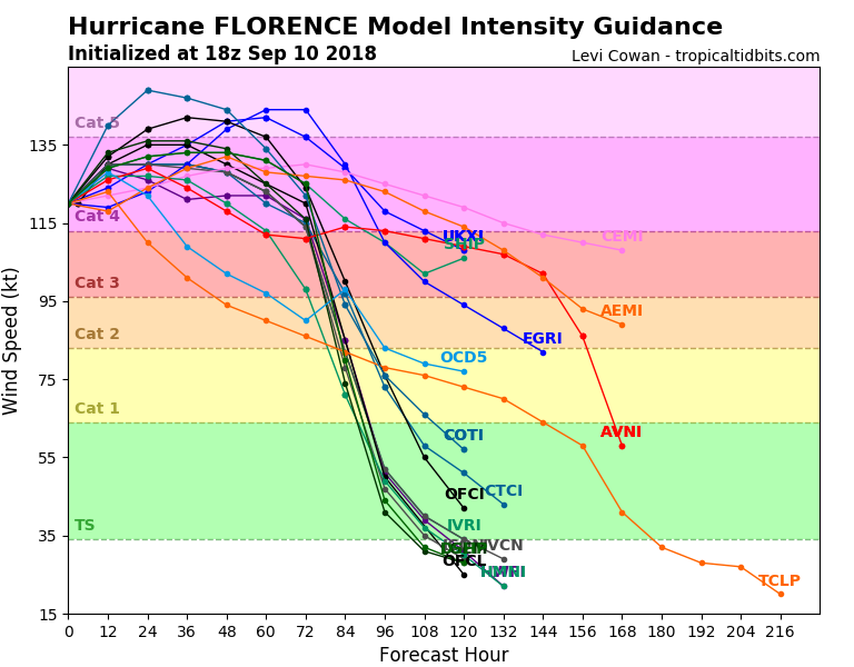
Latest 12z model runs guidance for hurricane Florence intensity suggesting a possibility of becoming a Category 5 by some models tomorrow or Wednesday. This is quite an improvement from the previous morning model runs.
Stay tuned, we will have another update in the morning hours!


