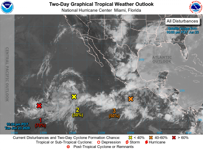
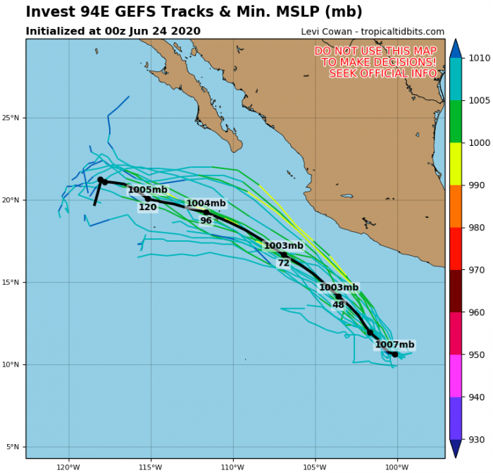
With the seasonal progress into summer, tropical weather activity begins. This week, four (4) tropical waves have formed over the Eastern Pacific and are organizing. The National Hurricane Center (NHC) has analyzed these 4 systems west of Central America, moving west. The most organized systems are Invest #93E and Invest 94E. System #94E will be moving west-northwestward parallel to the coast of Mexico over the next several days.
Satellite imagery
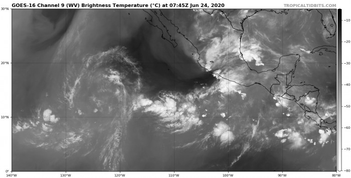
Attached are the Infrared and Water Vapour satellite images of the Eastern Pacific – we can see all four tropical waves ongoing and developing:
Here is the latest NOAA NHC forecast discussion on all four systems:
System #1 – Invest #93E
Showers and thunderstorms have increased during the past several hours in association with a small area of low pressure located about 1700 miles southwest of the southern tip of the Baja California peninsula. Environmental conditions are expected to support further thunderstorm activity, and the low is likely to become a tropical depression during the next couple of days while it moves slowly toward the west or west-northwest.
* Formation chance through 48 hours…high…70 percent.
* Formation chance through 5 days…high…70 percent.
System #2 – Invest #92E
An elongated area of low pressure located several hundred miles southwest of the southern tip of the Baja California peninsula continues to produce a wide area of disorganized showers and a few thunderstorms. Some development of this system is possible during the next day or two while the system moves westward at about 15 mph before it moves over cooler waters.
* Formation chance through 48 hours…low…30 percent.
* Formation chance through 5 days…low…30 percent.
System #3 – Invest #94E
Disorganized showers and thunderstorms located a few hundred miles south-southwest of the Gulf of Tehuantepec is associated with a tropical wave. Environmental conditions are forecast to be conducive for development, and the system is likely to become a tropical depression in a few days while it moves west-northwestward parallel to the coast of Mexico.
* Formation chance through 48 hours…medium…50 percent.
* Formation chance through 5 days…high…80 percent.
System #4
Another area of low pressure is forecast to form south of the Gulf
of Tehuantepec by late this week. The gradual development of this system
will be possible over the weekend as it moves west-northwestward
parallel to the coast of Mexico.
* Formation chance through 48 hours…low…near 0 percent.
* Formation chance through 5 days…low…30 percent.
We will continue monitoring these tropical waves and will keep you updated – stay tuned!
See also:


