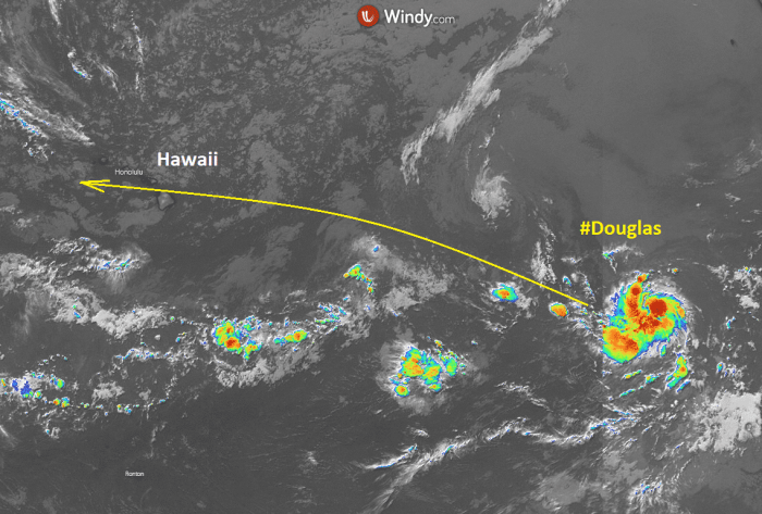
The Eastern Pacific is becoming active again. A Tropical storm Douglas formed this week. Tropical Storm Douglas could become a hurricane Douglas within the next 2 days as very favorable conditions are present in the region. The system will track across the Eastern Pacific and could eventually reach the Hawaii archipelago later this weekend or early next week. Its intensity at that time is yet to be determined.
Major Hurricane Douglas grazing across the eastern Pacific. It is likely to impact the Hawaii archipelago on Sunday!
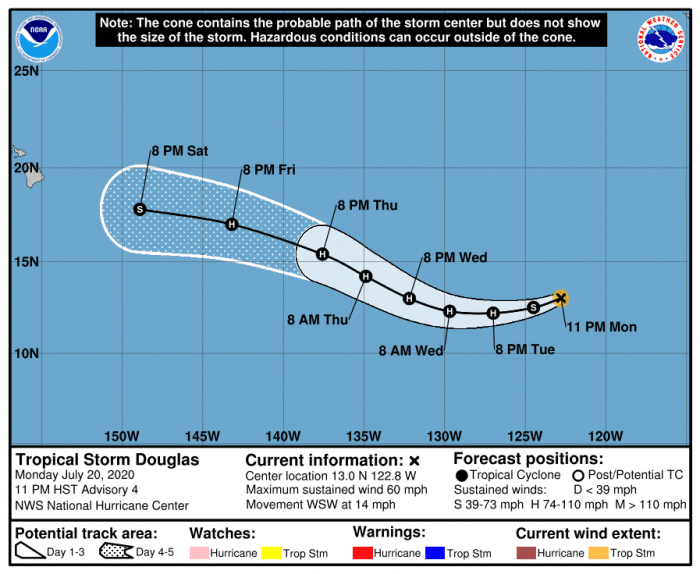
Douglas is packing maximum sustained winds of 50 knots (60 mph), gusting to 60 knots with a central pressure of around 999 mbar. The system is deepening and has been upgraded from the tropical depression on July 20th. Douglas has continued to strengthen since the upgrade.
Satellite imagery
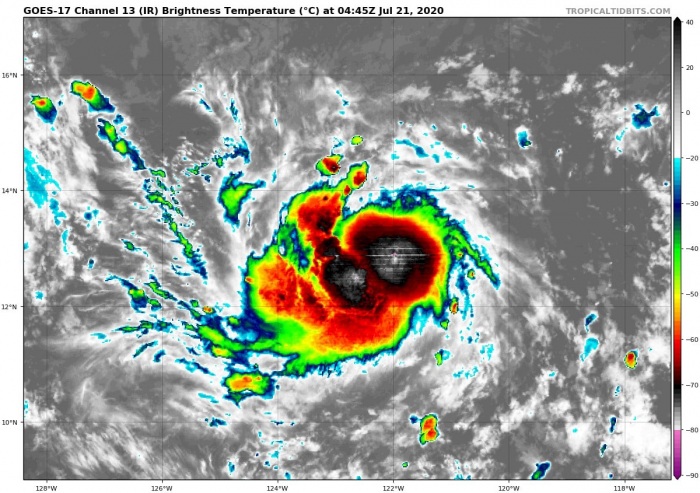
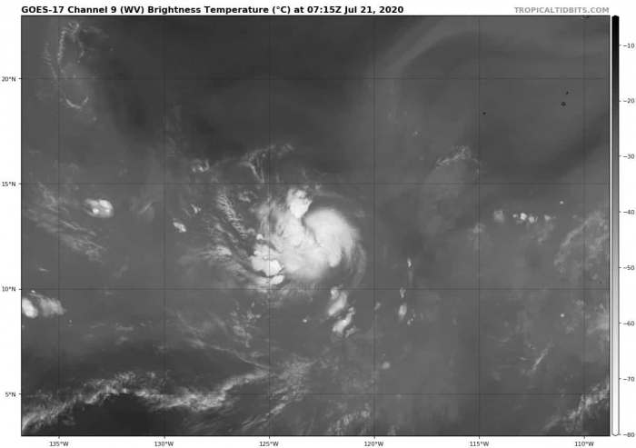
Looking over the water vapor and infrared satellite scans across the Eastern Pacific, the system is becoming strong. A broad area of circulation is seen with the Tropical Storm Douglas, gradually organizing into a better defined CDO (central dense overcast) cloud pattern. The environment in the region is definitely conducive to the further development of the system.
A compact area of explosive deep convection has also been observed in satellite data lately. This is suggesting the system is healthy enough for strengthening. Douglas could be soon upgraded into the first hurricane of the season – hurricane Douglas. The system future track could bring it close to Hawaii later this weekend into early next week.
Potential for hurricane development
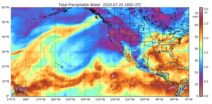
An impressive moist environment with very high precipitable water (PWAT) is present in the region of the Eastern Pacific. There is also favorable upper-level divergence and low deep-layer shear present. Sea surface temperatures nearly at +30 °C, indeed very high as well. Therefore, conditions are prime for (finally) the first hurricane development this season. Remember, the attempt of Tropical Storm Cristina two weeks ago failed.
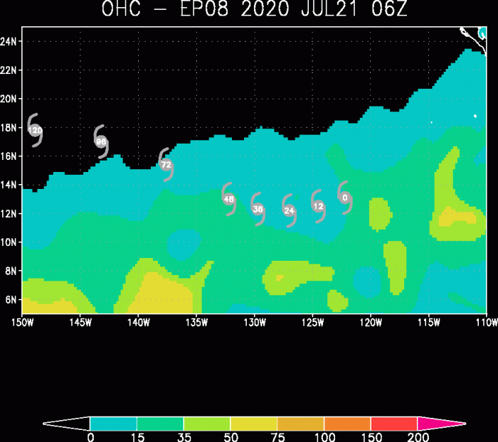
The Ocean Heat content (OHC) chart over the Eastern Pacific does suggest that a favorable environment is present. The system will travel into better conditions over the next 48-72 hours. Therefore, we can expect to see a faster development of potential hurricane Douglas until Thursday. These conditions should normally boost the intensity of a tropical system.
Forecast track
The National Hurricane Center (NHC) is forecasting Douglas could become a Category 1 hurricane over the next day or so – tonight or tomorrow (Wednesday). Potentially even a Category 2 system on Thursday. Packing sustained winds of around 80 knots (= 90 mph) during its peak intensity. Its movement will be west-northwestward at about 10-15 kt.
It is important to note that, although Douglas should remain in a favorable low shear and high SSTs over the next 72 h, rapid intensification might not occur. Douglas is actually a rather small tropical storm. The effects of dry mid-level air intrusions could prevent those explosive bursts which are usually a sign of rapid intensification.
Intensity forecast for Douglas
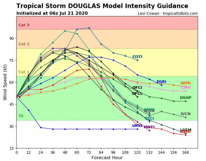
Here is the various model forecast for the intensity of Douglas during its lifecycle. There is indeed some potential it could become a powerful Category 2 hurricane on Thursday into Friday. Definitely a need to monitor the system further. After Thursday, it should begin its gradually weakening trend after entering less favorable conditions.
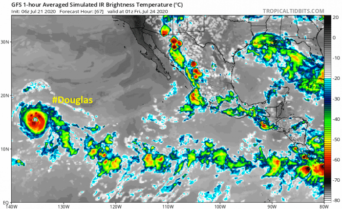
Attached is the infrared satellite simulation chart for Thursday evening, July 24th. This is during the peak time of hurricane Douglas. It could become a very organized and strong tropical system. Located over the open waters of Eastern Pacific, moving west. Away from any land areas of central America.
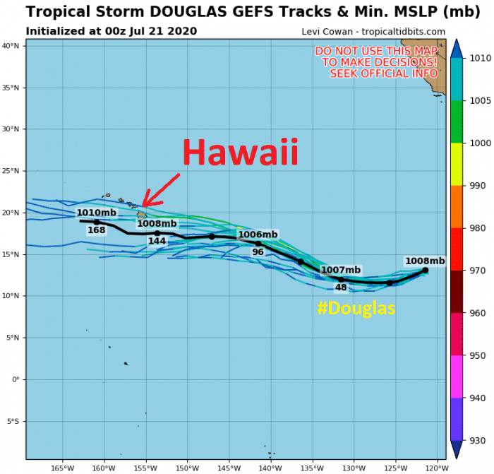
However, the future track more than 5 days ahead is still rather uncertain. Both global models GFS and ECMWF are forecasting the system to be well organized. ECMWF is more aggressive and brings Douglas to Hawaii sometime between Sunday and Tuesday. While the GFS model does not and simulates it to dissipate it would reach the archipelago.
Wind and rainfall threat forecast
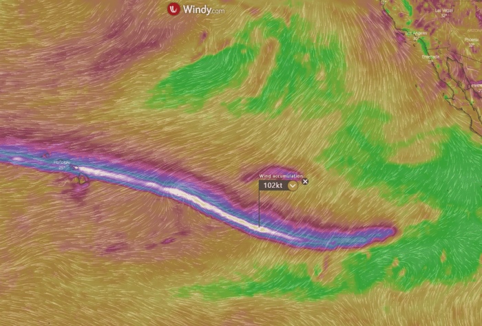
Douglas seems to become a hurricane over the next 24-48 hours, depending on how the current conditions emerge today and tonight. The system does show a very well-defined track across the Eastern Pacific, reaching Hawaii after Sunday. This is ECMWF global model simulation. It peaks above 100 knots of wind gusts in the coming days.
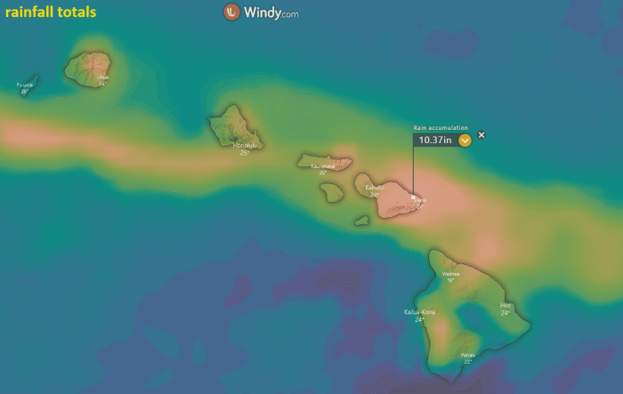
The ECMWF model simulation for the rainfall totals over the Hawaii archipelago over the next 10 days. It definitely depends on the exact track of Douglas, but the potential is there high amounts of rain are possible and could bring flooding threats.
We are monitoring further development of Douglas and will be publishing more updates as hurricane strength emerges. Stay tuned!
Read also about the previous storm in the region – Tropical Storm Cristina. It did had a good try to become a hurricane, but somehow failed to build up a stronger core and remain at the tropical storm strength only:
Hurricane season 2020 prediction
Hurricane season 2020 could be very active – see details:
