Outlook day 1 (valid: 19/02/2017)
VALID FOR 19-02-2017 A trough pushes into SE Europe and transforms into a cutoff upper low, producing storms over the S Adriatic region, the Ionian …
VALID FOR 19-02-2017 A trough pushes into SE Europe and transforms into a cutoff upper low, producing storms over the S Adriatic region, the Ionian …

VALID FOR 18-02-2017 A short wave trough crosses the Balkan peninsula associated by a surface cold front across the Adriatic sea and W Balkan countries. …

VALID FOR 17-02-2017 An extensive ridge finally collapses as several short waves spread across N and W Europe on Friday. One of these troughs will …

VALID FOR 16-02-2017 An omega blocking pattern with extensive surface high pressure system over south-central Europe is gradually weakening as new troughs are pushed from …

VALID FOR 15-02-2017 An established omega blocking pattern with extensive surface high pressure system dominates Europe. On its eastern flank a short wave trough with …

VALID FOR 14-02-2017 The extensive ridge dominating over Europe is slowly transforming into an omega blocking pattern. E Atlantic and Iberian peninsula are under a …

VALID FOR 13-02-2017 An extensive upper ridge still dominates, centered across S Scandinavia and NW Europe. A deep upper low is rotating over the Iberian …
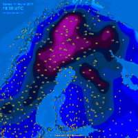
Good evening, our friends and followers! After a hiatus of almost two years our severe weather outlooks return! An extensive upper ridge dominates Europe, centered …