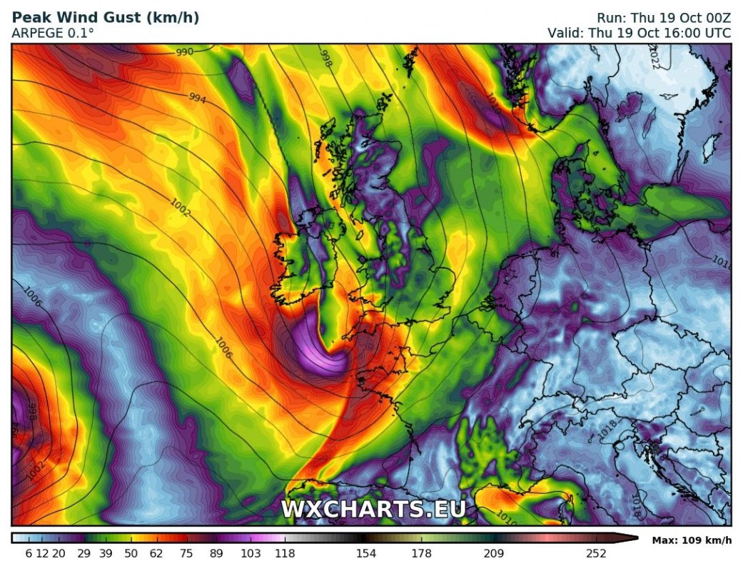
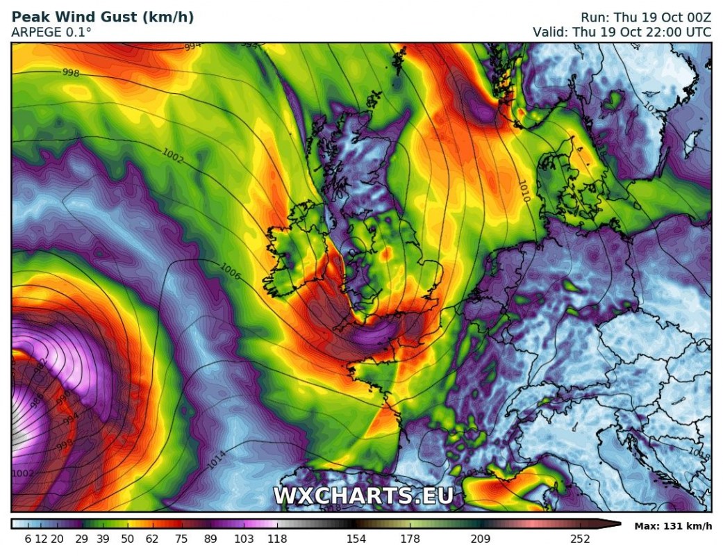
A windy day is ahead for extreme southwestern UK, the English Channel and northwestern France, with gale force winds gusting up to 90-110 km/h. Another, stronger windstorm is coming tomorrow!
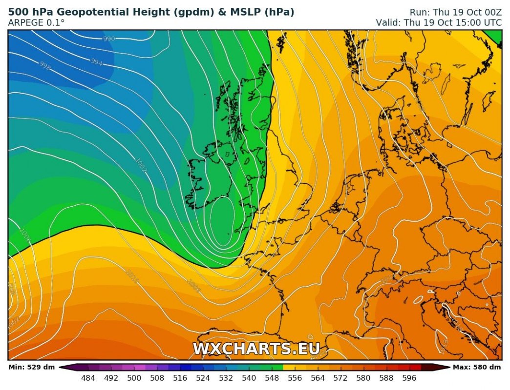
A small cyclone rapidly forms from a short wave trough over the Atlantic and deepens south of Ireland, moving eastwards into the English Channel. Expect gale force winds, gusting up to 90-110 km/h in southern Cornwall, Devon, Hampshire and West Sussex as well as the Isle of Wight. Expect similarly strong gusts in extreme north of Brittany and Normandy, France. Expect choppy seas south of Ireland and into the English Channel.
Pressure map for late this morning.Maps: Wxcharts.eu.
Strongest wind gusts in late afternoon today. Maps: Wxcharts.eu.
Strongest wind gusts in late evening today. Maps: Wxcharts.eu.
Check out videos of windstorm Ophelia too!
.


