It has been a week of intense and excessive snowfall across the northern Alps, more precisely across the eastern Switzerland and northern Austria. Locally, 100-200 cm of snow has been reported from several areas. A classic Stau effect has developed and maintaining intense snowfall has lead into extreme amounts of snow. Unfortunately, no break is coming this week as yet another powerful Arctic cold outbreak pushes towards the central Europe and bring continuing moisture advection towards the northern Alps. A life-threatening situation with high risk for snow avalanches develops for some of the Alpine valleys.
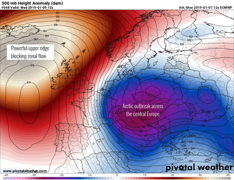
The pattern evolving through mid this week reveals a strong dipole with a very powerful upper ridge over the northern Atlantic, completely blocking the zonal (westerly) flow towards Europe. On its eastern flank, an intense Arctic cold outbreak pushes into central Europe and Mediterranean. The pressure gradient between these two systems will result in persistent north/northwesterly flow towards the Alps and develop Stau effect and intense snowfall once again.
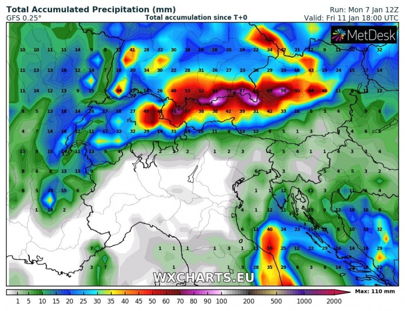
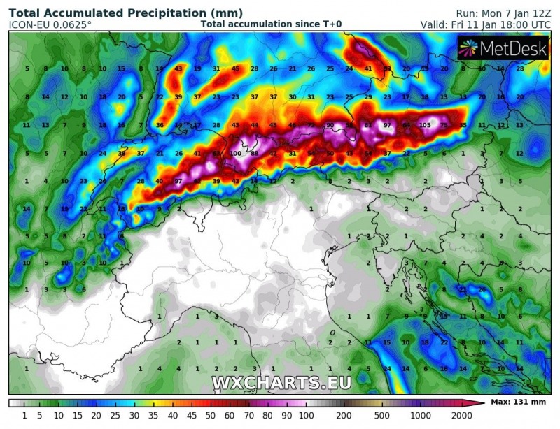
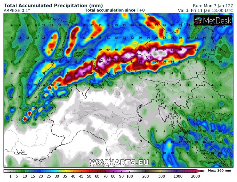
Here is the latest high-resolution and global model (GFS, ARPEGE, ICON-EU) comparison of total accumulated precipitation until Friday evening. All models are confirming huge amounts of precipitation along the northern Alpine flank where strong orographic effect will develop and result in excessive amounts of precipitation.
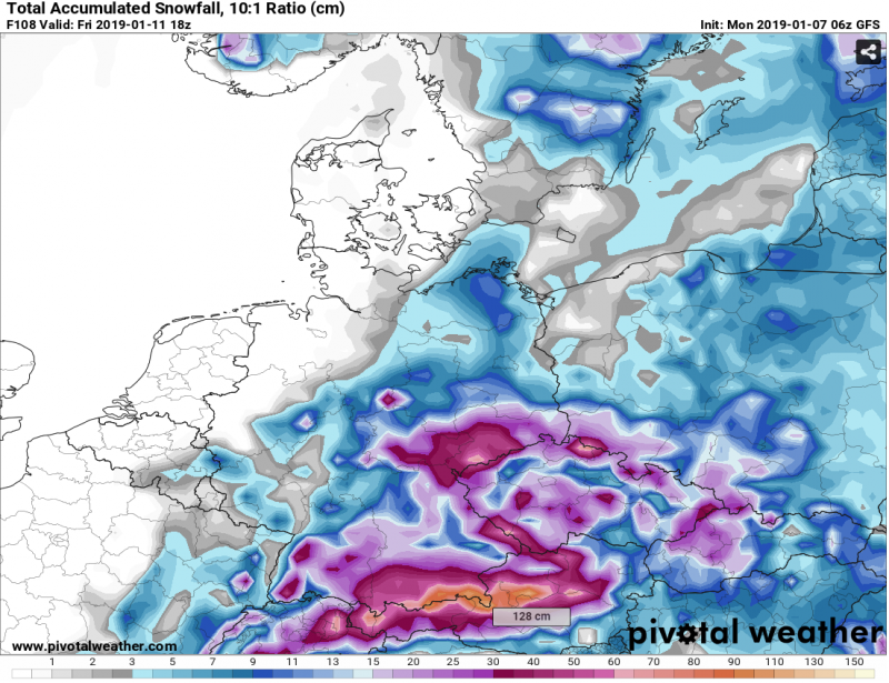
GFS model map for total accumulated snowfall until Friday evening suggesting there is quite high probability for more than a metre (100 cm) of fresh snow. Bottom line: all models agree in another extreme batch of snow to accumulate through Friday.
This week’s weather pattern will dump huge amounts of snow across the northern Austria, parts of extreme south Germany and east-central Switzerland. With already 100-200 cm of fresh snow in place from the previous days (week), this will significantly enhance snow avalanche threat and develop a life-threatening situation for some of the Alpine valleys.
On the southern (lee) side of the Alps, persistent north/northwesterly flow results in a precipitation gap due to Foehn effect and region is missing any kind of precipitation and indeed snow as well. Here are details:
No snow for the southern side of the Alps in the foreseeable future
Read also:
Last copies of our calendar are available, get your copy here:
http://www.severe-weather.eu/calendar-2019/
Stay alert in this dangerous pattern and stay tuned for additional updates in the coming days!
