Parts of Europe are in deep winter weather as the current pattern is producing outbreaks of very cold airmass across the east-central Europe. Lots of snow has been reported across the northern Alps, parts of the Balkan peninsula, central Italy and even south Italy, Greece, Turkey and the Middle East. More winter weather is expected this week, even in some new areas which have not had winter weather so far. Let us take a detailed look over a day-to-day pattern evolution through the next seven days.
Tuesday, Jan 8th
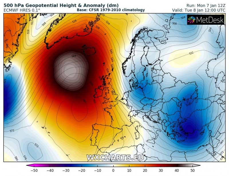
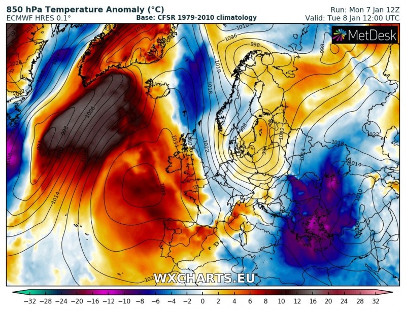
A powerful ridge dominates the northern Atlantic, shutting down the zonal flow towards the continental Europe. On its northwest side, strong warm advection is being pushed towards Iceland and Greenland. Over east/southeast Europe, a new outbreak of very cold airmass is being pushed across the Balkan peninsula and the Black Sea. In between, a new trough / low is moving across the southern Scandinavia towards Germany and Poland, establishing a corridor of strong meridional flow from the Arctic region towards the North Sea.
Wednesday, Jan 9th
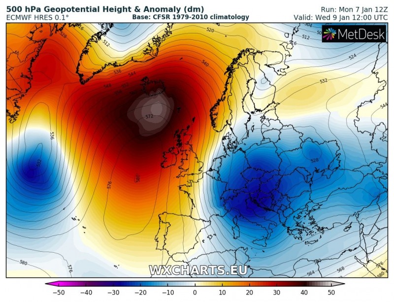
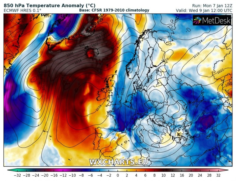
The north Atlantic ridge remains very powerful while gradually moving towards north, allowing very warm airmass advection across Iceland and southern Greenland – a very warm day is expected there! The cold pool over the southeast Europe dissipates while the trough from southern Scandinavia moves into the Alpine region and intensifies – the new Arctic outbreak reaches central Europe and brings new intense snowfall into the northern Alpine flank (Austria, eastern Switzerland, south Germany).
Thursday, Jan 10th
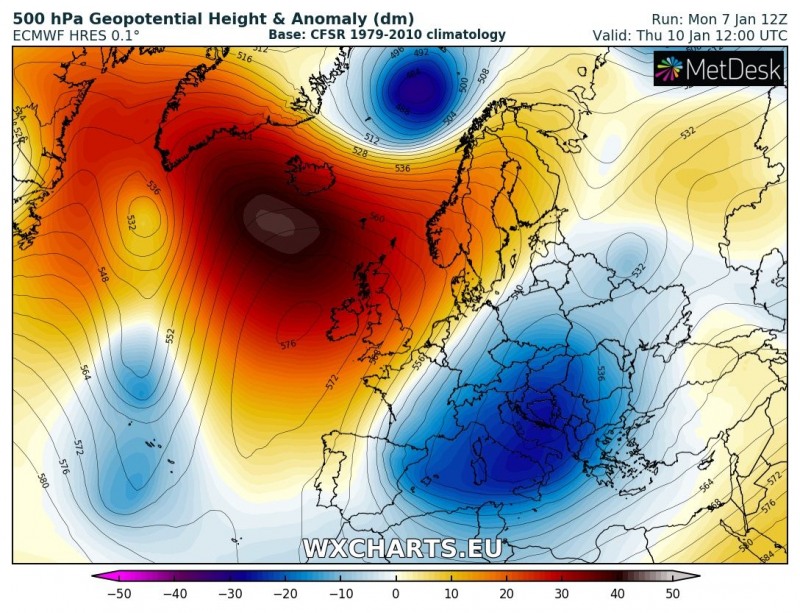
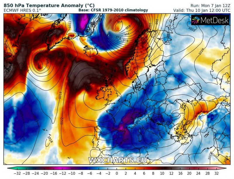
A large upper low with Arctic outbreak over central Europe slides further south into the Mediterranean while the powerful north Atlantic ridge expands towards northern Europe. A deep trough/low develops east of Greenland and moves towards north Scandinavia. Very warm airmass advection spreads towards Norway while very cold airmass over central Europe spreads into west/southwest Europe and west-central Mediterranean. Snow will be possible over southern and eastern France, Pyrenees and parts of north Spain. Ahead of the Mediterranean low, warm advection pushes into Turkey and Black sea region.
Friday, Jan 11th
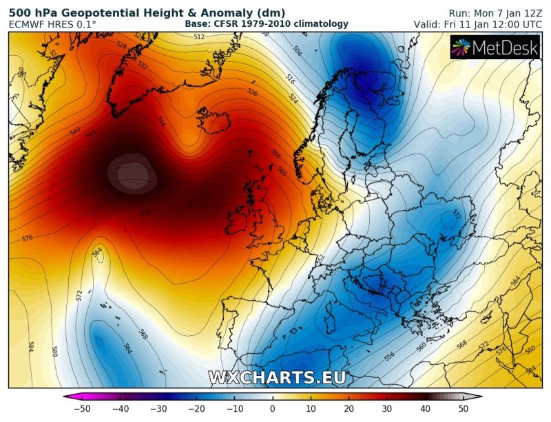
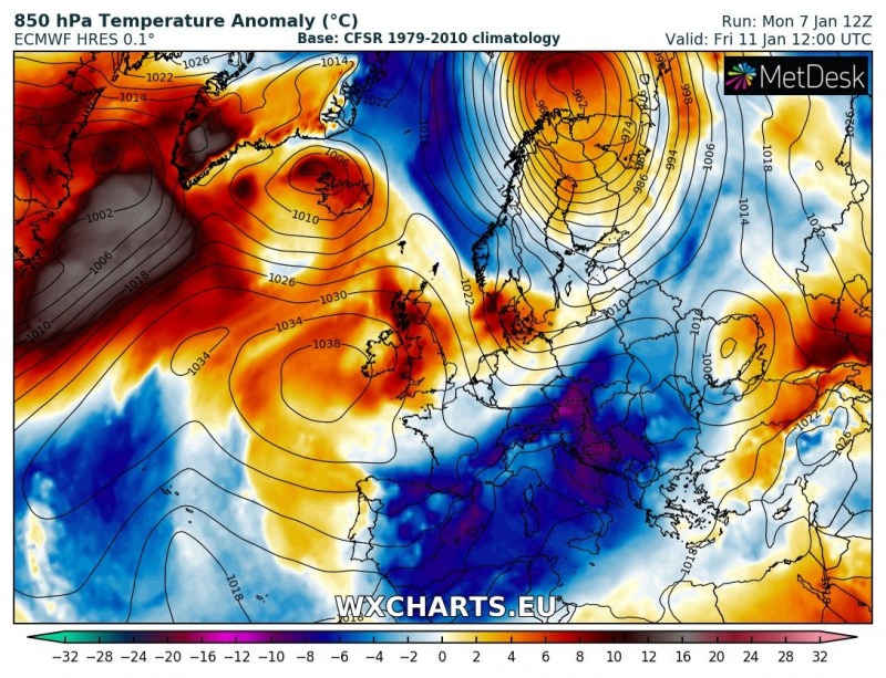
The north Atlantic ridge weakens a bit while a deep trough pushes across northern Scandinavia and brings a severe windstorm for Norway. Arctic cold airmass remains over the central Europe and Mediterranean, as well as Iberian peninsula and also reaches North Africa (Algeria, Tunisia).
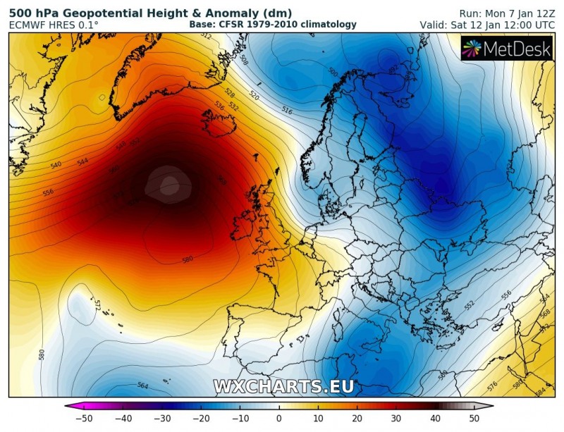
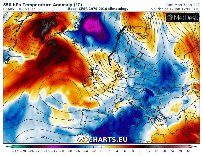
Saturday, Jan 12th
The ridge over the north Atlantic re-strengthens again while deep trough pushes from north Scandinavia into east/northeast Europe and establishes a new corridor of Arctic airmass in between the ridge to the west. Cold airmass develops over the Norwegian sea and advects towards Scandinavia. The Mediterranean cold pool dissipates as the trough/low moves into south/southeast Mediterranean, but cold weather remains over North Africa.
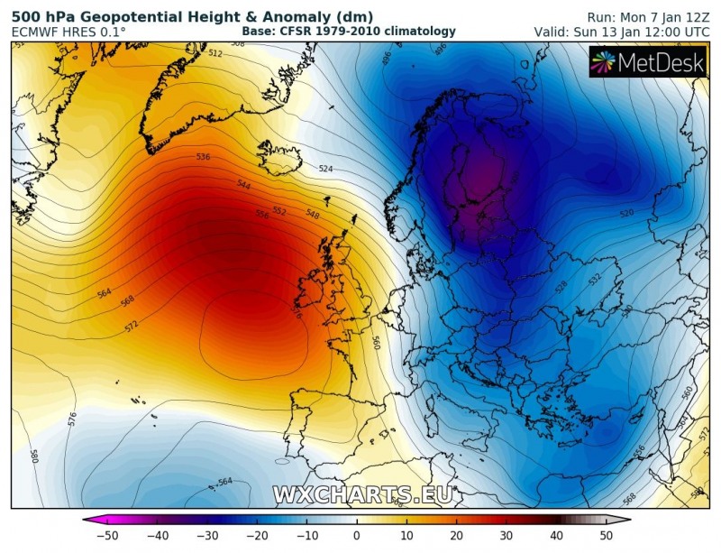
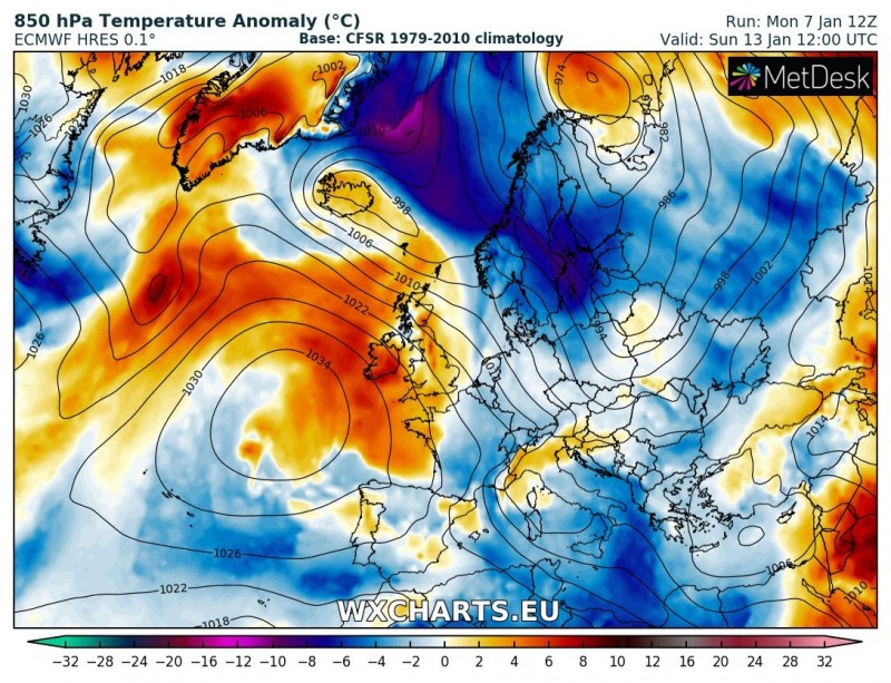
Sunday, Jan 13th
While the north Atlantic ridge weakens, the trough over the northeast Europe deepens and develops a new powerful Arctic outbreak across Scandinavia towards the eastern Europe. Most of Europe is experiencing slightly colder weather than average, except the British Isles and Ireland where mild weather remains due to the ridging pattern.
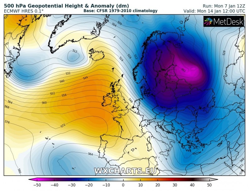
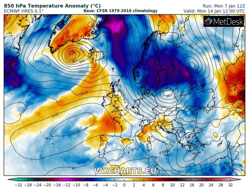
Monday, Jan 14th
The deep trough over east/northeast Europe becomes very intense and pushes very cold airmass across the northeast Europe. While the rest of Europe remains in slightly colder weather than normal, the north Atlantic becomes more dynamic as a trough pushes from eastern Canada.
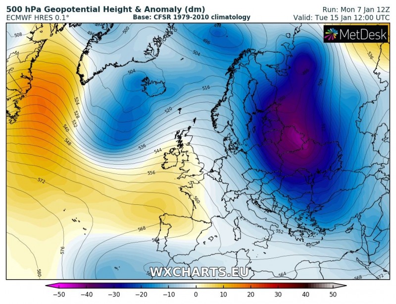
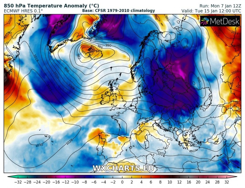
Tuesday, Jan 15th
A powerful Arctic outbreak establishes across the eastern half of Europe, spreading also towards the central Europe and the Balkan peninsula. The deep trough moves over the North Atantic and pushes cold weather towards the western Europe as well. Despite the pattern being a week ahead, trends seem to continue towards the expected response (a overall cooling across the European continent) from the Sudden Stratospheric Warming and Polar Vortex split which occurred around New Year.
We are closely monitoring pattern evolution and will be updating through the next days, especially with more details on separate systems – stay tuned!
