Latest satellite imagery and weather station data across Iceland indicate the extremely severe winds are fully developed across the North Atlantic. The mature stage of a very large extra-tropical cyclone has brought a strong pressure gradient across Iceland, where the most exposed locations are already reporting 200-220 km/h wind gusts this morning. Conditions will worsen through the next hours!
Here is the latest ICON-EU model peak gusts animation across the North Atlantic – violent winds are present around the featured cyclone today, but we can also see the newly developing powerful windstorm #Dennis and major waves towards the UK and Ireland this week. Attached are peak gusts and waves animations:
Mean sea-level pressure analysis across Iceland reveal an incredible pressure difference across the country, with around 995 mbar over the far northeast parts but already around 960 mbar over the Reykjanes peninsula (that is more than 36 mbar difference, while the pressure gradient is the most intense/dense across the western parts):
NOAA 00 UTC analysis reveals the cyclone has matured and reached its peak in the past 6 hours, the central pressure was 936 mbar. It is drifting north and is expected to be between Iceland and Greenland tonight:
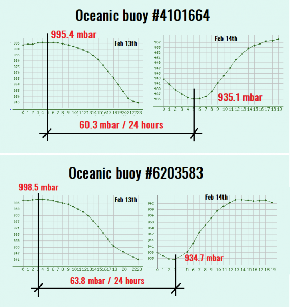
The cyclone has passed over (or very near) two oceanic buoys along its path – they were reporting an extreme pressure drop of 60-64 mbar in the 24-hour period!
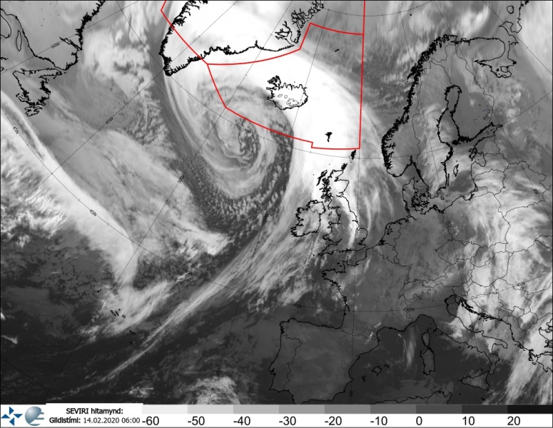
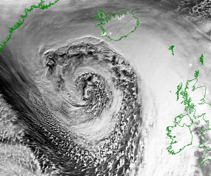
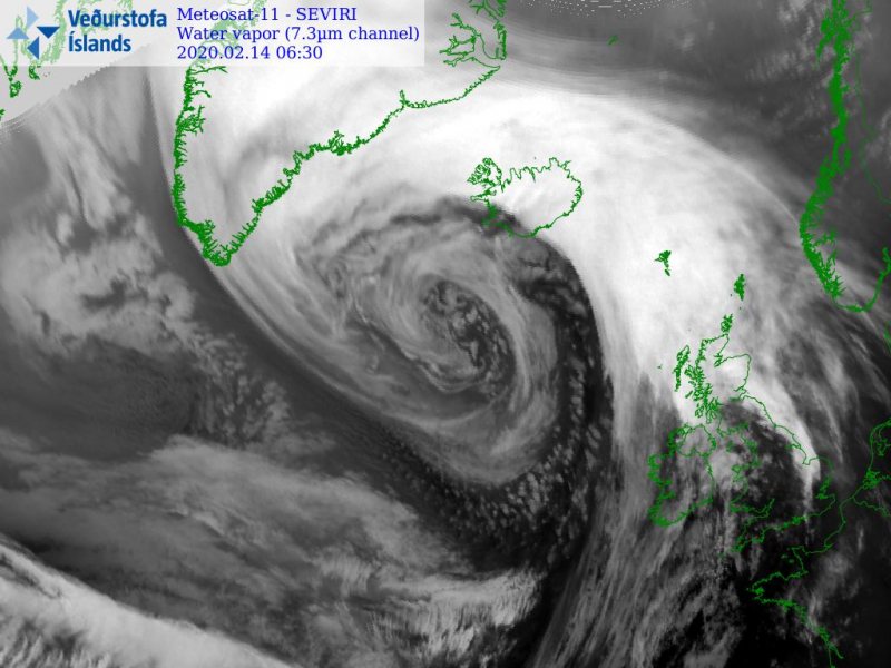
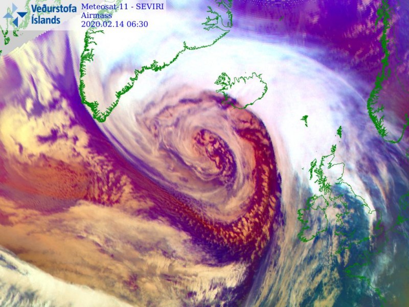
Satellite imagery reveal an exceptional presentation, the system is *very* large and occluding:
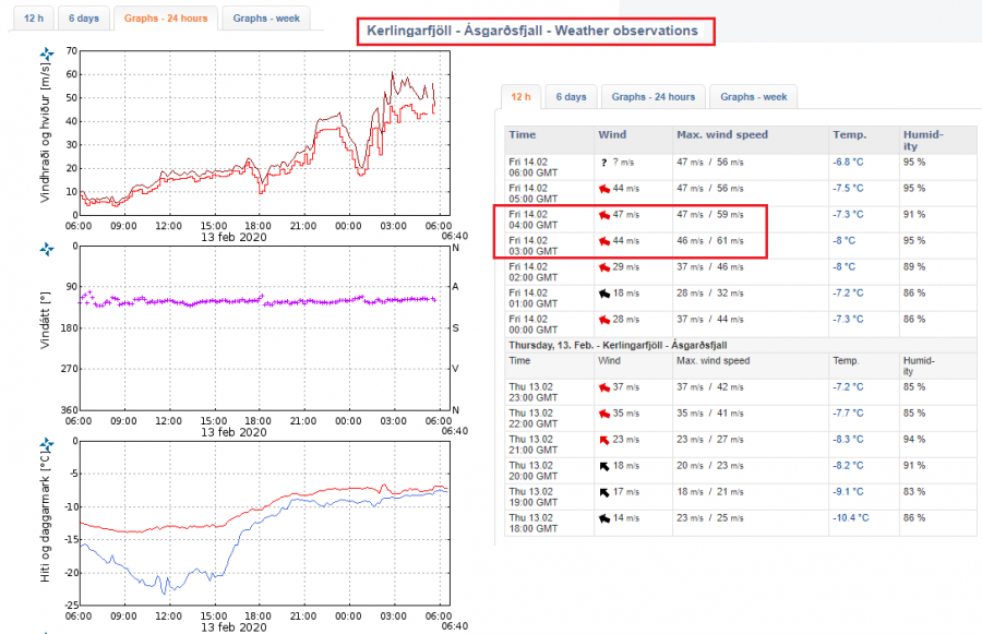
Weather report from the station Kerlingarfjöll – Ásgarðsfjall; up to 220 km/h (61 m/s = 113 kt = 136 mph) gusts already!
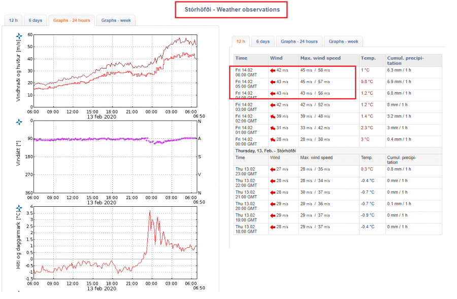
Weather report from the station Stórhöfði; up to 210 km/h (58 m/s = 118 kt = 130 mph) gusts already!
Depending on the connections, we have a reporter going live this morning from the Iceland capital Reykjavik – follow up our Facebook page, so you don’t miss it: https://www.facebook.com/severeweatherEU/
See also:
The perfect storm – monster extra-tropical cyclone over the North Pacific today


