Although we are experiencing mild winter this year, there is always room more even warmer periods. With the strong zonal flow from the North Atlantic into the European continent this weekend and the upper ridge developed over the southern half of Europe, the result will be even warmer weather than we’ve been experiencing lately! Afternoon temperatures should climb into low 20s in some areas again. Very warm weather is also expected over the Alps.
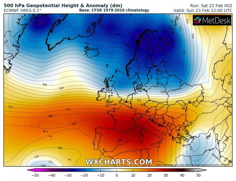
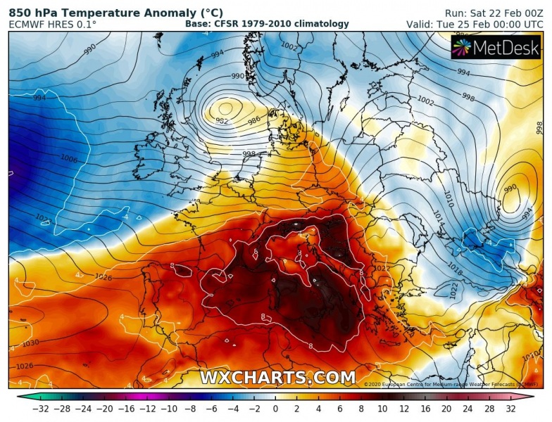
An upper ridging will be strengthening this weekend over southwest Europe, gradually expanding into the south and central Europe. The powerful westerly zonal jet stream will be present to the north of the ridge, trapped between the deep trough over northern Europe:
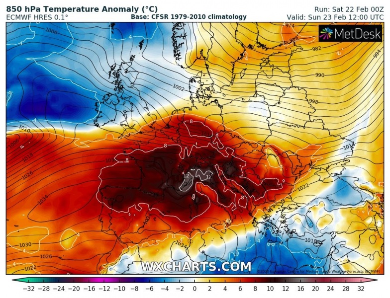
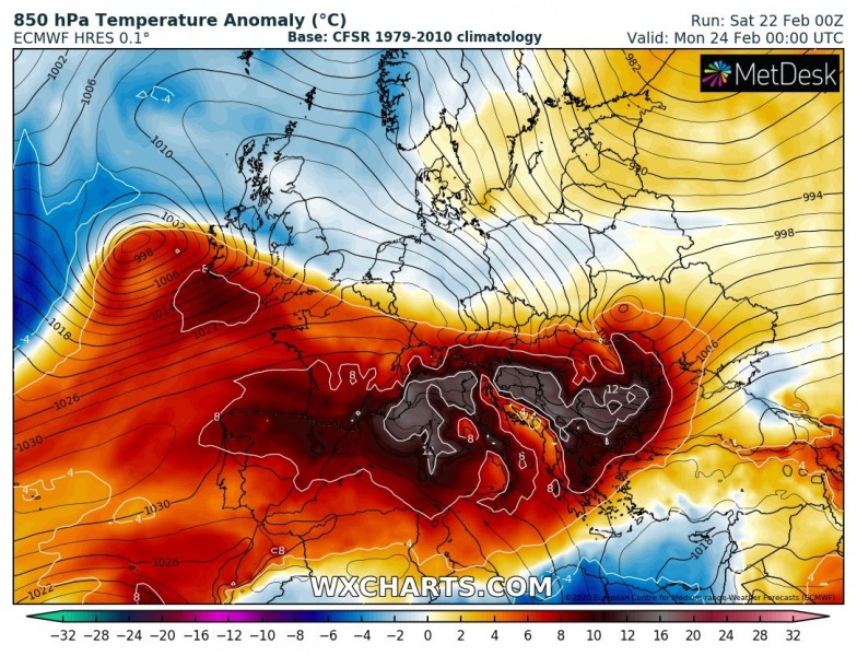
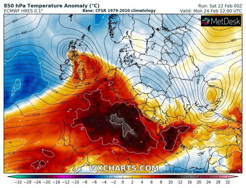
The result of both strong warm advection with the zonal flow and warming airmass by subsidence in the strengthening high-pressure system, will introduce a significant temperature anomaly in the lowest levels. This should contribute to 8-12 °C warmer air mass than normally for the end of February. The strongest anomaly is expected on Monday:
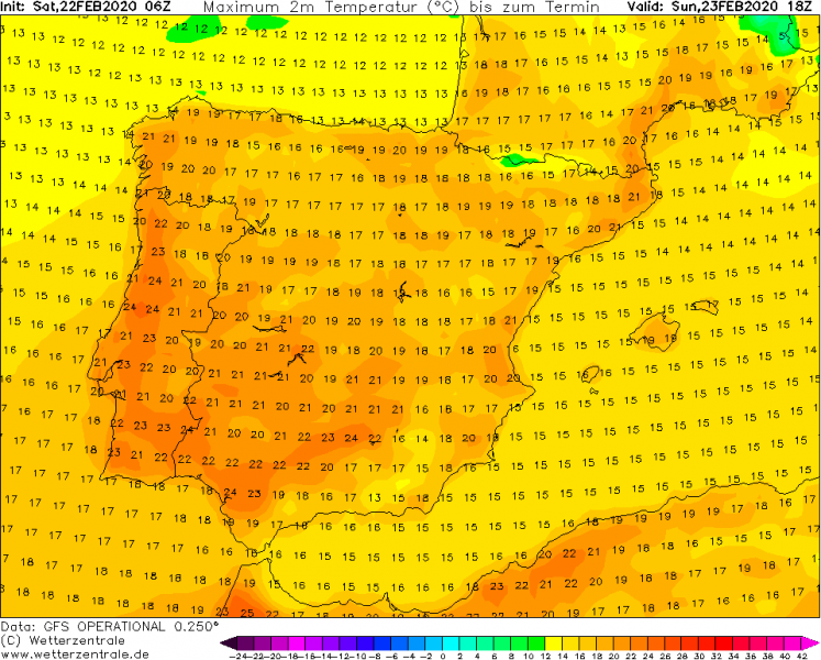
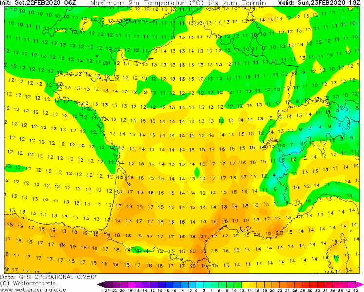
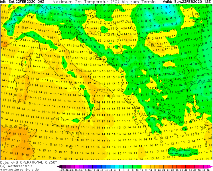
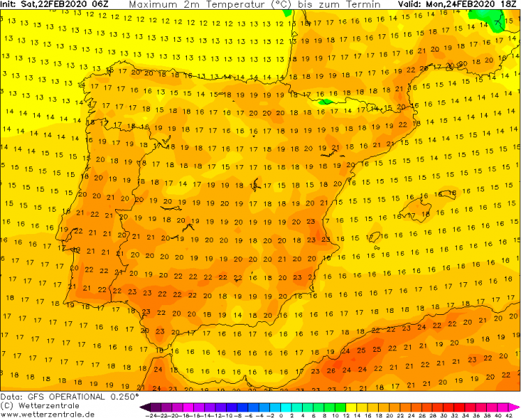
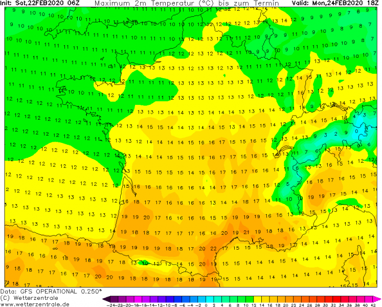
Maximum temperatures through Sunday and Monday should reach upper 10 to low 20s in some areas, possibly into mid 20s over southern Spain:
Sunday:
Monday:
See also – the zonal flow is resulting in huge amount of rain over UK and Ireland:
https://www.severe-weather.eu/mcd/excessive-rainfall-uk-ireland-scotland-mk/
Windstorms continue towards western Europe:
