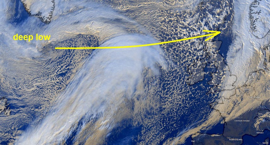
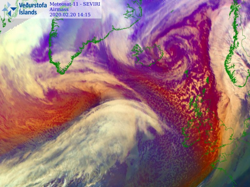
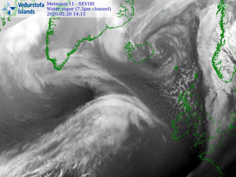
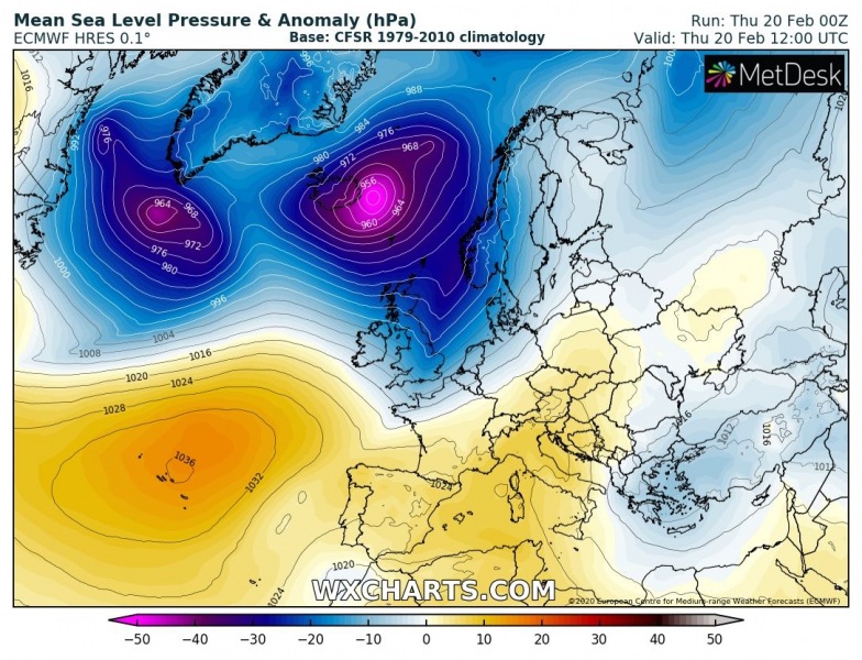
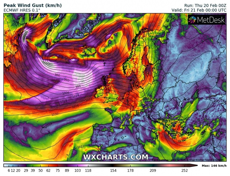
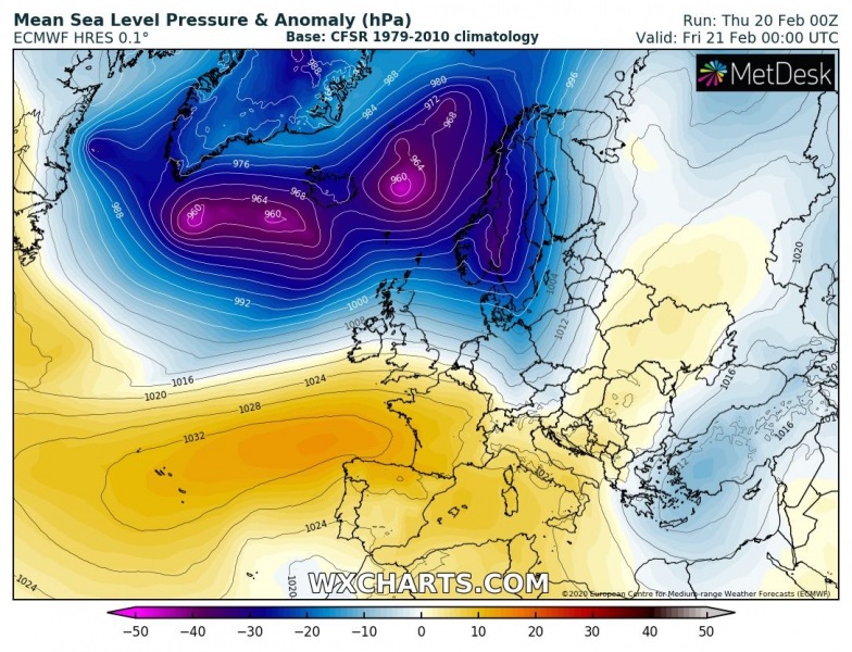
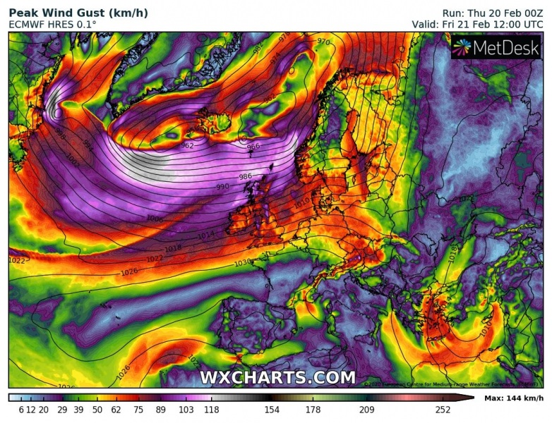
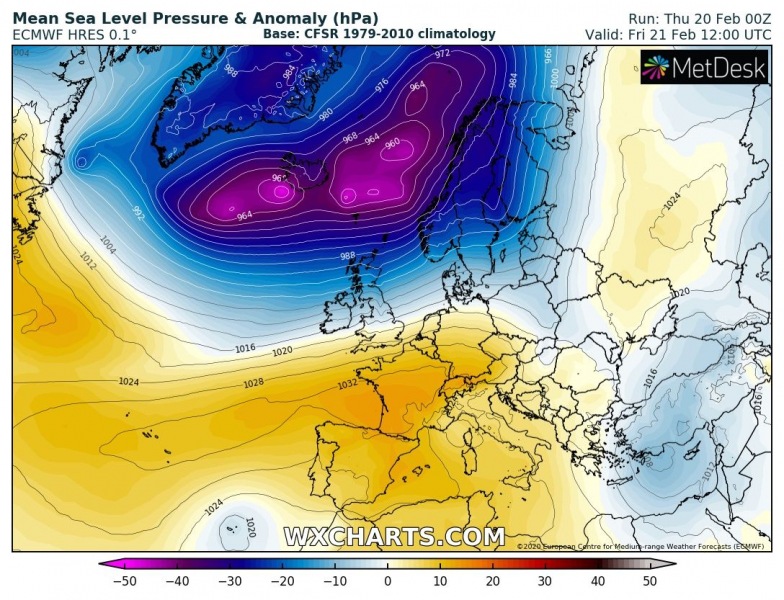
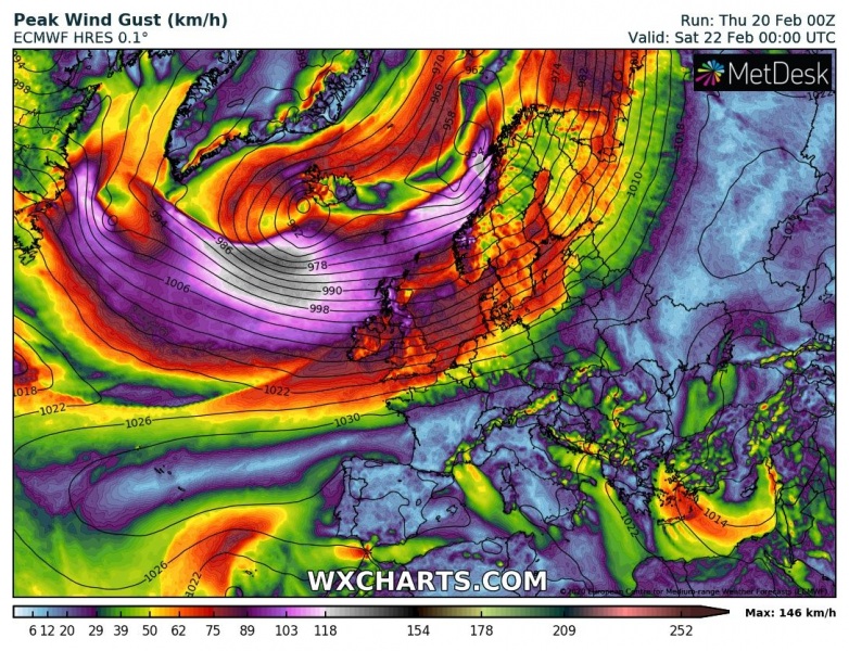
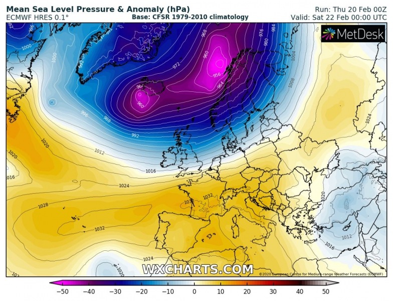
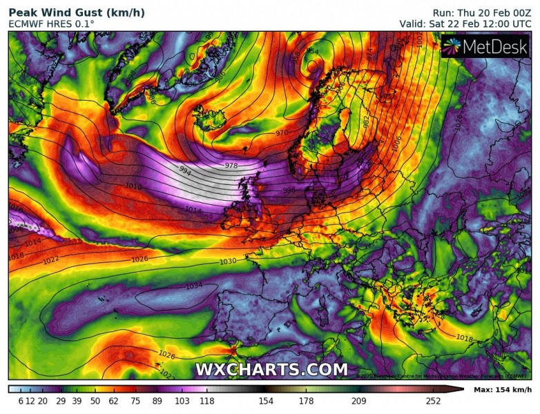
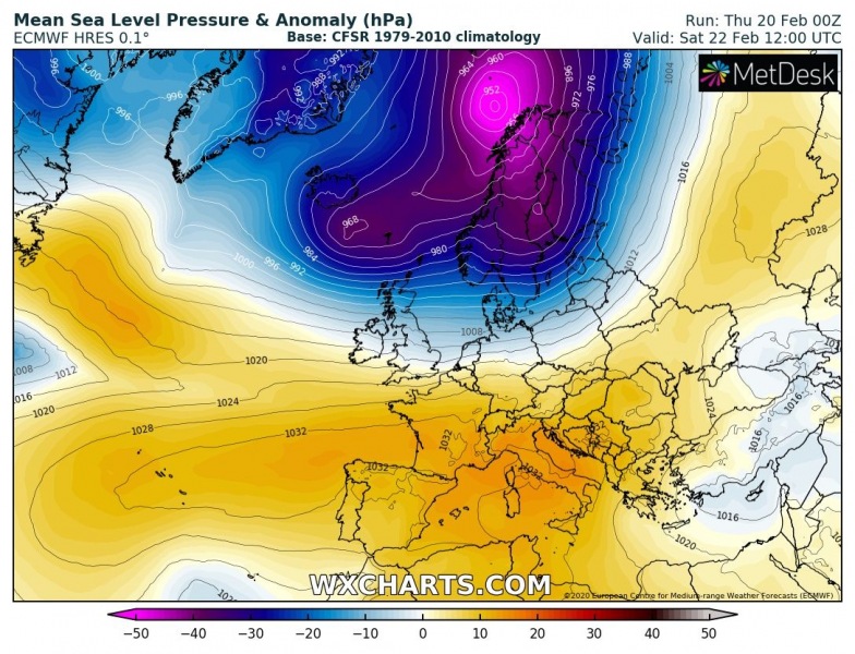
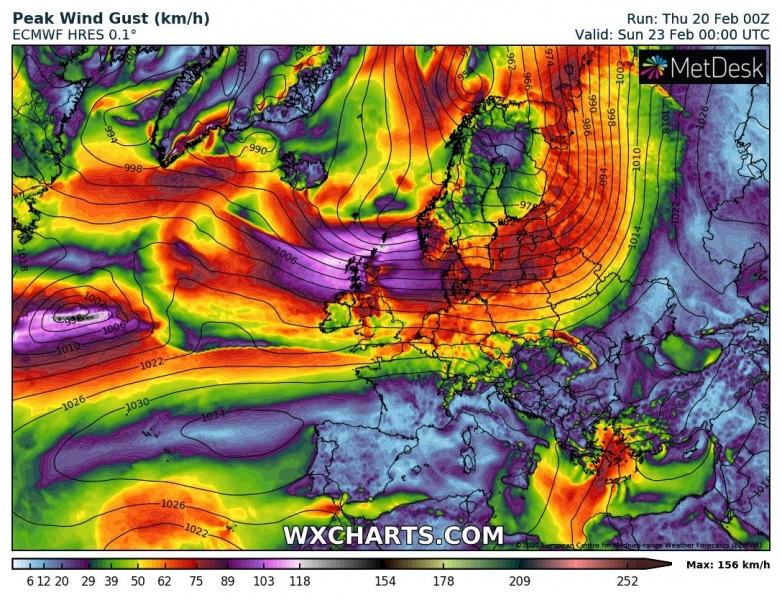
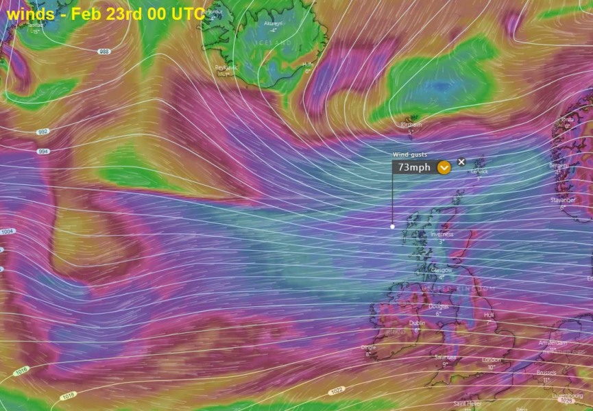
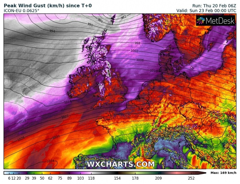
While a large deep extra-tropical cyclone over the North Atlantic is currently occluding, there is already a new rapidly intensifying cyclone to its west. Its future track will be further south than the first one, likely smashing into the UK with a potentially severe windstorm this weekend. Models are in fairly good agreement it will produce a broad windstorm over the North Atlantic as well as major waves and severe winds towards UK and Ireland on Saturday! The system could become the #stormEllen.
*********************************************
*********************************************
Looking over the satellite imagery, the system is quite impressive already, a cyclone is undergoing rapid intensification today. The system is becoming large and is expected to grow much bigger with time during the next 36 hours. It will be moving right behind today’s cyclone which gets absorbed into it tomorrow. We can already see a broad dry/cold push from the west towards the new cyclone’s core.
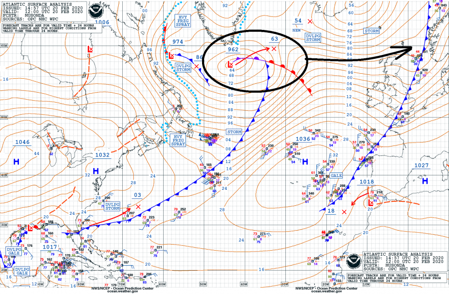
Here are the 6-hour sequence pressure analysis data (per OPC NOAA) since the system’ birth in eastern Canada yesterday. As of 12 UTC today, Feb 20th, the minimum central pressure was at 962 mbar, which is 36 mbar pressure change since yesterday 12 UTC (-36 mbar / 24 hour period). So the system is yet another extra-tropical cyclone that is undergoing an explosive development!
- 962 mbar at 12 UTC, Feb 20th
- 967 mbar at 06 UTC, Feb 20th
- 979 mbar at 00 UTC, Feb 19th
- 991 mbar at 18 UTC, Feb 19th
- 998 mbar at 12 UTC, Feb 19th
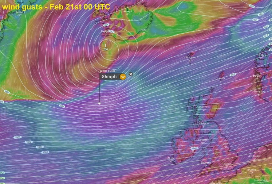
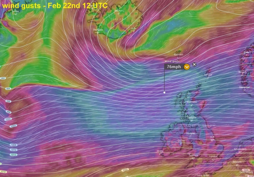
While the cyclone is still under intensification today, it is expected to mature tonight while reaching the central pressure below 960 mbar. It will be gradually expanding in size while drifting east across the North Atlantic on Friday, developing an intense and broad wind field. It will merge with the existing deep low-pressure system east of Iceland. Then the resulting very large system will continue east into northern Europe over the weekend. A severe windstorm and major waves are developing along the southern flank of the low, spreading towards western Europe. First, severe winds will reach Scotland by Friday morning while the main wind blast arrives on Friday night into Saturday morning.
Thursday, Feb 20th 12 UTC
Friday, Feb 21st 00 UTC
Friday, Feb 21st 12 UTC
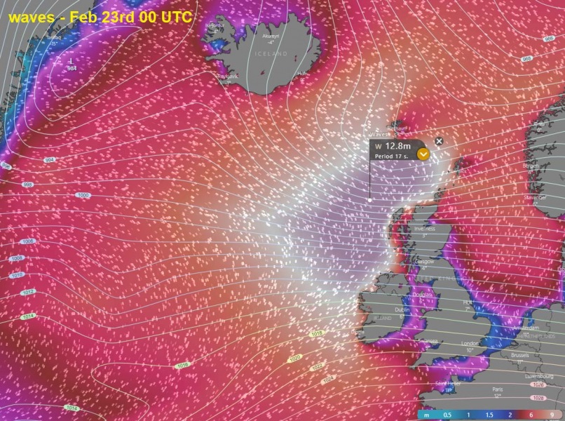
Saturday, Feb 22nd 00 UTC
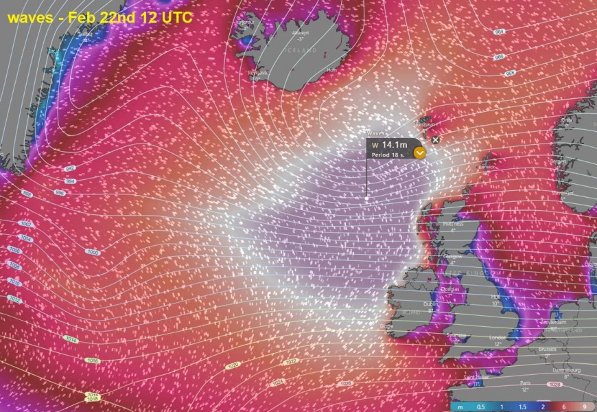
Saturday, Feb 22nd 12 UTC
Models are in good agreement the quite strong windstorm will develop around the system tonight and gradually spread towards western Europe on Friday. Severe winds are expected to reach the UK and Ireland by Friday morning and midday hours. The system begins its weakening trend on Saturday night when it already reached the North Sea.
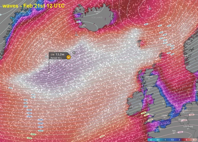
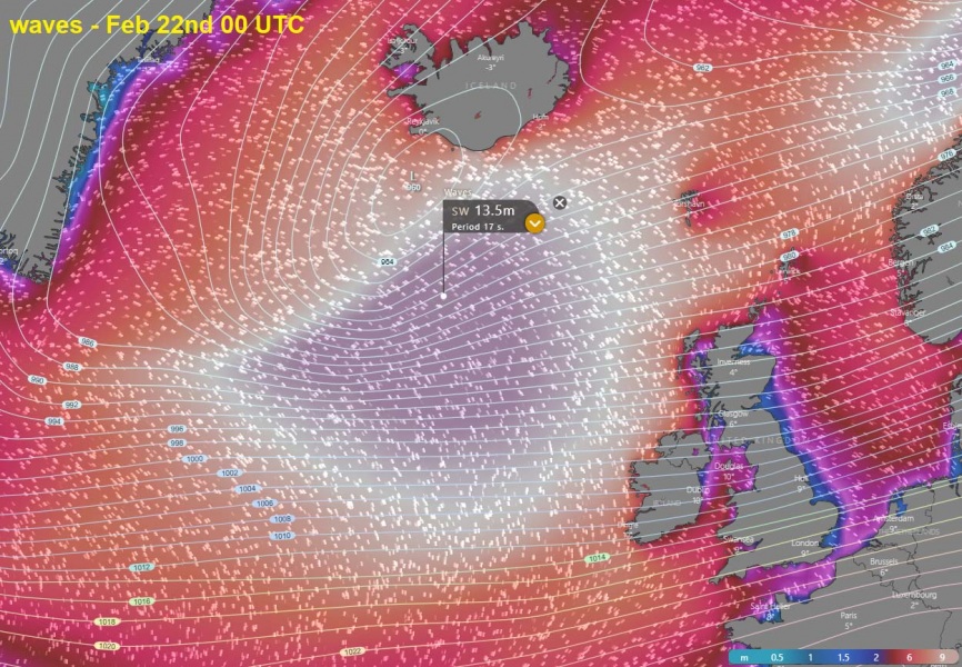
A broad wind field will also produce major waves, starting over the northwest parts of North Atlantic tonight, gradually spreading towards the UK and Ireland on late Friday and Saturday. Significant wave heights are possible, likely reaching 13-15 meters, slightly lower when reaching the coastal areas on Saturday:
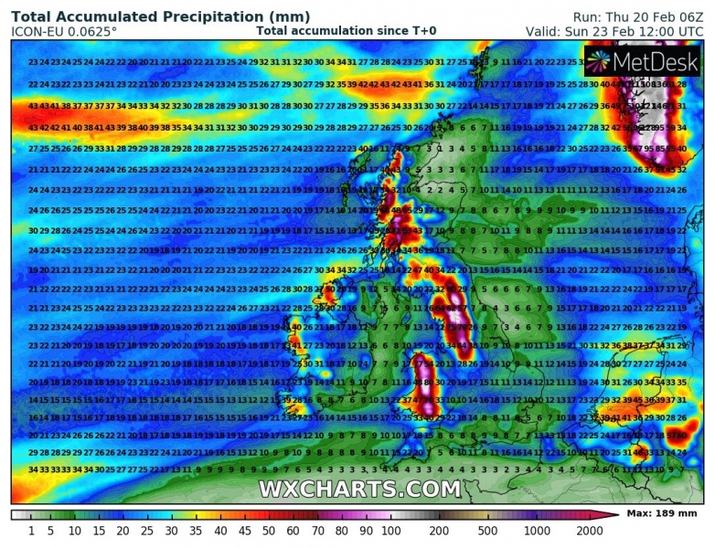
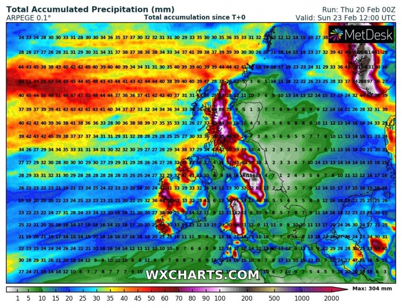
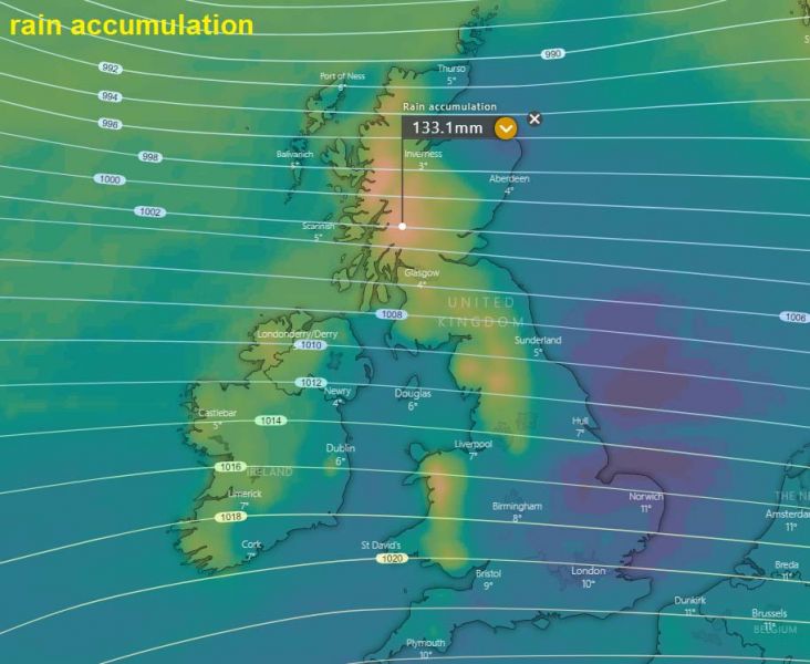
The persistent westerly (zonal) flow will also contribute in a lot of rain, again over western parts of the UK and Ireland – western Ireland, western parts of Northern Ireland, Wales, northern England and indeed Scotland. Locally, more than 150 mm of rainfall is likely until Sunday which will additionally enhance flooding threat and affect broader area! Much more rain is also expected into the mountainous terrain of SW Norway!
We are closely monitoring the storm’s evolution and will keep you updated – stay tuned!
Discussion on the currently occluding cyclone near Iceland:
The currently active deep cyclone is pushing a cold front and squall line across western Europe:
See the recap of the strongest North Atlantic storm of the season – #Dennis:
