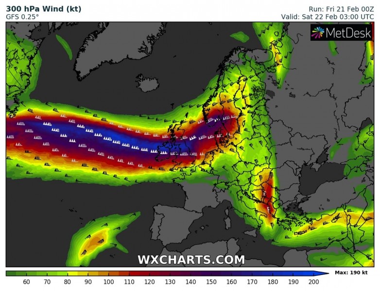
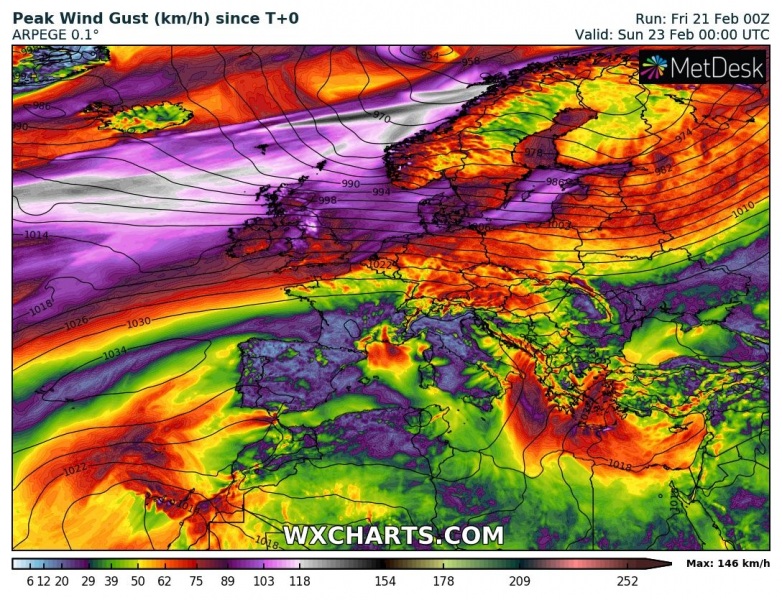
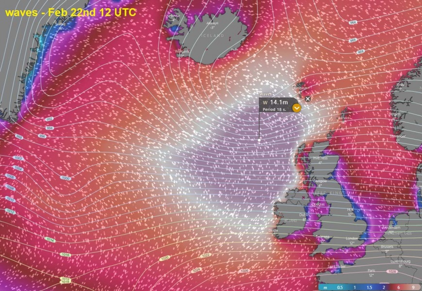
Satellite and surface analysis indicate a broad and powerful zonal westerly flow is established over the North Atlantic. Placed between a large low-pressure system on the north and high-pressure system on the south, a tight pressure gradient has resulted in between. This will develop a severe windstorm and major waves, gradually spreading towards western Europe tonight into Saturday morning.
First, here is the animation of wind gusts through today into the weekend. Notice also a new potentially dangerous deep cyclone and violent winds arriving into Ireland and UK on Monday:
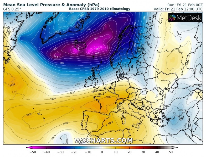
06 UTC analysis today, Feb 21st, revealed a very large cyclone dominating North Atlantic, with several mesovortices embedded. Placed between Iceland and Labrador sea – we can see 4 of them with central pressure between 955 and 979 mbar. A broad and intense wind field has established south of the lows, in response to the tightening pressure gradient against the building ridge and high-pressure system extending from the Azores into southwestern Europe. More than 70 mbar pressure difference is seen between the Azores and North Atlantic!
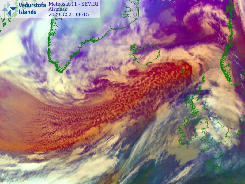
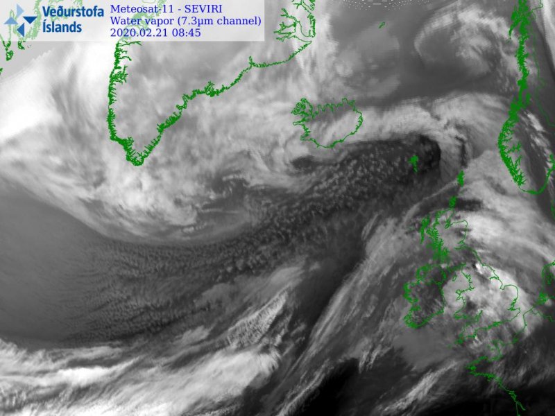
Morning satellite imagery reveal a broad maritime airmass advecting over the North Atlantic within the powerful zonal flow. Tightening pressure gradient on its western part of developing a severe windstorm, gradually moving east towards the western Europe and Scandinavia.
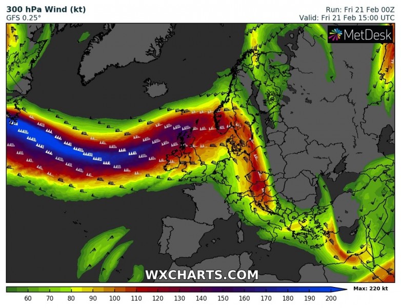
The pressure gradients are particularly strong this weekend and there is a huge contrast between low pressure system over the far North Atlantic and persistent ridge / high-pressure system further south of the Azores. The upper-level zonal flow is exceeding 200 knots! At the surface, a large cyclonic system is slowly drifting east towards the northern Europe.
Friday, Feb 21st 12 UTC
Saturday, Feb 22nd 00 UTC
Peak wind gusts will be severe to locally extremely severe, especically across the northern UK (Scotland, northern England and Northern Ireland) and across the Norwegian sea towards the western Norway. As the wind field is quite wide, major to significant waves are also a big concern towards the coastal areas of western Ireland, Northern Ireland and Scotland, as well as towards the western Norway.
Excessive rainfall will continue across the orographic features Wales, northern England and Scotland. Locally additional 100-150 mm of rainfall seems likely until tomorrow evening!
Refer to the previous mesoscale discussions for further details:


