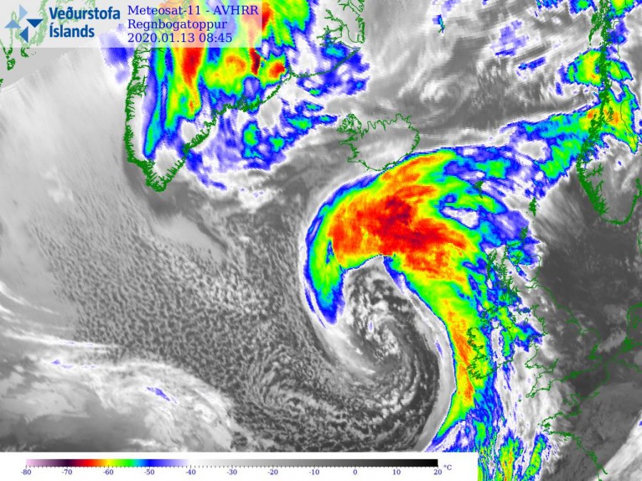
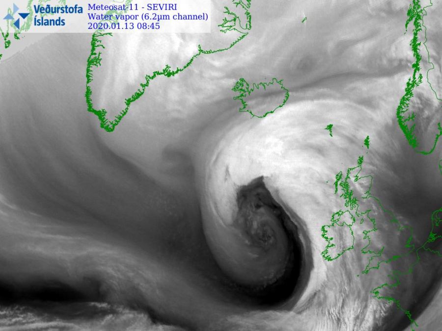
As expected, a powerful bomb cyclone #Brandan continues its explosive development and rapid intensification while moving towards the British and Irish Isles – Brendan is becoming a *monster*! Central pressure is already below 945 mbar, continues deepening. Gale force winds are being pushed towards western Ireland, Northern Ireland and Scotland, while conditions are expected to significantly worsen through the next hours as cyclone moves closer. Expect hurricane-force winds and major waves to deliver life-threatening conditions.
10 m wind gusts animation as seen by the ICON-EU model (graphics produced by our co-admin Andrej Flis):
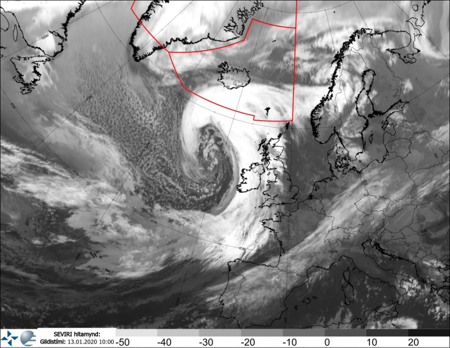
Beasty look on the satellites! Attached are several IR, WV and VIS channel through midday today – notice how HUGE the whole system is and its textbook appearance with sting-jet forming on the southwestern part of the cyclone – this means violent winds gusting well above 160 km/h = 100 mph are forming:
A wider look over the system reveals the true size of it – that is a spectacular satellite presentation!
Latest mean sea-level pressure analysis across the North Atlantic and western Europe – Brendan’s center is already below 945 mbar, while oceanic buoy data are revealing an exceptional pressure drop since midnight – around 35 mbar pressure change in 10-hour period!
Gale force winds are already spreading into western Ireland and Scotland, delivering wind gusts up to 120 km/h while even higher gusts – up to 160 km/h – are currently observed over Scottish Highlands! Winds will intensify tonight!
Stay tuned for further updates this evening and stay alert for dangerous winds and major waves!
See previous discussions and forecast details:
Meanwhile, tropical weather is active again around Australia – a strong Category 3 Tropical Cyclone #Claudia is ongoing:
A Tall volcano has erupted in Philippines this weekend:
Interested in our calendar? We are proud to present and promote the best weather photographers in Europe – see details:


