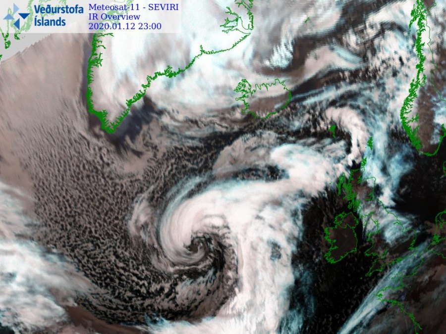
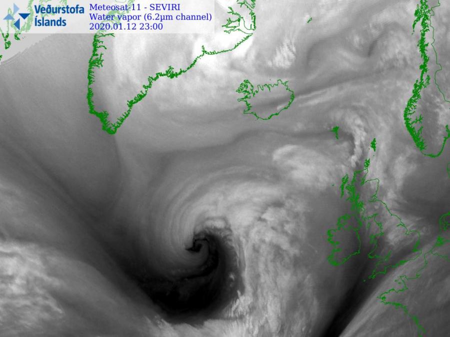
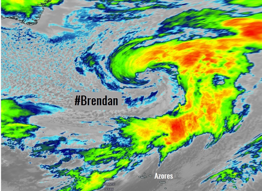
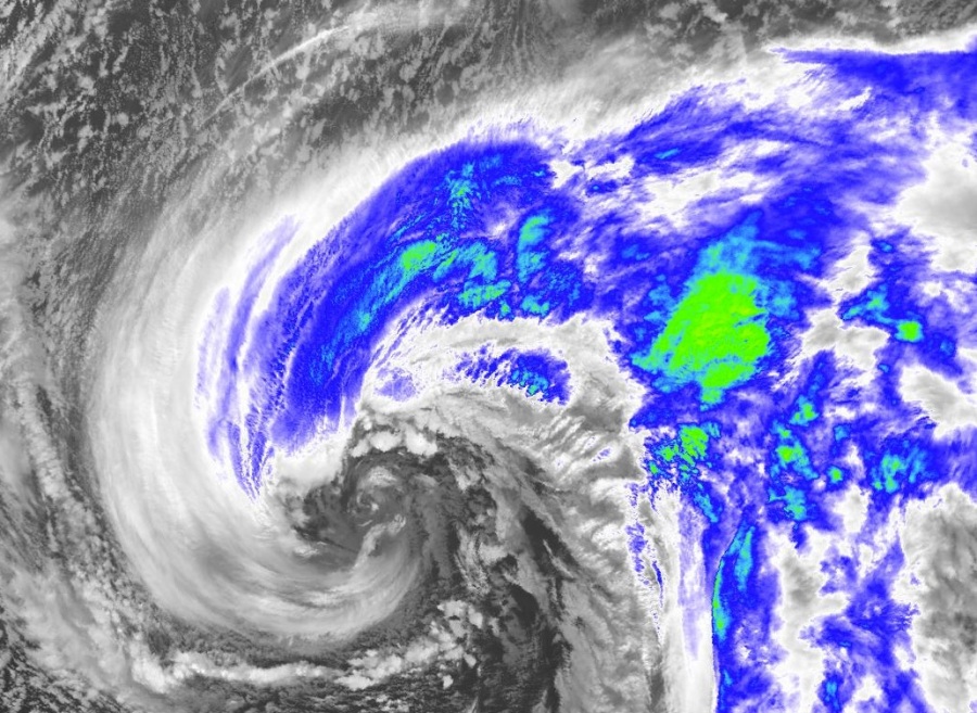
Extra-tropical cyclone #Brendan has been rapidly intensifying lately, introducing an impressive satellite presentation, developing a ‘beasty look’ this evening! Brendan is expected to intensify for additional 20-25 mbar within the next 12 hours, which will definitely deliver exceptional imagery on Monday morning! Its behavior remains on track – a violent windstorm towards Ireland, Northern Ireland and Scotland is expected!
*** There is a significant risk of coastal flooding due to the combination of high spring tides and storm surge along the western Ireland ***
*********************************************
*********************************************
10 m wind gusts animation as seen by the ICON-EU model (graphics produced by our co-admin Andrej Flis):
Violent windstorm with hurricane-force winds usually delivers significant waves into the coastal areas – here is an example of such dangerous conditions in Faroe Islands:
Some of the satellite imagery this evening, in high-resolution details. An intense dry intrusion is wrapping around the rapidly intensifying core.
NOTE: This is the textbook appearance of the Shapiro-Keyser cyclone, an extra-tropical cyclone development. These systems are often the rapidly developing cyclones known as ‘bomb cyclones’. The back-bent front can also be associated with the sting jet phenomenon – a short duration flow of strong winds that can reach 100+ mph at surface level. And models are hinting we can expect this to occur tomorrow!
Last post tonight before I head for the Leaba. Video animation showing even longer version of #StormBrendan forming in the Atlantic with rapid or explosive cyclogenesis. A rough day ahead tomorrow, keep up to date with forecasts and warnings and stay safe everyone. pic.twitter.com/IgBfhj80IL
— Carlow Weather (@CarlowWeather) January 12, 2020
Incoming!#StormBrendan is in beast mode right now.
Satellite data via @metdesk /@eumetsat pic.twitter.com/zUucvqfHcn
— Scott Duncan (@ScottDuncanWX) January 12, 2020
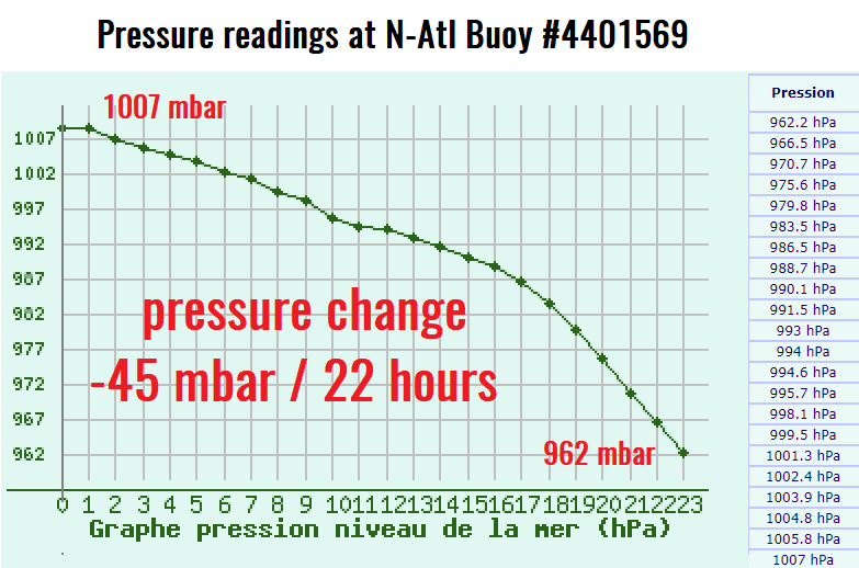
Evening mean sea-level analysis reveals explosive cyclogenesis taking place to the west of Ireland, central pressure is already below 960 mbar and dropping at a fast rate! Cyclone has traveled very near the Oceanic buoys, where we can see the pressure had an unprecedented 45-50 mbar change in less than 24 hours!
The Irish MetOffice has issued Orange / Red warnings for most of the country. It is likely this will be upgraded tomorrow when violent storm unfolds:
MARINE WARNING
STATUS RED – GALE WARNING
Southerly winds will reach storm force during Monday on all Irish coastal waters and on the Irish sea, with violent storm-force winds expected at times on western coasts between Mizen Head and Malin Head.
Issued: 22:00 Sunday 12/01/2020
NATIONAL WARNING
Status Orange – Wind warning for Connacht, Donegal and Kerry
Update: As Storm Brendan tracks to the northwest of Ireland, southerly winds will reach mean speeds of 65 to 80 km/h with gusts generally up to 130 km/h, higher in exposed areas.
There is a significant risk of coastal flooding due to the combination of high spring tides and storm surge.
Valid: 05:00 Monday 13/01/2020 to 21:00 Monday 13/01/2020
Issued: 15:00 Sunday 12/01/2020Status: Orange
Wind warning for Leinster, Cavan, Monaghan, Clare, Cork, Limerick, Tipperary and Waterford
Status Orange – Wind warning for Leinster, Cavan, Monaghan, Clare, Cork, Limerick, Tipperary and Waterford
Update: As Storm Brendan tracks to the northwest of Ireland, southerly winds will reach mean speeds of 50 to 70 km/h with gusts of 100 to 120 km/h, higher in exposed areas.
There is a significant risk of coastal flooding due to the combination of high spring tides and storm surge.
Valid: 08:00 Monday 13/01/2020 to 15:00 Monday 13/01/2020
Issued: 15:00 Sunday 12/01/2020
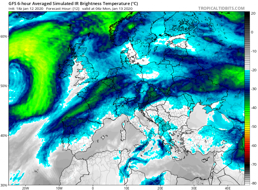
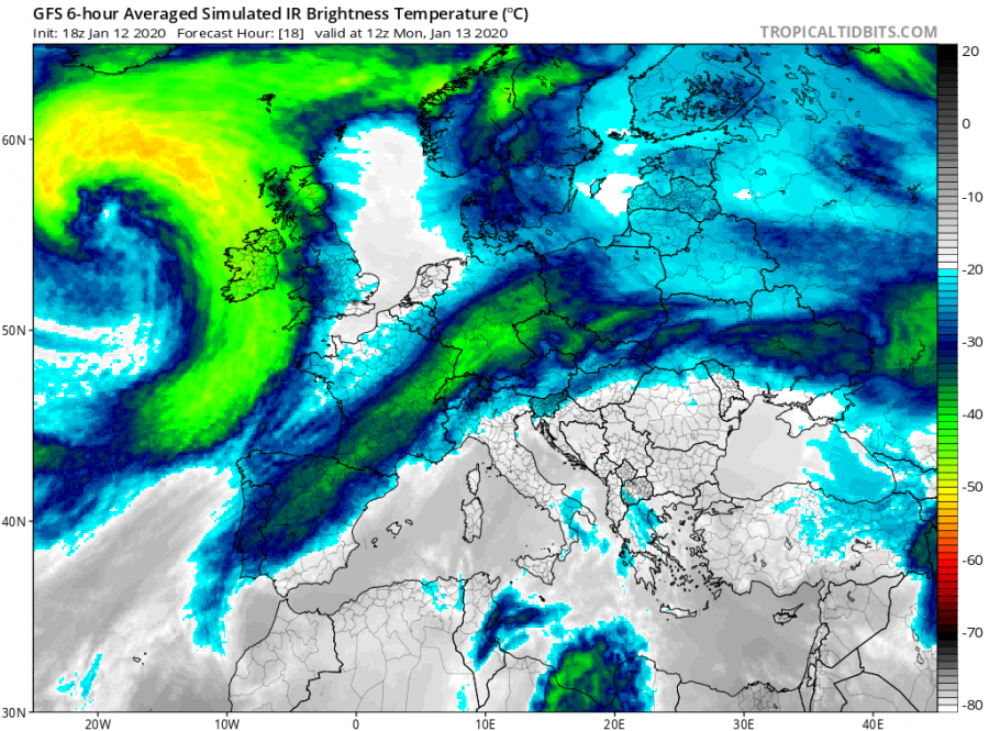
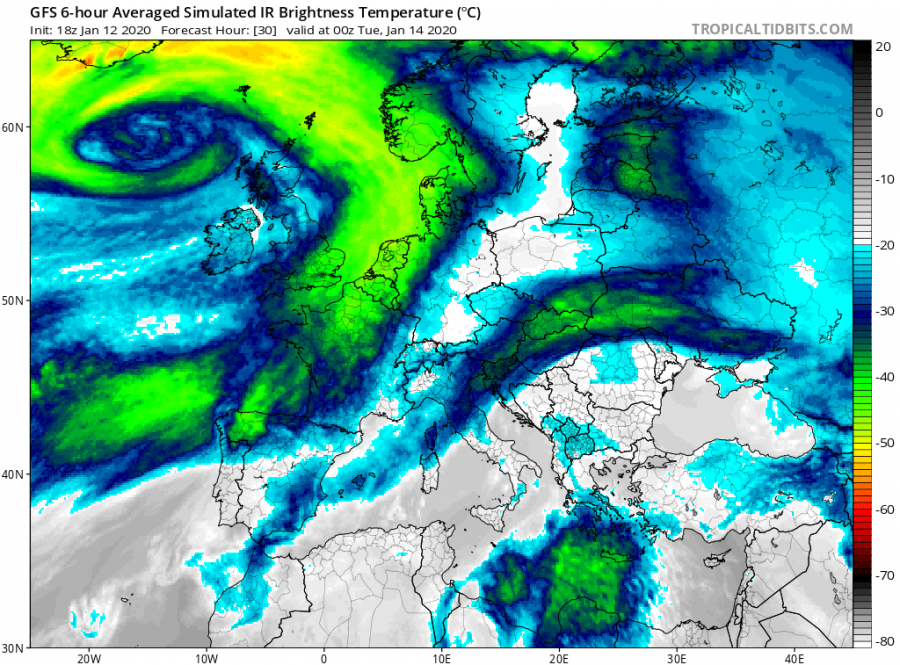
Simulated infrared satellite through Monday, system is on track with previous simulations. Notice the perfect structure of the cyclone is already seen on the global model GFS. You will be impressed by the real satellite observation tomorrow. These extra-tropical cyclones are in the rivalry this winter, which will deliver the most photogenic presentation.
10 m wind gusts animation as seen by the ICON-EU model (graphics produced by our co-admin Andrej Flis):
Please refer to the primary mesoscale discussions for the forecasts details:
Interested in our calendar? We are proud to present and promote the best weather photographers in Europe – see details:

